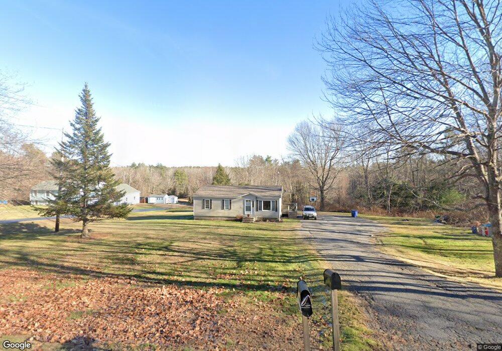
725 Methodist Rd Westbrook, ME 04092
Estimated Value: $388,148 - $492,000
3
Beds
1
Bath
1,080
Sq Ft
$412/Sq Ft
Est. Value
About This Home
This home is located at 725 Methodist Rd, Westbrook, ME 04092 and is currently estimated at $444,537, approximately $411 per square foot. 725 Methodist Rd is a home located in Cumberland County with nearby schools including Westbrook High School.
Ownership History
Date
Name
Owned For
Owner Type
Purchase Details
Closed on
Aug 3, 2010
Sold by
Tanguay Sharon J
Bought by
Tanguay John A and Tanguay Sharon J
Current Estimated Value
Purchase Details
Closed on
Jun 25, 2008
Sold by
Tanguay John A
Bought by
Tanguay John A and Tanguay Sharon
Home Financials for this Owner
Home Financials are based on the most recent Mortgage that was taken out on this home.
Original Mortgage
$127,750
Interest Rate
6.07%
Mortgage Type
FHA
Create a Home Valuation Report for This Property
The Home Valuation Report is an in-depth analysis detailing your home's value as well as a comparison with similar homes in the area
Home Values in the Area
Average Home Value in this Area
Purchase History
| Date | Buyer | Sale Price | Title Company |
|---|---|---|---|
| Tanguay John A | -- | -- | |
| Tanguay John A | -- | -- |
Source: Public Records
Mortgage History
| Date | Status | Borrower | Loan Amount |
|---|---|---|---|
| Previous Owner | Tanguay John A | $127,750 |
Source: Public Records
Tax History
| Year | Tax Paid | Tax Assessment Tax Assessment Total Assessment is a certain percentage of the fair market value that is determined by local assessors to be the total taxable value of land and additions on the property. | Land | Improvement |
|---|---|---|---|---|
| 2023 | $4,402 | $263,900 | $109,700 | $154,200 |
| 2022 | $3,984 | $220,100 | $91,600 | $128,500 |
| 2021 | $3,924 | $220,100 | $91,600 | $128,500 |
| 2020 | $0 | $220,100 | $91,600 | $128,500 |
| 2019 | $0 | $220,100 | $91,600 | $128,500 |
| 2018 | $0 | $171,700 | $63,900 | $107,800 |
| 2017 | $0 | $171,700 | $63,900 | $107,800 |
| 2016 | $3,159 | $171,700 | $63,900 | $107,800 |
| 2015 | $3,084 | $171,700 | $63,900 | $107,800 |
| 2014 | $2,953 | $171,700 | $63,900 | $107,800 |
| 2013 | $2,953 | $171,700 | $63,900 | $107,800 |
Source: Public Records
Map
Nearby Homes
- 680 Methodist Rd
- 65 Batchelder Rd
- 89 Duck Pond Rd
- 375 Pride St Unit 38
- 169 Brook St
- 171 Brook St Unit 49
- 171 Brook St Unit 44
- 171 Brook St Unit 50
- 171 Brook St Unit 3
- 171 Brook St Unit 52
- 171 Brook St Unit 41
- 171 Brook St Unit 47
- 171 Brook St Unit 54
- 171 Brook St Unit 53
- 171 Brook St Unit 42
- 171 Brook St Unit 43
- 171 Brook St Unit 45
- 171 Brook St Unit 51
- 171 Brook St Unit 60
- 18 Summit Cir
- 735 Methodist Rd
- 614 Methodist Rd
- 22 Methodist Rd
- 00 Methodist Rd
- 709 Methodist Rd
- 734 Methodist Rd
- 701 Methodist Rd
- 716 Methodist Rd
- 747 Methodist Rd
- 746 Methodist Rd
- 706 Methodist Rd
- 667 Methodist Rd
- 667 Methodist Rd
- 669 Methodist Rd
- 754 Methodist Rd
- 757 Methodist Rd
- 0 Methodist Rd
- 776 Methodist Rd
- 777 Methodist Rd
- 630 Methodist Rd
Your Personal Tour Guide
Ask me questions while you tour the home.