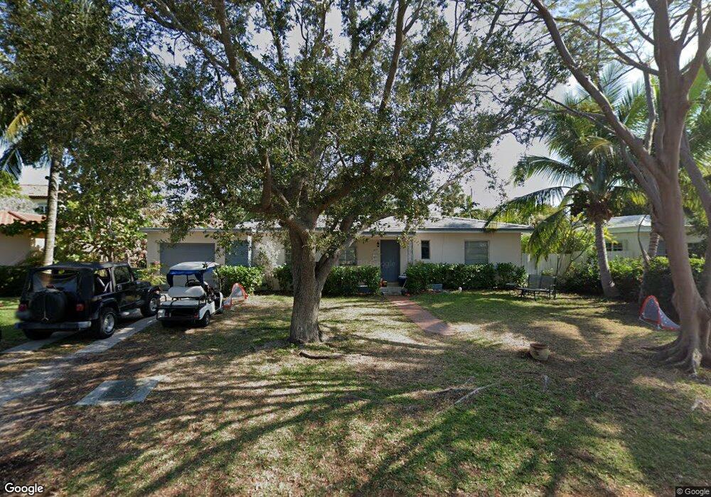
725 Myrtlewood Ln Key Biscayne, FL 33149
Estimated Value: $2,504,976 - $3,035,000
3
Beds
2
Baths
1,341
Sq Ft
$2,076/Sq Ft
Est. Value
About This Home
This home is located at 725 Myrtlewood Ln, Key Biscayne, FL 33149 and is currently estimated at $2,784,494, approximately $2,076 per square foot. 725 Myrtlewood Ln is a home located in Miami-Dade County with nearby schools including Key Biscayne K-8 Center, Ponce de Leon Middle School, and Coral Gables Senior High School.
Ownership History
Date
Name
Owned For
Owner Type
Purchase Details
Closed on
Mar 3, 2007
Sold by
Vale William M
Bought by
Vale Robert A and Vale Emma Katherine
Current Estimated Value
Purchase Details
Closed on
Mar 13, 2006
Sold by
Vale William M
Bought by
Vale Robert A and Vale Emma Katherine
Purchase Details
Closed on
Apr 15, 2005
Sold by
Vale William M
Bought by
Vale Robert A and Vale Emma Katherine
Purchase Details
Closed on
Dec 28, 2004
Sold by
Vale William M
Bought by
Vale Robert A and Vale Emma Katherine
Purchase Details
Closed on
Aug 6, 1999
Sold by
Vale William G
Bought by
Vale William G
Create a Home Valuation Report for This Property
The Home Valuation Report is an in-depth analysis detailing your home's value as well as a comparison with similar homes in the area
Home Values in the Area
Average Home Value in this Area
Purchase History
| Date | Buyer | Sale Price | Title Company |
|---|---|---|---|
| Vale Robert A | -- | Attorney | |
| Vale Robert A | -- | Attorney | |
| Vale Robert A | -- | -- | |
| Vale Robert A | -- | -- | |
| Vale Robert A | -- | -- | |
| Vale William G | $100 | -- |
Source: Public Records
Tax History Compared to Growth
Tax History
| Year | Tax Paid | Tax Assessment Tax Assessment Total Assessment is a certain percentage of the fair market value that is determined by local assessors to be the total taxable value of land and additions on the property. | Land | Improvement |
|---|---|---|---|---|
| 2025 | $26,421 | $1,529,431 | -- | -- |
| 2024 | $25,667 | $1,390,392 | -- | -- |
| 2023 | $25,667 | $1,263,993 | $0 | $0 |
| 2022 | $21,798 | $1,149,085 | $0 | $0 |
| 2021 | $19,202 | $1,044,623 | $0 | $0 |
| 2020 | $17,545 | $1,061,458 | $939,658 | $121,800 |
| 2019 | $19,542 | $1,227,293 | $1,105,480 | $121,813 |
| 2018 | $19,676 | $1,227,305 | $1,105,480 | $121,825 |
| 2017 | $22,210 | $1,189,600 | $0 | $0 |
| 2016 | $21,729 | $1,154,959 | $0 | $0 |
| 2015 | $20,282 | $1,049,963 | $0 | $0 |
| 2014 | $18,694 | $954,512 | $0 | $0 |
Source: Public Records
Map
Nearby Homes
- 670 Allendale Rd
- 420 Island Dr
- 861 Harbor Dr
- 635 Curtiswood Dr
- 677 Hampton Ln
- 600 Allendale Rd
- 797 Ridgewood Rd
- 610 Harbor Cir
- 691 Ridgewood Rd
- 285 W Enid Dr
- 631 N Mashta Dr
- 699 N Mashta Dr
- 960 Mariner Dr
- 200 W Mcintyre St
- 544 Allendale Rd
- 545 Sabal Palm Dr
- 550 Harbor Dr
- 669 S Mashta Dr
- 689 Glenridge Rd
- 481 S Mashta Dr
- 715 Myrtlewood Ln
- 735 Myrtlewood Ln
- 740 Curtiswood Dr
- 730 Curtiswood Dr
- 750 Curtiswood Dr
- 705 Myrtlewood Ln
- 730 Myrtlewood Ln
- 745 Myrtlewood Ln
- 710 Curtiswood Dr
- 720 Myrtlewood Ln
- 740 Myrtlewood Ln
- 710 Myrtlewood Ln
- 758 Curtiswood Dr
- 701 Myrtlewood Ln
- 750 Myrtlewood Ln
- 700 Curtiswood Dr
- 765 Myrtlewood Ln
- 745 Curtiswood Dr
- 735 Curtiswood Dr
- 775 Harbor Dr