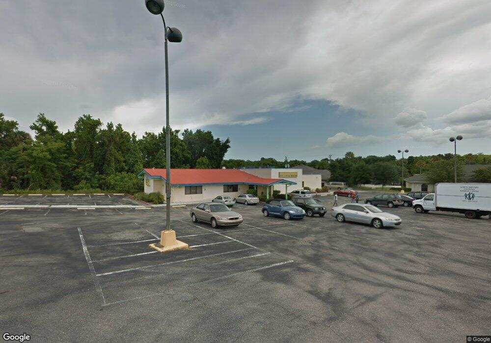
725 N Washington Ave Titusville, FL 32796
--
Bed
--
Bath
7,324
Sq Ft
1.71
Acres
About This Home
This home is located at 725 N Washington Ave, Titusville, FL 32796. 725 N Washington Ave is a home located in Brevard County with nearby schools including Mims Elementary School, James Madison Middle School, and Astronaut High School.
Ownership History
Date
Name
Owned For
Owner Type
Purchase Details
Closed on
May 1, 2008
Sold by
City First Mortgage Corp
Bought by
Joseph C Llc
Purchase Details
Closed on
Sep 20, 2007
Sold by
Everstar Inc and Hwang Tzuoo Rong
Bought by
City First Mortgage Corp
Purchase Details
Closed on
Aug 22, 2007
Sold by
Everstar Inc and Hwang Tzuoo Rong
Bought by
Not Provided
Purchase Details
Closed on
Feb 2, 2006
Sold by
China Star Of Sanford Inc
Bought by
Everstar Inc
Home Financials for this Owner
Home Financials are based on the most recent Mortgage that was taken out on this home.
Original Mortgage
$725,000
Interest Rate
6.14%
Create a Home Valuation Report for This Property
The Home Valuation Report is an in-depth analysis detailing your home's value as well as a comparison with similar homes in the area
Home Values in the Area
Average Home Value in this Area
Purchase History
| Date | Buyer | Sale Price | Title Company |
|---|---|---|---|
| Joseph C Llc | $800,000 | Attorney | |
| City First Mortgage Corp | -- | None Available | |
| Not Provided | -- | None Available | |
| Everstar Inc | $1,370,000 | Attorney |
Source: Public Records
Mortgage History
| Date | Status | Borrower | Loan Amount |
|---|---|---|---|
| Previous Owner | Everstar Inc | $725,000 |
Source: Public Records
Tax History Compared to Growth
Tax History
| Year | Tax Paid | Tax Assessment Tax Assessment Total Assessment is a certain percentage of the fair market value that is determined by local assessors to be the total taxable value of land and additions on the property. | Land | Improvement |
|---|---|---|---|---|
| 2025 | $17,070 | $830,440 | -- | -- |
| 2024 | $15,432 | $817,710 | -- | -- |
| 2023 | $15,432 | $688,790 | $0 | $0 |
| 2022 | $13,847 | $638,040 | $0 | $0 |
| 2021 | $13,120 | $540,600 | $156,580 | $384,020 |
| 2020 | $15,039 | $630,110 | $156,580 | $473,530 |
| 2019 | $14,677 | $582,210 | $156,580 | $425,630 |
| 2018 | $14,132 | $539,140 | $156,580 | $382,560 |
| 2017 | $13,819 | $515,000 | $0 | $515,000 |
| 2016 | $12,102 | $489,000 | $0 | $0 |
| 2015 | $11,761 | $455,000 | $111,840 | $343,160 |
| 2014 | $11,703 | $450,000 | $111,840 | $338,160 |
Source: Public Records
Map
Nearby Homes
- 0000 Buffalo Rd
- 870 Century Medical Dr
- 610 East Ct
- 2135 Mayfair Way Unit Lot 71
- 2135 Mayfair Way Unit 84
- 2135 Mayfair Way Unit 98
- 7.26 Route 1
- 2015 Malinda Ln
- 614 West Ct
- 424 Lenore Ave
- 502 Vaughn St
- Tbd N Washington Ave
- 1636 Violet Ave
- 671 N Dixie Ave Unit 18A
- 1615 Violet Ave
- 1539 Violet Ave
- 970 Carolina Cir
- 1115 Jones St
- 0000 Unknown N Park Ave
- 0 N Brown Ave
- 0 Buffalo Rd
- 830 Century Medical Dr
- 800 Century Medical Dr
- 836 Century Medical Dr
- Tbd Buffalo Rd
- 000 Buffalo Rd
- 1900 Buffalo Rd
- 865 Century Medical Dr
- 850 Century Medical Dr
- 805 Century Medical Dr
- 825 Century Medical Dr Unit A
- 639 Childre Ave
- 835 Century Medical Dr
- 1910 Buffalo Rd
- 1920 Buffalo Rd
- 860 Century Medical Dr
- 845 Century Medical Dr
- 633 Childre Ave Unit C
- 633 Childre Ave Unit A
- O Unknown