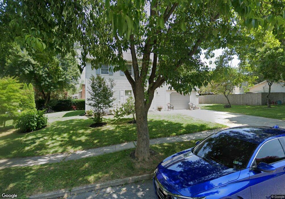
725 S Mill Rd Kennett Square, PA 19348
Estimated Value: $395,000 - $439,000
3
Beds
2
Baths
1,508
Sq Ft
$278/Sq Ft
Est. Value
About This Home
This home is located at 725 S Mill Rd, Kennett Square, PA 19348 and is currently estimated at $419,447, approximately $278 per square foot. 725 S Mill Rd is a home located in Chester County with nearby schools including Kennett Middle School, Kennett High School, and St. Patrick School.
Ownership History
Date
Name
Owned For
Owner Type
Purchase Details
Closed on
Oct 23, 2024
Sold by
Trujeque-Garcia Ernesto
Bought by
Trujeque-Garcia Ernesto and Anselmo Delfina Arellano
Current Estimated Value
Purchase Details
Closed on
Jan 30, 2002
Sold by
Melendez Pedro F and Melendez Maria S
Bought by
Trujeque Garcia Ernesto
Home Financials for this Owner
Home Financials are based on the most recent Mortgage that was taken out on this home.
Original Mortgage
$132,914
Interest Rate
7.13%
Mortgage Type
FHA
Purchase Details
Closed on
Apr 24, 1997
Sold by
Ayllon Efrain Quintana and Quintana Carmen
Bought by
Melendez Pedro F and Melendez Maria S
Home Financials for this Owner
Home Financials are based on the most recent Mortgage that was taken out on this home.
Original Mortgage
$124,500
Interest Rate
7.85%
Mortgage Type
FHA
Create a Home Valuation Report for This Property
The Home Valuation Report is an in-depth analysis detailing your home's value as well as a comparison with similar homes in the area
Home Values in the Area
Average Home Value in this Area
Purchase History
| Date | Buyer | Sale Price | Title Company |
|---|---|---|---|
| Trujeque-Garcia Ernesto | -- | None Listed On Document | |
| Trujeque Garcia Ernesto | $135,000 | -- | |
| Melendez Pedro F | $125,000 | -- |
Source: Public Records
Mortgage History
| Date | Status | Borrower | Loan Amount |
|---|---|---|---|
| Previous Owner | Trujeque Garcia Ernesto | $132,914 | |
| Previous Owner | Melendez Pedro F | $124,500 |
Source: Public Records
Tax History
| Year | Tax Paid | Tax Assessment Tax Assessment Total Assessment is a certain percentage of the fair market value that is determined by local assessors to be the total taxable value of land and additions on the property. | Land | Improvement |
|---|---|---|---|---|
| 2025 | $5,900 | $121,070 | $29,320 | $91,750 |
| 2024 | $5,900 | $121,070 | $29,320 | $91,750 |
| 2023 | $5,719 | $121,070 | $29,320 | $91,750 |
| 2022 | $5,227 | $121,070 | $29,320 | $91,750 |
| 2021 | $5,180 | $121,070 | $29,320 | $91,750 |
| 2020 | $5,093 | $121,070 | $29,320 | $91,750 |
| 2019 | $5,033 | $121,070 | $29,320 | $91,750 |
| 2018 | $4,915 | $121,070 | $29,320 | $91,750 |
| 2017 | $4,777 | $119,550 | $29,320 | $90,230 |
| 2016 | $474 | $119,550 | $29,320 | $90,230 |
| 2015 | $474 | $119,550 | $29,320 | $90,230 |
| 2014 | $474 | $119,550 | $29,320 | $90,230 |
Source: Public Records
Map
Nearby Homes
- 109 Chandler Mill Rd
- 115 Chandler Mill Rd
- 117 Chandler Mill Rd
- 114 Chandler Mill Rd
- 1261 Benjamin Dr
- 629 W Mulberry St
- 619 W Mulberry St
- 607 W Mulberry St
- 631 Magnolia Ct
- 621 Magnolia Ct
- 602 D St
- 118 Austin Dr
- 126 Austin Dr
- 107 W State St
- 159 Penns Manor Dr
- 311 E State St
- 100 Declan Unit HAWTHORNE
- 100 Declan Unit NOTTINGHAM
- 100 Declan Unit MAGNOLIA
- 100 Declan Unit SAVANNAH
Your Personal Tour Guide
Ask me questions while you tour the home.