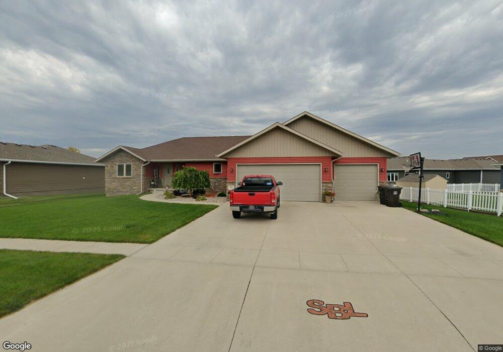
725 Stable Path Sergeant Bluff, IA 51054
Estimated Value: $415,000 - $502,000
5
Beds
6
Baths
1,852
Sq Ft
$245/Sq Ft
Est. Value
About This Home
This home is located at 725 Stable Path, Sergeant Bluff, IA 51054 and is currently estimated at $453,095, approximately $244 per square foot. 725 Stable Path is a home located in Woodbury County with nearby schools including Sergeant Bluff-Luton Primary School, Sergeant Bluff-Luton Elementary School, and Sergeant Bluff-Luton Middle School.
Ownership History
Date
Name
Owned For
Owner Type
Purchase Details
Closed on
Jul 17, 2012
Sold by
Settlers Point Llc
Bought by
Moore Pete and Moore Daniele M
Current Estimated Value
Create a Home Valuation Report for This Property
The Home Valuation Report is an in-depth analysis detailing your home's value as well as a comparison with similar homes in the area
Home Values in the Area
Average Home Value in this Area
Purchase History
| Date | Buyer | Sale Price | Title Company |
|---|---|---|---|
| Moore Pete | $36,500 | None Available |
Source: Public Records
Tax History
| Year | Tax Paid | Tax Assessment Tax Assessment Total Assessment is a certain percentage of the fair market value that is determined by local assessors to be the total taxable value of land and additions on the property. | Land | Improvement |
|---|---|---|---|---|
| 2025 | $6,452 | $458,710 | $50,000 | $408,710 |
| 2024 | $63 | $428,560 | $40,570 | $387,990 |
| 2023 | $6,044 | $428,560 | $40,570 | $387,990 |
| 2022 | $5,992 | $352,870 | $40,570 | $312,300 |
| 2021 | $5,992 | $352,870 | $40,570 | $312,300 |
| 2020 | $4,614 | $268,660 | $43,410 | $225,250 |
| 2019 | $3,962 | $268,660 | $43,410 | $225,250 |
| 2018 | $3,864 | $228,500 | $41,130 | $187,370 |
| 2017 | $3,864 | $228,500 | $41,130 | $187,370 |
| 2016 | $3,346 | $204,750 | $0 | $0 |
| 2015 | $2,192 | $159,840 | $38,440 | $121,400 |
| 2014 | $1,620 | $109,700 | $38,440 | $71,260 |
Source: Public Records
Map
Nearby Homes
- 723 Stable Path
- 808 Coffie Farm Rd
- 810 Coffie Farm Rd
- 721 Stable Path
- 802 Coffie Farm Rd
- 724 Coffie Farm Rd
- 804 Coffie Farm Rd
- 722 Stable Path
- 720 Stable Path
- 722 Stable Path
- 722 Coffie Farm Rd
- 718 Stable Path
- 724 Stable Path
- 719 Stable Path
- 720 Coffie Farm Rd
- 716 Stable Path
- 726 Stable Path
- 817 Coffie Farm Rd
- 813 Coffie Farm Rd
- 811 Coffie Farm Rd
Your Personal Tour Guide
Ask me questions while you tour the home.