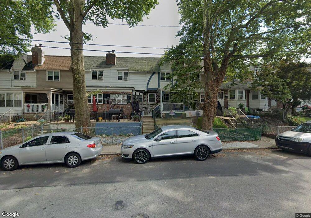
7258 Lamport Rd Upper Darby, PA 19082
Estimated Value: $133,809 - $156,000
3
Beds
2
Baths
956
Sq Ft
$152/Sq Ft
Est. Value
About This Home
This home is located at 7258 Lamport Rd, Upper Darby, PA 19082 and is currently estimated at $145,702, approximately $152 per square foot. 7258 Lamport Rd is a home located in Delaware County with nearby schools including Upper Darby Kdg Center, Upper Darby High School, and Vision Academy Charter School.
Ownership History
Date
Name
Owned For
Owner Type
Purchase Details
Closed on
Jan 31, 2013
Sold by
Robinson Alice M
Bought by
Taylor Kellee
Current Estimated Value
Home Financials for this Owner
Home Financials are based on the most recent Mortgage that was taken out on this home.
Original Mortgage
$58,913
Outstanding Balance
$41,126
Interest Rate
3.38%
Mortgage Type
FHA
Estimated Equity
$104,576
Purchase Details
Closed on
Jul 14, 2005
Sold by
Bucciero Ann Marie
Bought by
Robinson Alice M
Home Financials for this Owner
Home Financials are based on the most recent Mortgage that was taken out on this home.
Original Mortgage
$67,500
Interest Rate
5.59%
Mortgage Type
Fannie Mae Freddie Mac
Create a Home Valuation Report for This Property
The Home Valuation Report is an in-depth analysis detailing your home's value as well as a comparison with similar homes in the area
Home Values in the Area
Average Home Value in this Area
Purchase History
| Date | Buyer | Sale Price | Title Company |
|---|---|---|---|
| Taylor Kellee | $61,808 | None Available | |
| Robinson Alice M | $67,500 | -- |
Source: Public Records
Mortgage History
| Date | Status | Borrower | Loan Amount |
|---|---|---|---|
| Open | Taylor Kellee | $58,913 | |
| Closed | Robinson Alice M | $67,500 |
Source: Public Records
Tax History Compared to Growth
Tax History
| Year | Tax Paid | Tax Assessment Tax Assessment Total Assessment is a certain percentage of the fair market value that is determined by local assessors to be the total taxable value of land and additions on the property. | Land | Improvement |
|---|---|---|---|---|
| 2025 | $2,652 | $62,700 | $13,610 | $49,090 |
| 2024 | $2,652 | $62,700 | $13,610 | $49,090 |
| 2023 | $2,627 | $62,700 | $13,610 | $49,090 |
| 2022 | $2,556 | $62,700 | $13,610 | $49,090 |
| 2021 | $3,447 | $62,700 | $13,610 | $49,090 |
| 2020 | $2,397 | $37,050 | $12,370 | $24,680 |
| 2019 | $2,355 | $37,050 | $12,370 | $24,680 |
| 2018 | $2,327 | $37,050 | $0 | $0 |
| 2017 | $2,267 | $37,050 | $0 | $0 |
| 2016 | $203 | $37,050 | $0 | $0 |
| 2015 | $203 | $37,050 | $0 | $0 |
| 2014 | $203 | $37,050 | $0 | $0 |
Source: Public Records
Map
Nearby Homes
- 419 Gilpin Rd
- 404 Croyden Rd
- 7139 Guilford Rd
- 346 Long Ln
- 669 Long Ln
- 655 Copley Rd
- 92 Springton Rd
- 607 Littlecroft Rd
- 433 Copley Rd
- 432 Grace Rd
- 7120 Clinton Rd
- 273 Coverly Rd
- 219 Le Carra Dr
- 426 Hampden Rd
- 418 Hampden Rd
- 7265 Calvin Rd
- 7162 Radbourne Rd
- 291 N Wycombe Ave
- 213 1/2 Melrose Ave
- 504 Woodcliffe Rd
- 7256 Lamport Rd
- 430 Croyden Rd
- 406 Croyden Rd
- 7262 Lamport Rd
- 7254 Lamport Rd
- 422 Croyden Rd
- 424 Croyden Rd
- 420 Croyden Rd
- 421 Gilpin Rd
- 426 Croyden Rd
- 403 Gilpin Rd
- 418 Croyden Rd
- 7252 Lamport Rd
- 428 Croyden Rd
- 414 Croyden Rd
- 7250 Lamport Rd
- 412 Croyden Rd
- 415 Gilpin Rd
- 409 Croyden Rd
- 405 Croyden Rd