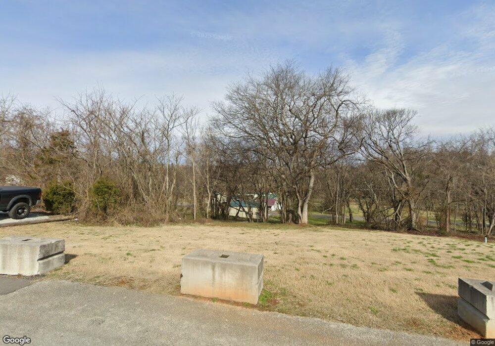
726 Davis St Jefferson City, TN 37760
Estimated Value: $55,000 - $71,347
--
Bed
1
Bath
644
Sq Ft
$96/Sq Ft
Est. Value
About This Home
This home is located at 726 Davis St, Jefferson City, TN 37760 and is currently estimated at $61,782, approximately $95 per square foot. 726 Davis St is a home located in Jefferson County with nearby schools including Heritage Christian Academy.
Ownership History
Date
Name
Owned For
Owner Type
Purchase Details
Closed on
Oct 11, 2017
Sold by
Burnette Bradford and Burnette Melissa
Bought by
Carson Newman University
Current Estimated Value
Purchase Details
Closed on
Mar 13, 2006
Sold by
Michael Hulick Donald
Bought by
Bradford Burnette
Purchase Details
Closed on
Jan 24, 2005
Bought by
Hulick Donald Michael
Purchase Details
Closed on
Jun 3, 1996
Sold by
Potts William D and Potts Paralee
Bought by
Michael Hulick D
Purchase Details
Closed on
Mar 27, 1965
Bought by
Potts William D and Potts Paralee
Create a Home Valuation Report for This Property
The Home Valuation Report is an in-depth analysis detailing your home's value as well as a comparison with similar homes in the area
Home Values in the Area
Average Home Value in this Area
Purchase History
| Date | Buyer | Sale Price | Title Company |
|---|---|---|---|
| Carson Newman University | $35,000 | Colonial Title | |
| Bradford Burnette | $26,000 | -- | |
| Hulick Donald Michael | -- | -- | |
| Michael Hulick D | $15,000 | -- | |
| Potts William D | -- | -- |
Source: Public Records
Tax History Compared to Growth
Tax History
| Year | Tax Paid | Tax Assessment Tax Assessment Total Assessment is a certain percentage of the fair market value that is determined by local assessors to be the total taxable value of land and additions on the property. | Land | Improvement |
|---|---|---|---|---|
| 2025 | $43 | $3,575 | $3,575 | -- |
| 2023 | $278 | $7,950 | $0 | $0 |
| 2022 | $269 | $7,950 | $2,750 | $5,200 |
| 2021 | $269 | $7,950 | $2,750 | $5,200 |
| 2020 | $269 | $7,950 | $2,750 | $5,200 |
| 2019 | $269 | $7,950 | $2,750 | $5,200 |
| 2018 | $204 | $5,750 | $1,500 | $4,250 |
| 2017 | $204 | $5,750 | $1,500 | $4,250 |
| 2016 | $204 | $5,750 | $1,500 | $4,250 |
| 2015 | $201 | $5,750 | $1,500 | $4,250 |
| 2014 | $198 | $5,750 | $1,500 | $4,250 |
Source: Public Records
Map
Nearby Homes
- 902 N College St
- 1819 Brookline Ct
- 409 Clearbrook Dr
- 1905 Walnut Ave
- 431 Clearbrook Dr
- 807 E Ellis St
- 1405 Odell Ave
- 1916 N Sizer Ave
- 903 Julianne Dr
- 165 Jesse Baker Ln
- 213 Newman Cir
- 2028 N Sizer Ave
- 784 Forgety Rd
- 1366 Clinch View Cir
- 1003 Battle Ridge
- 1825 Burnette Ave
- 1004 Battle Ridge
- Cabral Plan at Battle Ridge
- Macon Plan at Battle Ridge
- Aria Plan at Battle Ridge
- 728 Davis St
- 730 Davis St
- 732 Davis St
- 2215 Walnut Ave
- 2211 Walnut Ave
- 2217 Walnut Ave
- 734 Davis St
- 2207 Walnut Ave
- 2219 Walnut Ave
- 2205 Walnut Ave
- 736 Davis St
- 2221 Walnut Ave
- 2203 Walnut Ave
- 2223 Walnut Ave
- 740 Davis St
- 2220 Walnut Ave
- 2204 Walnut Ave
- 2216 Walnut Ave
- 2212 Walnut Ave
- 911 N College St
