Estimated Value: $396,159 - $454,000
2
Beds
1
Bath
1,241
Sq Ft
$342/Sq Ft
Est. Value
About This Home
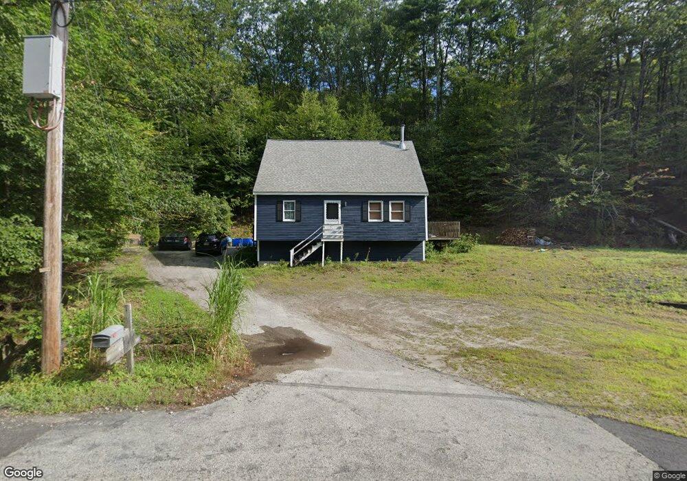
This home is located at 726 Deering Center Rd, Weare, NH 03281 and is currently estimated at $424,790, approximately $342 per square foot. 726 Deering Center Rd is a home with nearby schools including Center Woods Elementary School, Weare Middle School, and John Stark Regional High School.
Ownership History
Date
Name
Owned For
Owner Type
Purchase Details
Closed on
Feb 1, 2008
Sold by
Sydorwicz Steven
Bought by
Morrill James and Cardin Melanie
Current Estimated Value
Home Financials for this Owner
Home Financials are based on the most recent Mortgage that was taken out on this home.
Original Mortgage
$202,910
Interest Rate
6.18%
Mortgage Type
Purchase Money Mortgage
Purchase Details
Closed on
Sep 26, 2002
Sold by
Monroe Joann and Monroe Jennifer L
Bought by
Mcauliffe Timothy Colm
Home Financials for this Owner
Home Financials are based on the most recent Mortgage that was taken out on this home.
Original Mortgage
$130,000
Interest Rate
6.25%
Purchase Details
Closed on
Jan 3, 2001
Sold by
Dubreuil Renald A
Bought by
Monroe Joann and Monroe Jennifer L
Home Financials for this Owner
Home Financials are based on the most recent Mortgage that was taken out on this home.
Original Mortgage
$115,900
Interest Rate
7.69%
Create a Home Valuation Report for This Property
The Home Valuation Report is an in-depth analysis detailing your home's value as well as a comparison with similar homes in the area
Home Values in the Area
Average Home Value in this Area
Purchase History
| Date | Buyer | Sale Price | Title Company |
|---|---|---|---|
| Morrill James | $203,900 | -- | |
| Mcauliffe Timothy Colm | $162,500 | -- | |
| Monroe Joann | $122,000 | -- |
Source: Public Records
Mortgage History
| Date | Status | Borrower | Loan Amount |
|---|---|---|---|
| Open | Monroe Joann | $199,450 | |
| Closed | Monroe Joann | $202,910 | |
| Previous Owner | Monroe Joann | $130,000 | |
| Previous Owner | Monroe Joann | $115,900 |
Source: Public Records
Tax History Compared to Growth
Tax History
| Year | Tax Paid | Tax Assessment Tax Assessment Total Assessment is a certain percentage of the fair market value that is determined by local assessors to be the total taxable value of land and additions on the property. | Land | Improvement |
|---|---|---|---|---|
| 2024 | $6,019 | $295,200 | $170,000 | $125,200 |
| 2023 | $5,562 | $295,200 | $170,000 | $125,200 |
| 2022 | $5,136 | $295,200 | $170,000 | $125,200 |
| 2021 | $5,077 | $295,200 | $170,000 | $125,200 |
| 2020 | $5,640 | $235,500 | $147,600 | $87,900 |
| 2019 | $5,584 | $235,500 | $147,600 | $87,900 |
| 2018 | $4,592 | $235,500 | $147,600 | $87,900 |
| 2016 | $5,268 | $235,500 | $147,600 | $87,900 |
| 2015 | $4,446 | $198,400 | $109,000 | $89,400 |
| 2014 | $4,453 | $200,500 | $109,000 | $91,500 |
| 2013 | $4,361 | $200,500 | $109,000 | $91,500 |
Source: Public Records
Map
Nearby Homes
- 194 Buckley Rd Unit 2
- 194 Buckley Rd Unit 44
- 281 Hodgdon Rd
- 200 Mountain Rd
- 30 Dels Way
- 196 Deering Center Rd
- 107 Branch Rd
- 10 Sap House Rd
- Lot 13 E Deering Rd
- 238 Old Francestown Rd
- 108 E Shore Dr
- 62 Collins Landing Rd Unit 46
- 233 N Stark Hwy
- 101-125 Winslow Rd
- 624 S Stark Hwy
- 92 Woodbury Rd
- 179 Oak Hill Rd
- 9 Reservoir Rd
- 103 Renshaw Rd
- 133 Hay Hill Rd
- 702 Deering Center Rd
- 733 Deering Center Rd
- 674 Deering Center Rd
- 670 Deering Center Rd
- 671 Deering Center Rd
- 29 Oliver Rd
- 669 Deering Center Rd
- 731 Deering Center Rd
- 656 Deering Center Rd
- 665 Deering Center Rd
- 788 Deering Center Rd
- 772 Deering Center Rd
- 655 Deering Center Rd
- 790 Deering Center Rd
- 771 Deering Center Rd
- 4 Oliver Rd
- 832 Deering Center Rd
- 789 Deering Center Rd
- 11 Hodgdon Rd
- 9 Hodgdon Rd