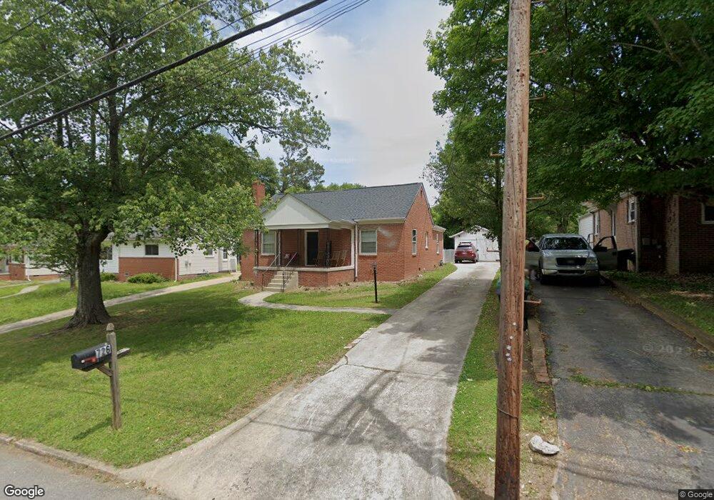
726 Forrest St High Point, NC 27262
Greater High Point NeighborhoodEstimated Value: $112,000 - $212,000
3
Beds
1
Bath
1,368
Sq Ft
$113/Sq Ft
Est. Value
About This Home
This home is located at 726 Forrest St, High Point, NC 27262 and is currently estimated at $154,694, approximately $113 per square foot. 726 Forrest St is a home located in Guilford County with nearby schools including Kirkman Park Elementary School, Penn-Griffin School for the Arts, and T.W. Andrews High School.
Ownership History
Date
Name
Owned For
Owner Type
Purchase Details
Closed on
Apr 27, 2021
Sold by
Shoaf Cynthia
Bought by
Bms Investment Properties Llc
Current Estimated Value
Purchase Details
Closed on
Sep 11, 2001
Sold by
Dorsett Paul Loftin
Bought by
Shoaf Tommy and Shoaf Cynthia S
Home Financials for this Owner
Home Financials are based on the most recent Mortgage that was taken out on this home.
Original Mortgage
$55,000
Interest Rate
6.98%
Mortgage Type
Purchase Money Mortgage
Create a Home Valuation Report for This Property
The Home Valuation Report is an in-depth analysis detailing your home's value as well as a comparison with similar homes in the area
Home Values in the Area
Average Home Value in this Area
Purchase History
| Date | Buyer | Sale Price | Title Company |
|---|---|---|---|
| Bms Investment Properties Llc | $73,000 | None Available | |
| Bms Investment Properties Llc | $146 | Legal Graystar | |
| Shoaf Tommy | $62,000 | -- |
Source: Public Records
Mortgage History
| Date | Status | Borrower | Loan Amount |
|---|---|---|---|
| Previous Owner | Shoaf Tommy | $55,000 |
Source: Public Records
Tax History
| Year | Tax Paid | Tax Assessment Tax Assessment Total Assessment is a certain percentage of the fair market value that is determined by local assessors to be the total taxable value of land and additions on the property. | Land | Improvement |
|---|---|---|---|---|
| 2025 | $1,312 | $95,200 | $14,000 | $81,200 |
| 2024 | $1,312 | $95,200 | $14,000 | $81,200 |
| 2023 | $1,312 | $95,200 | $14,000 | $81,200 |
| 2022 | $1,283 | $95,200 | $14,000 | $81,200 |
| 2021 | $1,056 | $76,600 | $14,000 | $62,600 |
| 2020 | $1,056 | $76,600 | $14,000 | $62,600 |
| 2019 | $1,056 | $76,600 | $0 | $0 |
| 2018 | $1,050 | $76,600 | $0 | $0 |
| 2017 | $1,056 | $76,600 | $0 | $0 |
| 2016 | $1,001 | $71,400 | $0 | $0 |
| 2015 | $1,007 | $71,400 | $0 | $0 |
| 2014 | $1,024 | $71,400 | $0 | $0 |
Source: Public Records
Map
Nearby Homes
- 721 Forrest St
- 719 Forrest St
- 509 Woodrow Ave
- 910 E Dayton Ave
- 304 Louise Ave
- 1108 Forrest St
- 1110 Forrest St
- 905 Mint Ave
- 837 Willow Place
- 1310 Madison St
- 844 Willow Place
- 1428 Futrelle Dr
- 613 Woodridge Ln
- 513 Saunders Place Unit A & B
- 511 Saunders Place Unit A & B
- 1433 Larkin St
- 1308 Boundary Ave
- 1129 Bridges Dr
- 1518 Johnson St
- 1604 E Lexington Ave
Your Personal Tour Guide
Ask me questions while you tour the home.