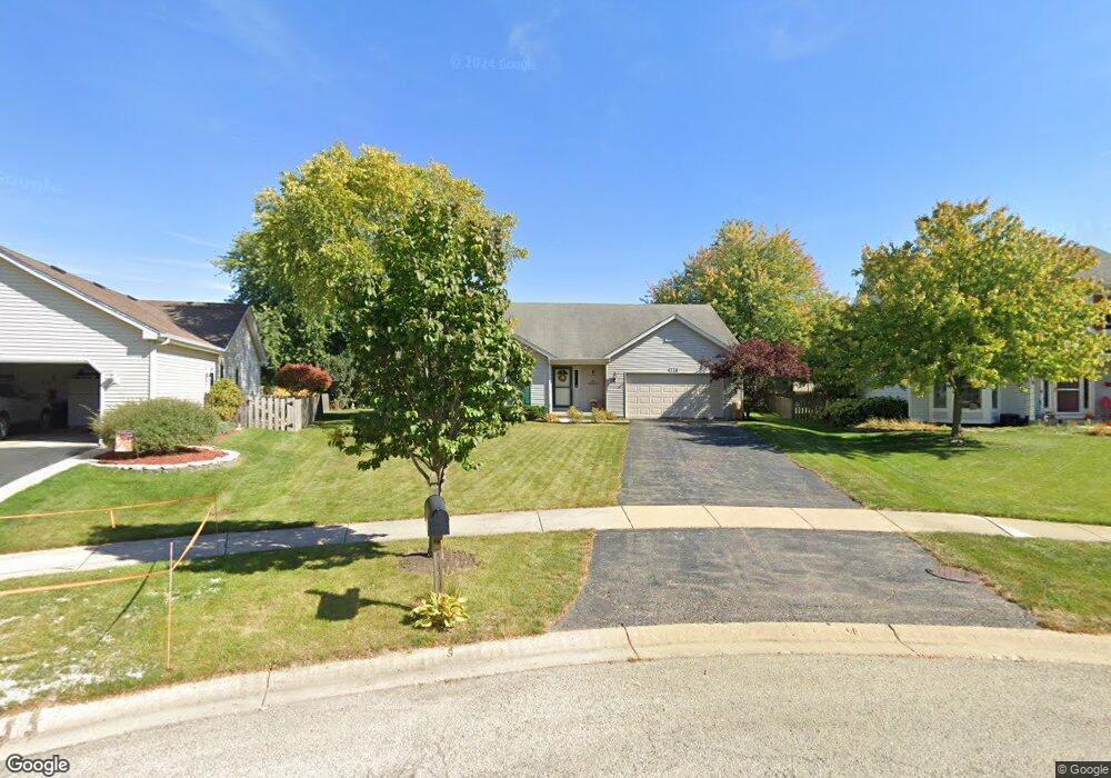
726 Highview Ct Elburn, IL 60119
Estimated Value: $337,000 - $397,000
Studio
1
Bath
1,622
Sq Ft
$220/Sq Ft
Est. Value
About This Home
This home is located at 726 Highview Ct, Elburn, IL 60119 and is currently estimated at $356,184, approximately $219 per square foot. 726 Highview Ct is a home with nearby schools including Kaneland John Stewart Elementary School, Harter Middle School, and Kaneland High School.
Ownership History
Date
Name
Owned For
Owner Type
Purchase Details
Closed on
Nov 19, 1996
Sold by
Feltes Land Inc
Bought by
Dixon Richard J and Dixon Lori K
Current Estimated Value
Home Financials for this Owner
Home Financials are based on the most recent Mortgage that was taken out on this home.
Original Mortgage
$135,800
Outstanding Balance
$11,678
Interest Rate
6.62%
Estimated Equity
$344,506
Create a Home Valuation Report for This Property
The Home Valuation Report is an in-depth analysis detailing your home's value as well as a comparison with similar homes in the area
Home Values in the Area
Average Home Value in this Area
Purchase History
| Date | Buyer | Sale Price | Title Company |
|---|---|---|---|
| Dixon Richard J | $48,500 | Chicago Title Insurance Co |
Source: Public Records
Mortgage History
| Date | Status | Borrower | Loan Amount |
|---|---|---|---|
| Open | Dixon Richard J | $135,800 |
Source: Public Records
Tax History
| Year | Tax Paid | Tax Assessment Tax Assessment Total Assessment is a certain percentage of the fair market value that is determined by local assessors to be the total taxable value of land and additions on the property. | Land | Improvement |
|---|---|---|---|---|
| 2024 | $8,738 | $99,547 | $17,252 | $82,295 |
| 2023 | $8,580 | $89,000 | $15,424 | $73,576 |
| 2022 | $7,962 | $79,142 | $14,054 | $65,088 |
| 2021 | $7,667 | $74,726 | $13,270 | $61,456 |
| 2020 | $7,616 | $73,651 | $13,079 | $60,572 |
| 2019 | $7,619 | $72,570 | $12,887 | $59,683 |
| 2018 | $7,739 | $72,570 | $12,887 | $59,683 |
| 2017 | $7,703 | $71,505 | $12,698 | $58,807 |
| 2016 | $7,717 | $69,699 | $12,377 | $57,322 |
| 2015 | -- | $67,774 | $12,035 | $55,739 |
| 2014 | -- | $68,814 | $12,220 | $56,594 |
| 2013 | -- | $69,968 | $12,425 | $57,543 |
Source: Public Records
Map
Nearby Homes
- 620 Ridge Dr
- 644 Houtz Cir
- Lot 77 Houtz Cir
- 820 N 1st St Unit 820
- 608 Hoyt Dr
- 526 N Main St
- 410 W Reader St
- 411 S 1st St
- 803 Station Blvd
- 1085 Station Blvd
- 875 Station Blvd
- 1457 Collins St
- 634 Virginia St
- 607 Virginia St
- 425 Cambridge Ave
- 645 Virginia St
- 540 Parkside Dr
- 671 Virginia St
- 713 Elizabeth St
- 000 Illinois 47
- 734 Highview Ct
- 718 Highview Ct
- 648 Downing Ct
- 644 Downing Ct
- 517 Highland Dr
- 742 Highview Ct
- 710 Highview Ct
- 525 Highland Dr
- 640 Downing Ct
- 660 Downing St
- 458 Erickson Ct
- 652 Downing Ct
- 741 Highview Ct Unit 5
- 466 Erickson Ct
- 711 Highview Ct
- 733 Highview Ct
- 721 Highview Ct
- 450 Erickson Ct
- 632 Downing Ct
- 449 Highland Dr
Your Personal Tour Guide
Ask me questions while you tour the home.