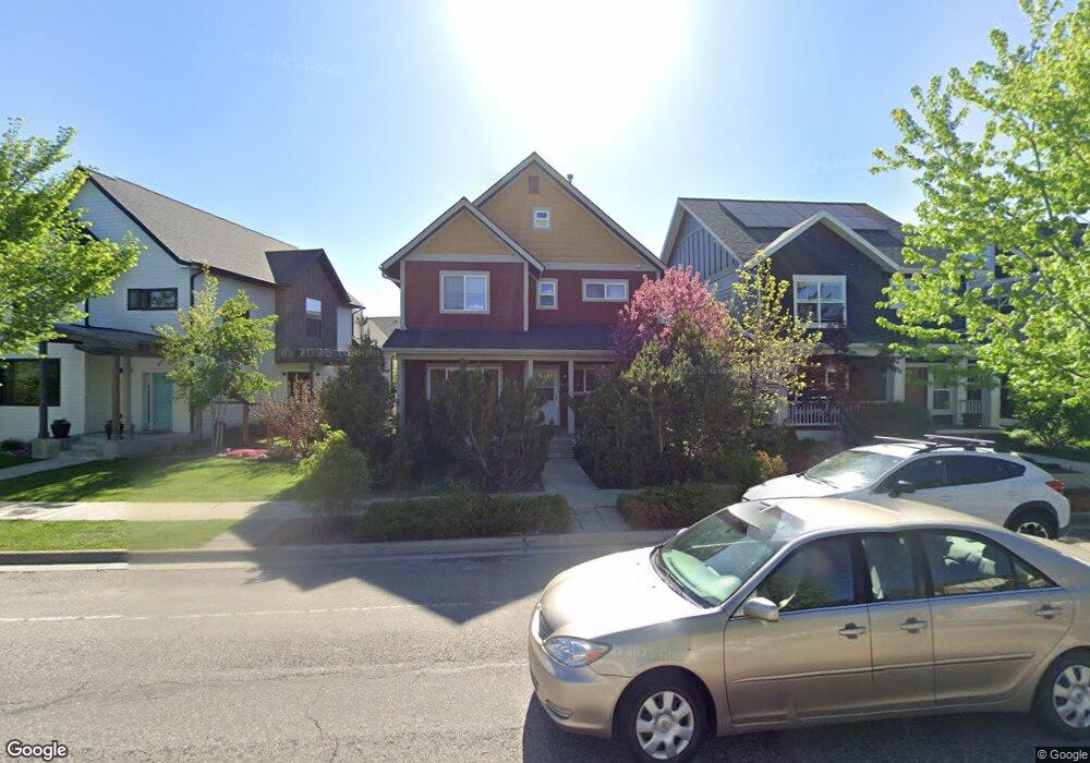
726 N 15th Ave Bozeman, MT 59715
North Bozeman NeighborhoodEstimated Value: $614,000 - $783,000
3
Beds
3
Baths
1,764
Sq Ft
$394/Sq Ft
Est. Value
About This Home
This home is located at 726 N 15th Ave, Bozeman, MT 59715 and is currently estimated at $695,610, approximately $394 per square foot. 726 N 15th Ave is a home located in Gallatin County with nearby schools including Whittier School, Chief Joseph Middle School, and Bozeman High School.
Ownership History
Date
Name
Owned For
Owner Type
Purchase Details
Closed on
Dec 30, 2005
Sold by
Foster Gary L and Foster Anne A
Bought by
Turner Gary A
Current Estimated Value
Home Financials for this Owner
Home Financials are based on the most recent Mortgage that was taken out on this home.
Original Mortgage
$95,000
Outstanding Balance
$53,681
Interest Rate
6.36%
Mortgage Type
Purchase Money Mortgage
Estimated Equity
$641,929
Purchase Details
Closed on
Feb 22, 2005
Sold by
Durston Development Corp
Bought by
Foster Gary L and Foster Anne A
Home Financials for this Owner
Home Financials are based on the most recent Mortgage that was taken out on this home.
Original Mortgage
$42,400
Interest Rate
5.73%
Mortgage Type
Purchase Money Mortgage
Create a Home Valuation Report for This Property
The Home Valuation Report is an in-depth analysis detailing your home's value as well as a comparison with similar homes in the area
Home Values in the Area
Average Home Value in this Area
Purchase History
| Date | Buyer | Sale Price | Title Company |
|---|---|---|---|
| Turner Gary A | -- | American Land Title Company | |
| Foster Gary L | -- | Altc |
Source: Public Records
Mortgage History
| Date | Status | Borrower | Loan Amount |
|---|---|---|---|
| Open | Turner Gary A | $95,000 | |
| Previous Owner | Foster Gary L | $42,400 |
Source: Public Records
Tax History
| Year | Tax Paid | Tax Assessment Tax Assessment Total Assessment is a certain percentage of the fair market value that is determined by local assessors to be the total taxable value of land and additions on the property. | Land | Improvement |
|---|---|---|---|---|
| 2025 | $3,074 | $672,500 | $0 | $0 |
| 2024 | $4,309 | $647,300 | $0 | $0 |
| 2023 | $4,169 | $647,300 | $0 | $0 |
| 2022 | $3,198 | $417,000 | $0 | $0 |
| 2021 | $3,529 | $417,000 | $0 | $0 |
| 2020 | $2,911 | $340,500 | $0 | $0 |
| 2019 | $2,977 | $340,500 | $0 | $0 |
| 2018 | $2,918 | $309,300 | $0 | $0 |
| 2017 | $2,884 | $309,300 | $0 | $0 |
| 2016 | $2,548 | $269,800 | $0 | $0 |
| 2015 | $2,550 | $269,800 | $0 | $0 |
| 2014 | $2,263 | $140,874 | $0 | $0 |
Source: Public Records
Map
Nearby Homes
- 818 Matheson Way
- 854 Matheson Way
- 1460 Juniper St
- 999 Jessie Way
- 1033 N 14th Ave
- 907 N 17th Ave
- 1036 Oak Park Dr
- TBD N 19th Ave
- 403 N 18th Ave
- 526 N 10th Ave
- 318 & 320 N 19th
- 1608 W Beall St Unit B
- 1608 W Beall St Unit F
- 163 Wagon Train Trail
- 1610 W Beall St Unit E
- 316 N 10th Ave
- 1233 N 8th Ave
- 1232 N 8th Ave
- 1120 Brentwood Ave
- 760 Rogers Way Unit B
Your Personal Tour Guide
Ask me questions while you tour the home.