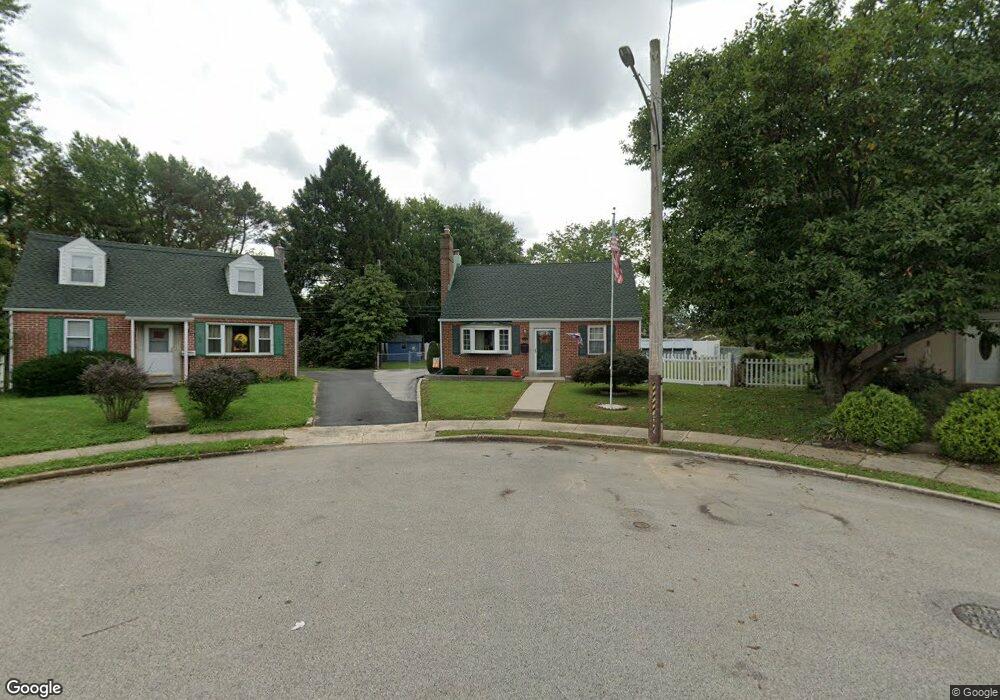
726 Pearl Cir Morton, PA 19070
Estimated Value: $364,000 - $400,000
3
Beds
2
Baths
1,523
Sq Ft
$252/Sq Ft
Est. Value
About This Home
This home is located at 726 Pearl Cir, Morton, PA 19070 and is currently estimated at $383,947, approximately $252 per square foot. 726 Pearl Cir is a home located in Delaware County with nearby schools including Amosland El School, Ridley Middle School, and Ridley High School.
Ownership History
Date
Name
Owned For
Owner Type
Purchase Details
Closed on
Nov 27, 2001
Sold by
Williams Donald J and Williams Ann F
Bought by
Johnson Thomas J and Johnson Teresa E
Current Estimated Value
Home Financials for this Owner
Home Financials are based on the most recent Mortgage that was taken out on this home.
Original Mortgage
$122,850
Outstanding Balance
$48,111
Interest Rate
6.6%
Mortgage Type
Stand Alone First
Estimated Equity
$335,836
Create a Home Valuation Report for This Property
The Home Valuation Report is an in-depth analysis detailing your home's value as well as a comparison with similar homes in the area
Home Values in the Area
Average Home Value in this Area
Purchase History
| Date | Buyer | Sale Price | Title Company |
|---|---|---|---|
| Johnson Thomas J | $136,500 | Fidelity National Title Ins |
Source: Public Records
Mortgage History
| Date | Status | Borrower | Loan Amount |
|---|---|---|---|
| Open | Johnson Thomas J | $122,850 |
Source: Public Records
Tax History Compared to Growth
Tax History
| Year | Tax Paid | Tax Assessment Tax Assessment Total Assessment is a certain percentage of the fair market value that is determined by local assessors to be the total taxable value of land and additions on the property. | Land | Improvement |
|---|---|---|---|---|
| 2025 | $7,973 | $229,610 | $83,080 | $146,530 |
| 2024 | $7,973 | $229,610 | $83,080 | $146,530 |
| 2023 | $7,626 | $229,610 | $83,080 | $146,530 |
| 2022 | $7,381 | $229,610 | $83,080 | $146,530 |
| 2021 | $11,426 | $229,610 | $83,080 | $146,530 |
| 2020 | $6,550 | $115,940 | $42,290 | $73,650 |
| 2019 | $6,430 | $115,940 | $42,290 | $73,650 |
| 2018 | $6,350 | $115,940 | $0 | $0 |
| 2017 | $6,350 | $115,940 | $0 | $0 |
| 2016 | $636 | $115,940 | $0 | $0 |
| 2015 | $636 | $115,940 | $0 | $0 |
| 2014 | $636 | $115,940 | $0 | $0 |
Source: Public Records
Map
Nearby Homes
- 916 Brooke Ave
- 810 Quince Ln
- 742 Agnes Ave
- 31 Silver Lake Terrace Unit 32
- 2330 Poe Rd
- 668 Hutchinson Terrace
- 136 Linden Ave
- 1015 Mitchell Ave
- 601 Country Ln
- 880 Quaint St
- 216-218 President Ave
- 2 Yale Ave
- 7 & 0 Woodland Ave
- 15 Sycamore Ave
- 115 President Ave
- 2379 Mole Rd
- 860 Wyndom Terrace
- 120 Bridge St
- 614 Highland Terrace
- 111 Broad St
- 728 Pearl Cir
- 724 Pearl Cir
- 730 Pearl Cir
- 722 Pearl Cir
- 732 Pearl Cir
- 802 Amosland Rd
- 720 Pearl Cir
- 2120 Pershing Ave
- 2116 Pershing Ave
- 2124 Pershing Ave
- 2112 Pershing Ave
- 734 Pearl Cir
- 2128 Pershing Ave
- 2108 Pershing Ave
- 806 Amosland Rd
- 740 Amosland Rd
- 718 Pearl Ave
- 716 Pearl Ave
- 2132 Pershing Ave
- 2119 Elder Ave