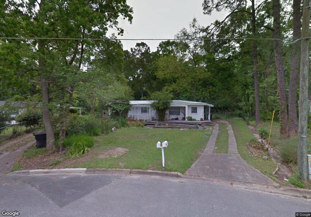
726 W 10th Ave Unit A Tallahassee, FL 32303
Midtown West NeighborhoodEstimated Value: $164,348 - $216,000
3
Beds
1
Bath
1,308
Sq Ft
$148/Sq Ft
Est. Value
About This Home
This home is located at 726 W 10th Ave Unit A, Tallahassee, FL 32303 and is currently estimated at $193,087, approximately $147 per square foot. 726 W 10th Ave Unit A is a home located in Leon County with nearby schools including Ruediger Elementary School, Augusta Raa Middle School, and Leon High School.
Ownership History
Date
Name
Owned For
Owner Type
Purchase Details
Closed on
Jul 12, 1999
Sold by
Ott Richard H and Mccall Nelle E
Bought by
Harmony Florence N
Current Estimated Value
Home Financials for this Owner
Home Financials are based on the most recent Mortgage that was taken out on this home.
Original Mortgage
$55,215
Outstanding Balance
$15,307
Interest Rate
7.43%
Mortgage Type
FHA
Estimated Equity
$177,780
Purchase Details
Closed on
Jun 30, 1997
Sold by
Ourland Farms & Prop Inc
Bought by
Ott Richard H and Mccall Nelle E
Home Financials for this Owner
Home Financials are based on the most recent Mortgage that was taken out on this home.
Original Mortgage
$52,500
Interest Rate
7.92%
Create a Home Valuation Report for This Property
The Home Valuation Report is an in-depth analysis detailing your home's value as well as a comparison with similar homes in the area
Home Values in the Area
Average Home Value in this Area
Purchase History
| Date | Buyer | Sale Price | Title Company |
|---|---|---|---|
| Harmony Florence N | $65,900 | -- | |
| Ott Richard H | $41,000 | -- |
Source: Public Records
Mortgage History
| Date | Status | Borrower | Loan Amount |
|---|---|---|---|
| Open | Harmony Florence N | $55,215 | |
| Previous Owner | Ott Richard H | $52,500 |
Source: Public Records
Tax History Compared to Growth
Tax History
| Year | Tax Paid | Tax Assessment Tax Assessment Total Assessment is a certain percentage of the fair market value that is determined by local assessors to be the total taxable value of land and additions on the property. | Land | Improvement |
|---|---|---|---|---|
| 2024 | $684 | $78,571 | -- | -- |
| 2023 | $645 | $76,283 | $0 | $0 |
| 2022 | $601 | $74,061 | $0 | $0 |
| 2021 | $609 | $71,904 | $0 | $0 |
| 2020 | $597 | $70,911 | $0 | $0 |
| 2019 | $597 | $69,317 | $0 | $0 |
| 2018 | $597 | $68,025 | $0 | $0 |
| 2017 | $597 | $66,626 | $0 | $0 |
| 2016 | $602 | $65,550 | $0 | $0 |
| 2015 | $608 | $65,094 | $0 | $0 |
| 2014 | $608 | $64,823 | $0 | $0 |
Source: Public Records
Map
Nearby Homes
- 732 Efferson St
- 1909 Nannette Dr Unit 2
- 00 Farley Ln W 10th Ave
- 418 W 9th Ave
- 1415 Jackson St
- 1303 Old Bainbridge Rd
- 1324 Branch St
- 1600 Green St
- 604 W 6th Ave
- 1320 Branch St
- 640 Voncile Ave
- 1415 Milton St
- 437 W 7th Ave
- 317 W 9th Ave
- 517 Shephard St
- 2205 Gibbs Dr
- 819 Abbiegail Dr
- 1115 N Woodward Ave
- 1007 Preston St
- 532 W 4th Ave
- 1650 Rich St
- 722 W 10th Ave
- 1646 Rich St
- 718 W 10th Ave
- 721 W 10th Ave
- 0 Rich St Unit 309424
- 0 Rich St Unit 309423
- Lot 10 Rich St
- Lot 12 Rich St
- xxx Rich St
- 0 Rich St
- 717 W 10th Ave
- 729 Monticello Dr
- 714 W 10th Ave
- 708 Monticello Dr
- 713 W 10th Ave
- 1638 Rich St
- 710 W 10th Ave
- 801 Teague Dr
- 722 Simmons St