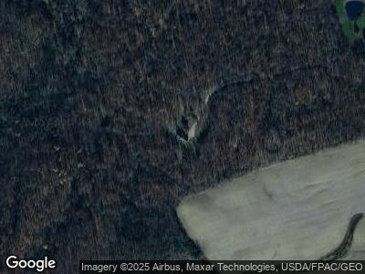
7262 State Route 287 Zanesfield, OH 43360
Estimated Value: $346,000 - $527,075
3
Beds
3
Baths
2,072
Sq Ft
$214/Sq Ft
Est. Value
About This Home
This home is located at 7262 State Route 287, Zanesfield, OH 43360 and is currently estimated at $444,025, approximately $214 per square foot. 7262 State Route 287 is a home located in Logan County with nearby schools including Triad Elementary School, Triad Middle School, and Triad High School.
Ownership History
Date
Name
Owned For
Owner Type
Purchase Details
Closed on
Jan 4, 2023
Sold by
Heath Mary Ann
Bought by
Shipp Troy
Current Estimated Value
Purchase Details
Closed on
Dec 21, 2018
Sold by
Shipp Shaun Troy
Bought by
Shipp Shaun Troy and Heath Mary Ann
Purchase Details
Closed on
Oct 11, 2017
Sold by
Shipp Teressa L
Bought by
Shipp Shaun Troy
Home Financials for this Owner
Home Financials are based on the most recent Mortgage that was taken out on this home.
Original Mortgage
$236,777
Interest Rate
3.91%
Create a Home Valuation Report for This Property
The Home Valuation Report is an in-depth analysis detailing your home's value as well as a comparison with similar homes in the area
Home Values in the Area
Average Home Value in this Area
Purchase History
| Date | Buyer | Sale Price | Title Company |
|---|---|---|---|
| Shipp Troy | -- | -- | |
| Shipp Shaun Troy | -- | None Available |
Source: Public Records
Mortgage History
| Date | Status | Borrower | Loan Amount |
|---|---|---|---|
| Previous Owner | Shipp Shaun | $236,777 |
Source: Public Records
Tax History Compared to Growth
Tax History
| Year | Tax Paid | Tax Assessment Tax Assessment Total Assessment is a certain percentage of the fair market value that is determined by local assessors to be the total taxable value of land and additions on the property. | Land | Improvement |
|---|---|---|---|---|
| 2024 | $3,749 | $112,520 | $42,130 | $70,390 |
| 2023 | $3,749 | $112,520 | $42,130 | $70,390 |
| 2022 | $3,753 | $90,010 | $33,700 | $56,310 |
| 2021 | $3,210 | $90,010 | $33,700 | $56,310 |
| 2020 | $3,214 | $81,210 | $23,860 | $57,350 |
| 2019 | $3,209 | $81,210 | $23,860 | $57,350 |
| 2018 | $2,855 | $81,210 | $23,860 | $57,350 |
| 2016 | $2,684 | $70,620 | $20,750 | $49,870 |
| 2014 | $2,634 | $70,620 | $20,750 | $49,870 |
| 2013 | $2,483 | $70,620 | $20,750 | $49,870 |
| 2012 | $2,334 | $69,460 | $18,460 | $51,000 |
Source: Public Records
Map
Nearby Homes
- 6398 State Route 287
- 6996 Township Road 150
- 6916 Township Road 177
- 10543 County Road 41
- 8455 County Road 44
- . Township Road 164
- 2547 State Route 245
- 2547 Ohio 245
- 0 Cox Rd Lot 10
- 0 Cox Rd Lot 11
- 7888 Mingo Lewisburg Rd
- 0 Cox Rd Lot 9
- 0 Cox Rd Lot 5
- 0 Cox Rd Lot 7
- 0 Cox Rd Lot 8
- 0 Cox Rd Lot 6
- 0
- 0 Township Road 147
- 6362 State Route 245
- 0
- 7262 State Route 287
- 7226 Ohio 287
- 7226 State Route 287
- 6932 Ohio 287
- 6932 State Route 287
- 6982 State Route 287
- 6876 State Route 287
- 6844 State Route 287
- 7440 Ohio 287
- 6880 State Route 287
- 10065 Ohio 287
- 7644 State Route 287
- 6340 State Route 287
- 6377 State Route 287
- 6478 State Route 287
- 6770 Township Road 150
- 6879 Ohio 287
- 9113 County Road 28
- 6426 State Route 287
- 9239 County Road 28
