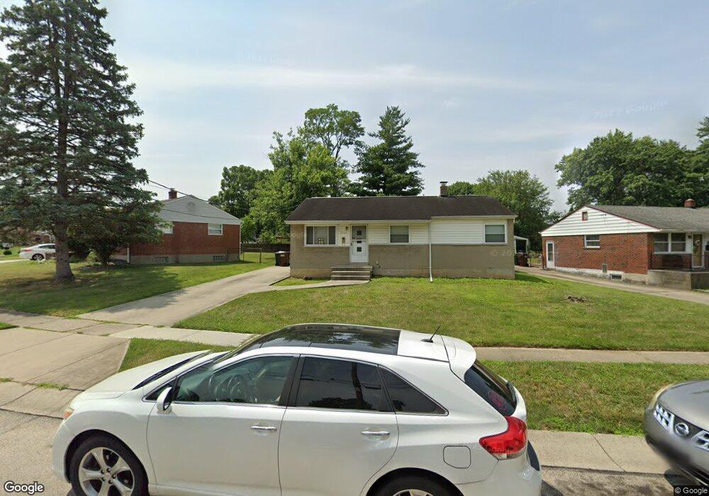
7265 Memory Ln Cincinnati, OH 45239
Estimated Value: $174,866 - $212,000
3
Beds
2
Baths
1,026
Sq Ft
$190/Sq Ft
Est. Value
About This Home
This home is located at 7265 Memory Ln, Cincinnati, OH 45239 and is currently estimated at $195,217, approximately $190 per square foot. 7265 Memory Ln is a home located in Hamilton County with nearby schools including White Oak Middle School, Colerain High School, and Cincinnati Achievement Academy.
Ownership History
Date
Name
Owned For
Owner Type
Purchase Details
Closed on
Jul 9, 2001
Sold by
Russell Constance J
Bought by
Russel Kenneth L
Current Estimated Value
Home Financials for this Owner
Home Financials are based on the most recent Mortgage that was taken out on this home.
Original Mortgage
$69,000
Interest Rate
10.5%
Purchase Details
Closed on
Jun 21, 2001
Sold by
Russell Kenneth L and Russell Norma L
Bought by
Russell Constance and Russell Constance J
Home Financials for this Owner
Home Financials are based on the most recent Mortgage that was taken out on this home.
Original Mortgage
$69,000
Interest Rate
10.5%
Create a Home Valuation Report for This Property
The Home Valuation Report is an in-depth analysis detailing your home's value as well as a comparison with similar homes in the area
Home Values in the Area
Average Home Value in this Area
Purchase History
| Date | Buyer | Sale Price | Title Company |
|---|---|---|---|
| Russel Kenneth L | -- | -- | |
| Russell Constance | -- | -- |
Source: Public Records
Mortgage History
| Date | Status | Borrower | Loan Amount |
|---|---|---|---|
| Closed | Russell Constance | $69,000 |
Source: Public Records
Tax History
| Year | Tax Paid | Tax Assessment Tax Assessment Total Assessment is a certain percentage of the fair market value that is determined by local assessors to be the total taxable value of land and additions on the property. | Land | Improvement |
|---|---|---|---|---|
| 2025 | $2,530 | $39,106 | $8,897 | $30,209 |
| 2023 | $2,370 | $39,106 | $8,897 | $30,209 |
| 2022 | $1,761 | $22,663 | $6,955 | $15,708 |
| 2021 | $1,747 | $22,663 | $6,955 | $15,708 |
| 2020 | $1,523 | $22,663 | $6,955 | $15,708 |
| 2019 | $1,385 | $19,205 | $5,894 | $13,311 |
| 2018 | $1,245 | $19,205 | $5,894 | $13,311 |
| 2017 | $1,181 | $19,205 | $5,894 | $13,311 |
| 2016 | $1,568 | $24,767 | $8,110 | $16,657 |
| 2015 | $1,530 | $24,767 | $8,110 | $16,657 |
| 2014 | $1,533 | $24,767 | $8,110 | $16,657 |
| 2013 | $1,606 | $26,919 | $8,813 | $18,106 |
Source: Public Records
Map
Nearby Homes
- 2564 Altura Dr
- 2680 Royal Glen Dr
- 2757 Banning Rd
- 2836 Banning Rd
- 6751 Rutherford Ct
- 2807 W Galbraith Rd
- 2427 Crosley Meadow
- 2750 W Galbraith Rd
- 2391 Deblin Dr
- 2701 Hennge Dr
- 2820 Geraldine Dr
- 2424 Banning Rd
- 8228 Haskell Dr
- 2405 Amelia Ct
- 8278 Lyness Dr
- 2806 Breezy Way
- 2655 Barthas Place
- 3140 Banning Rd
- 8265 Haskell Dr
- 2730 Byrneside Dr
- 7273 Memory Ln
- 7253 Memory Ln
- 7241 Memory Ln
- 7258 Memory Ln
- 7233 Memory Ln
- 7254 Memory Ln
- 7287 Memory Ln
- 7270 Memory Ln
- 7274 Memory Ln
- 7250 Longwood Ct
- 7264 Memory Ln
- 7280 Memory Ln
- 7227 Memory Ln
- 7248 Memory Ln
- 7286 Memory Ln
- 7242 Memory Ln
- 7291 Memory Ln
- 7230 Longwood Ct
- 7238 Memory Ln
- 7249 Longwood Ct
Your Personal Tour Guide
Ask me questions while you tour the home.