Estimated Value: $270,498 - $300,000
3
Beds
2
Baths
1,212
Sq Ft
$237/Sq Ft
Est. Value
About This Home
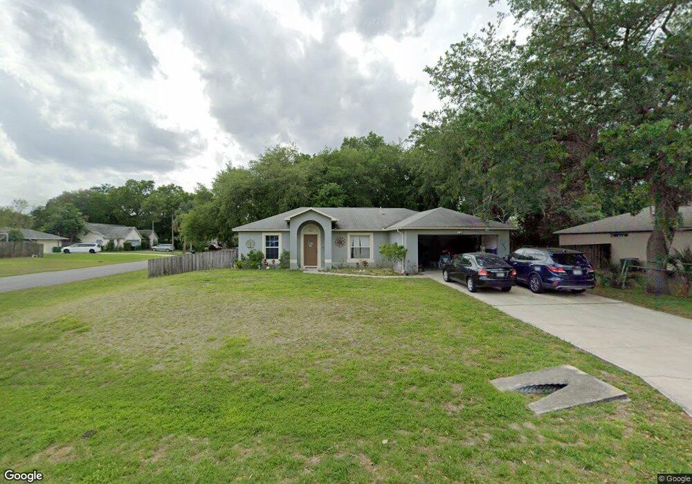
This home is located at 7270 Glentry Ave, Cocoa, FL 32927 and is currently estimated at $287,375, approximately $237 per square foot. 7270 Glentry Ave is a home located in Brevard County with nearby schools including Atlantis Elementary School, Space Coast Junior/Senior High School, and Sculptor Charter School.
Ownership History
Date
Name
Owned For
Owner Type
Purchase Details
Closed on
Mar 29, 2002
Sold by
Holiday Bldr Inc
Bought by
Mcchesney Todd L
Current Estimated Value
Home Financials for this Owner
Home Financials are based on the most recent Mortgage that was taken out on this home.
Original Mortgage
$91,421
Outstanding Balance
$37,871
Interest Rate
6.8%
Mortgage Type
Purchase Money Mortgage
Estimated Equity
$249,504
Purchase Details
Closed on
Nov 16, 2001
Sold by
Dunbar Jane M
Bought by
Holiday Bldr Inc
Create a Home Valuation Report for This Property
The Home Valuation Report is an in-depth analysis detailing your home's value as well as a comparison with similar homes in the area
Home Values in the Area
Average Home Value in this Area
Purchase History
| Date | Buyer | Sale Price | Title Company |
|---|---|---|---|
| Mcchesney Todd L | $89,700 | -- | |
| Holiday Bldr Inc | $11,000 | -- |
Source: Public Records
Mortgage History
| Date | Status | Borrower | Loan Amount |
|---|---|---|---|
| Open | Mcchesney Todd L | $91,421 |
Source: Public Records
Tax History
| Year | Tax Paid | Tax Assessment Tax Assessment Total Assessment is a certain percentage of the fair market value that is determined by local assessors to be the total taxable value of land and additions on the property. | Land | Improvement |
|---|---|---|---|---|
| 2025 | $1,108 | $82,790 | -- | -- |
| 2024 | $1,073 | $80,460 | -- | -- |
| 2023 | $1,073 | $78,120 | $0 | $0 |
| 2022 | $995 | $75,850 | $0 | $0 |
| 2021 | $993 | $73,650 | $0 | $0 |
| 2020 | $947 | $72,640 | $0 | $0 |
| 2019 | $895 | $71,010 | $0 | $0 |
| 2018 | $896 | $69,690 | $0 | $0 |
| 2017 | $898 | $68,260 | $0 | $0 |
| 2016 | $906 | $66,860 | $18,000 | $48,860 |
| 2015 | $915 | $66,400 | $15,000 | $51,400 |
| 2014 | $920 | $65,880 | $11,000 | $54,880 |
Source: Public Records
Map
Nearby Homes
- 7245 Grissom Pkwy
- 0 Cinnamon Fern Blvd
- 7275 Durban Ave
- 7456 Camio Ave
- 7155 Export Ave
- 5200 Frisco St
- 5150 Melody St
- 7310 Joshua Place
- 7450 Calmoso Ave
- 5080 Mayflower St
- 4550 Flood St
- 6990 Camden Ave
- 5165 Patricia St
- 4625 Curtis Blvd
- 7160 Carlowe Ave
- 7545 Fringe Place
- 5155 Mayflower St
- 4824 Curtis Blvd
- 5242 Yaupon Holly Dr
- 4760 Ivan St
- 7280 Glentry Ave
- 7270 Hartman St
- 7250 Glentry Ave
- 7275 Glentry Ave
- 4955 Crown St
- 7260 Hartman St
- 7285 Glentry Ave
- 7265 Glentry Ave
- 7275 Hartman St
- 7240 Glentry Ave
- 4965 Crown St
- 7255 Glentry Ave
- 4925 Crown St
- 7245 Hartman St
- 7250 Hartman St
- 7245 Glentry Ave
- 4975 Crown St
- 4940 Crown St
- 4950 Crown St
- 7230 Glentry Ave
Your Personal Tour Guide
Ask me questions while you tour the home.