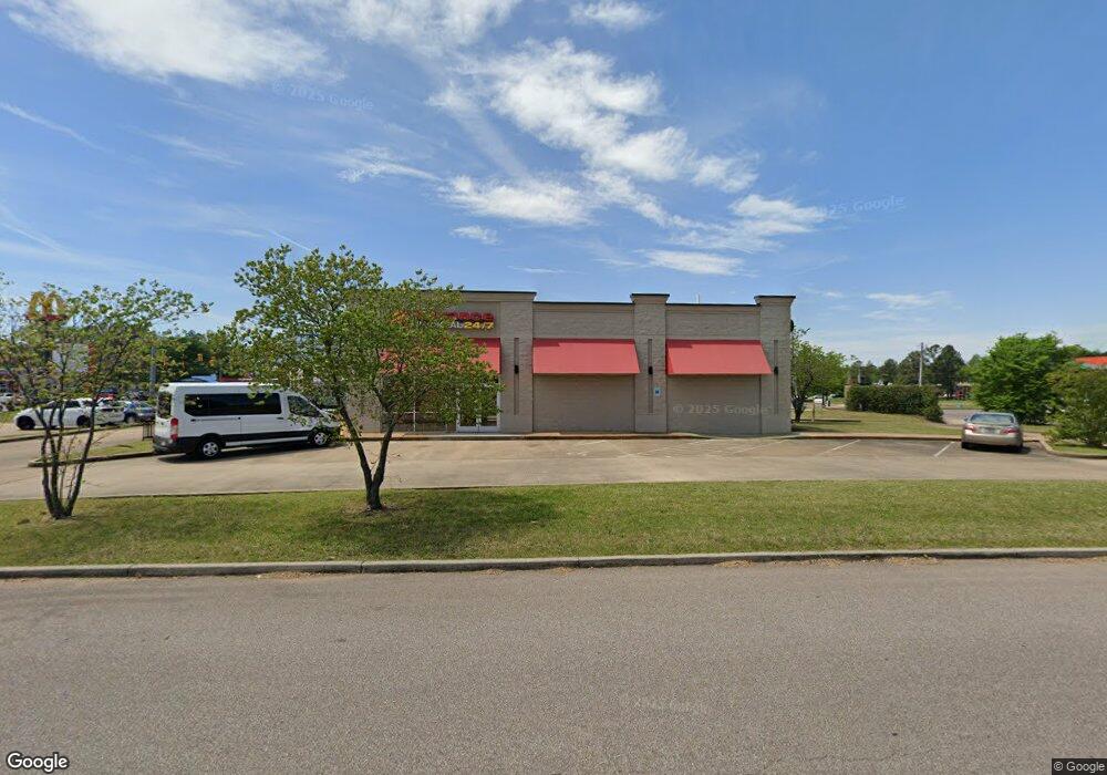
7275 Highway 64 Oakland, TN 38060
Estimated Value: $1,728,933
--
Bed
2
Baths
1,848
Sq Ft
$936/Sq Ft
Est. Value
About This Home
This home is located at 7275 Highway 64, Oakland, TN 38060 and is currently estimated at $1,728,933, approximately $935 per square foot. 7275 Highway 64 is a home located in Fayette County with nearby schools including Oakland Elementary School, West Junior High School, and Fayette Ware Comprehensive High School.
Ownership History
Date
Name
Owned For
Owner Type
Purchase Details
Closed on
May 11, 2023
Sold by
Series B A Separate Series Of Jdg001 Llc
Bought by
315 E Tickle Llc
Current Estimated Value
Home Financials for this Owner
Home Financials are based on the most recent Mortgage that was taken out on this home.
Original Mortgage
$1,360,000
Outstanding Balance
$1,274,754
Interest Rate
6.32%
Mortgage Type
New Conventional
Estimated Equity
$454,179
Purchase Details
Closed on
Jun 28, 2018
Sold by
Caldwell Fayette Llc
Bought by
Series Of Jdg 001 Llc
Home Financials for this Owner
Home Financials are based on the most recent Mortgage that was taken out on this home.
Original Mortgage
$1,022,400
Interest Rate
4.6%
Mortgage Type
Construction
Purchase Details
Closed on
Feb 27, 2007
Bought by
Caldwell Fayette Llc
Purchase Details
Closed on
Oct 31, 2006
Create a Home Valuation Report for This Property
The Home Valuation Report is an in-depth analysis detailing your home's value as well as a comparison with similar homes in the area
Home Values in the Area
Average Home Value in this Area
Purchase History
| Date | Buyer | Sale Price | Title Company |
|---|---|---|---|
| 315 E Tickle Llc | $1,700,000 | None Listed On Document | |
| Series Of Jdg 001 Llc | $775,000 | None Available | |
| Caldwell Fayette Llc | $397,500 | -- | |
| -- | $625,000 | -- |
Source: Public Records
Mortgage History
| Date | Status | Borrower | Loan Amount |
|---|---|---|---|
| Open | 315 E Tickle Llc | $1,360,000 | |
| Previous Owner | Series Of Jdg 001 Llc | $1,022,400 |
Source: Public Records
Tax History Compared to Growth
Tax History
| Year | Tax Paid | Tax Assessment Tax Assessment Total Assessment is a certain percentage of the fair market value that is determined by local assessors to be the total taxable value of land and additions on the property. | Land | Improvement |
|---|---|---|---|---|
| 2024 | $6,300 | $243,920 | $132,000 | $111,920 |
| 2023 | $6,300 | $243,920 | $0 | $0 |
| 2022 | $4,177 | $243,920 | $132,000 | $111,920 |
| 2021 | $4,177 | $243,920 | $132,000 | $111,920 |
| 2020 | $3,321 | $243,920 | $132,000 | $111,920 |
| 2019 | $4,471 | $220,320 | $115,520 | $104,800 |
| 2018 | $4,462 | $213,720 | $99,000 | $114,720 |
| 2017 | $3,802 | $213,720 | $99,000 | $114,720 |
| 2016 | $4,017 | $211,120 | $99,000 | $112,120 |
| 2015 | $4,017 | $211,120 | $99,000 | $112,120 |
| 2014 | $4,017 | $211,120 | $99,000 | $112,120 |
Source: Public Records
Map
Nearby Homes
- 000 Hwy 64
- 270 Oak St
- 0 Mcauley St Unit 10186597
- 65 Cleer Ave
- 50 High St
- 24.17 AC Tennessee 194
- 50 Umble St
- 60 Umble St
- 95 Blue St
- 65 Blue St
- 120 Blue St
- 0 Mcfadden Dr Unit 10209515
- 195 Chickasaw Trace Dr
- 40 Gracie Cove
- 70 Valleyview Ln
- 22 Doral Loop
- 300 Saint Andrews Dr
- 175 Saint Andrews Dr
- 290 Saint Andrews Dr
- 205 Saint Andrews Dr
- 7275 Highway 64
- 0 Hwy 194 Hwy N Unit 3128025
- 0 Hwy 194 Hwy N Unit 3166090
- 0 S Hwy 194 Hwy Unit 3166679
- 0 Hwy 194 Hwy N Unit 3167426
- 0 Hwy 194 Hwy N Unit 3170649
- 0 Hwy194 Hwy Unit 3175776
- 0 Hwy 194 Hwy N Unit 3186654
- 0 Hwy 194 Hwy N Unit 3246334
- 0 Hwy 194 Hwy N Unit 3246333
- 0 Hwy 194 Hwy N Unit 3259895
- 0 Hwy 194 Hwy N Unit 3266207
- 0 Highway 194 Hwy S Unit 9960027
- 0 Hwy 194 Hwy N Unit 3267606
- 0 Highway 194 Hwy S Unit 9974180
- 0 Highway 194 Hwy S Unit 9983267
- 0000 Highway 194 Hwy
- 0 Hwy 194 Hwy N Unit 10015048
- 0 Hwy 194 Hwy N Unit 10015367
- 0 Hwy 194 Hwy N Unit 10028655