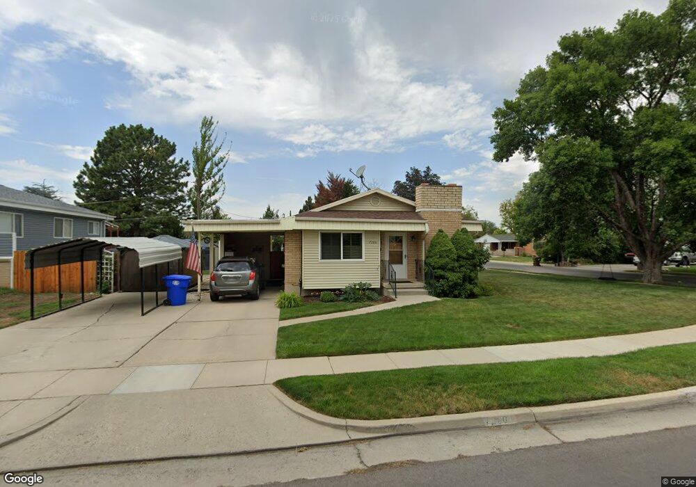
7280 Rusty Dr Midvale, UT 84047
Estimated Value: $545,432 - $774,000
7
Beds
3
Baths
3,550
Sq Ft
$191/Sq Ft
Est. Value
About This Home
This home is located at 7280 Rusty Dr, Midvale, UT 84047 and is currently estimated at $677,608, approximately $190 per square foot. 7280 Rusty Dr is a home located in Salt Lake County with nearby schools including Midvalley Elementary School, Hillcrest High School, and Midvale Middle School.
Ownership History
Date
Name
Owned For
Owner Type
Purchase Details
Closed on
Jun 13, 2023
Sold by
Beckstead Randal J
Bought by
Randal And Jacque Beckstead Trust
Current Estimated Value
Purchase Details
Closed on
Sep 27, 2001
Sold by
Beckstead Randal J
Bought by
Beckstead Randal J and Beckstead Jacque A
Home Financials for this Owner
Home Financials are based on the most recent Mortgage that was taken out on this home.
Original Mortgage
$177,500
Interest Rate
6.91%
Create a Home Valuation Report for This Property
The Home Valuation Report is an in-depth analysis detailing your home's value as well as a comparison with similar homes in the area
Home Values in the Area
Average Home Value in this Area
Purchase History
| Date | Buyer | Sale Price | Title Company |
|---|---|---|---|
| Randal And Jacque Beckstead Trust | -- | None Listed On Document | |
| Beckstead Randal J | -- | First American Title | |
| Beckstead Randal J | -- | First American Title |
Source: Public Records
Mortgage History
| Date | Status | Borrower | Loan Amount |
|---|---|---|---|
| Previous Owner | Beckstead Randal J | $177,500 |
Source: Public Records
Tax History
| Year | Tax Paid | Tax Assessment Tax Assessment Total Assessment is a certain percentage of the fair market value that is determined by local assessors to be the total taxable value of land and additions on the property. | Land | Improvement |
|---|---|---|---|---|
| 2025 | $3,541 | $614,500 | $157,600 | $456,900 |
| 2024 | $3,541 | $581,400 | $147,900 | $433,500 |
| 2023 | $3,358 | $546,300 | $140,700 | $405,600 |
| 2022 | $3,552 | $564,500 | $137,900 | $426,600 |
| 2021 | $3,161 | $429,500 | $137,900 | $291,600 |
| 2020 | $3,017 | $388,000 | $92,100 | $295,900 |
| 2019 | $2,958 | $370,600 | $86,900 | $283,700 |
| 2016 | $2,416 | $285,300 | $86,900 | $198,400 |
Source: Public Records
Map
Nearby Homes
- 106 E 7320 S
- 72 E 7320 S
- 7214 S 160 E
- 7377 S Ramanee Dr
- 221 E Fort Union Blvd
- 7045 S 65 E
- 7097 S 230 E
- 195 E 7060 S
- 110 Greenwood Ave
- 7479 S Randall Cir
- 30 W 7500 S Unit 18
- 7218 S Viansa Ct
- 220 E Greenwood Ave
- 7309 S Union Village Cir
- 6954 S 85 E
- 7045 S 300 E
- 7033 S 300 E
- 7359 S Dewmar Ct W Unit 32
- 489 E 7800 S Unit 2
- 7363 S Dewmar Ct W Unit 33
- 7292 S Rusty Dr
- 7292 Rusty Dr
- 104 Nicoletti Dr
- 122 Nicoletti Dr
- 7287 Rusty Dr
- 98 E Nicoletti Dr
- 98 Nicoletti Dr
- 7304 Rusty Dr
- 109 Nicoletti Dr
- 109 E Nicoletti Dr
- 113 Nicoletti Dr
- 113 E Nicoletti Dr
- 105 Nicoletti Dr
- 105 E Nicoletti Dr
- 7297 Rusty Dr
- 121 E Nicoletti Dr
- 95 Nicoletti Dr
- 80 E Nicoletti Dr
- 80 Nicoletti Dr
- 7280 S 145 E
Your Personal Tour Guide
Ask me questions while you tour the home.