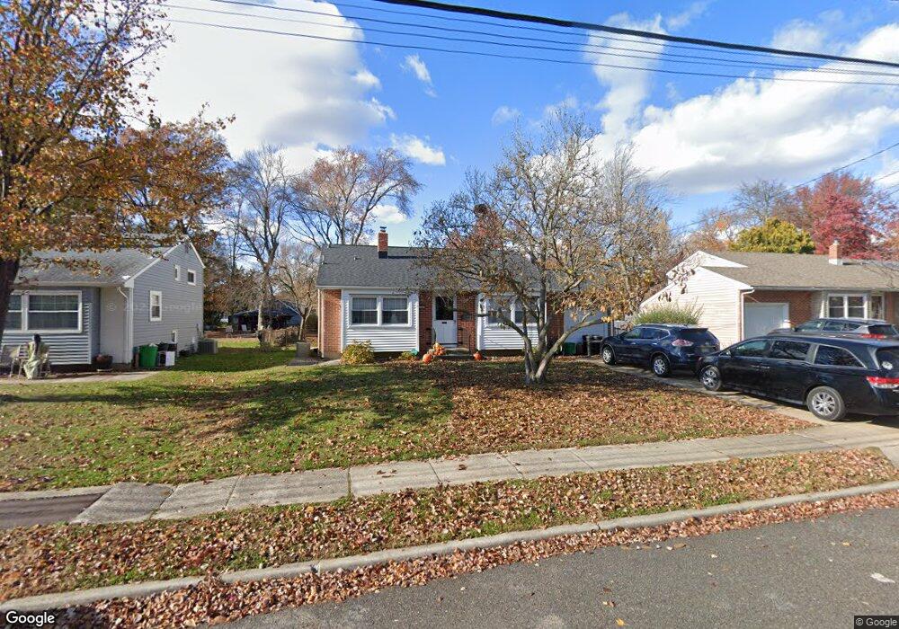
729 Shields Ave West Deptford, NJ 08096
West Deptford Township NeighborhoodEstimated Value: $331,914 - $368,000
3
Beds
2
Baths
1,464
Sq Ft
$239/Sq Ft
Est. Value
About This Home
This home is located at 729 Shields Ave, West Deptford, NJ 08096 and is currently estimated at $349,729, approximately $238 per square foot. 729 Shields Ave is a home located in Gloucester County with nearby schools including Oakview Elementary School, Red Bank Elementary School, and Green-Fields Elementary School.
Ownership History
Date
Name
Owned For
Owner Type
Purchase Details
Closed on
Nov 11, 2009
Sold by
Ferris Barbara and Ferris Leo Robert
Bought by
Still John T and Still Angela M
Current Estimated Value
Home Financials for this Owner
Home Financials are based on the most recent Mortgage that was taken out on this home.
Original Mortgage
$186,558
Outstanding Balance
$121,940
Interest Rate
5.02%
Mortgage Type
FHA
Estimated Equity
$227,790
Purchase Details
Closed on
Jan 20, 2006
Sold by
Leo Bertha
Bought by
Ferris Barbara and Ferris Leo Robert
Create a Home Valuation Report for This Property
The Home Valuation Report is an in-depth analysis detailing your home's value as well as a comparison with similar homes in the area
Home Values in the Area
Average Home Value in this Area
Purchase History
| Date | Buyer | Sale Price | Title Company |
|---|---|---|---|
| Still John T | $190,000 | Group 21 Title Agency | |
| Ferris Barbara | -- | -- |
Source: Public Records
Mortgage History
| Date | Status | Borrower | Loan Amount |
|---|---|---|---|
| Open | Still John T | $186,558 |
Source: Public Records
Tax History Compared to Growth
Tax History
| Year | Tax Paid | Tax Assessment Tax Assessment Total Assessment is a certain percentage of the fair market value that is determined by local assessors to be the total taxable value of land and additions on the property. | Land | Improvement |
|---|---|---|---|---|
| 2025 | $6,038 | $172,900 | $57,200 | $115,700 |
| 2024 | $5,960 | $172,900 | $57,200 | $115,700 |
| 2023 | $5,960 | $172,900 | $57,200 | $115,700 |
| 2022 | $5,932 | $172,900 | $57,200 | $115,700 |
| 2021 | $5,911 | $172,900 | $57,200 | $115,700 |
| 2020 | $5,898 | $172,900 | $57,200 | $115,700 |
| 2019 | $5,733 | $172,900 | $57,200 | $115,700 |
| 2018 | $5,578 | $172,900 | $57,200 | $115,700 |
| 2017 | $5,448 | $172,900 | $57,200 | $115,700 |
| 2016 | $5,296 | $172,900 | $57,200 | $115,700 |
| 2015 | $5,045 | $172,900 | $57,200 | $115,700 |
| 2014 | $4,795 | $172,900 | $57,200 | $115,700 |
Source: Public Records
Map
Nearby Homes
- 654 Frances Ave
- 193 Dubois Ave
- 210 Lawnton Ave
- 302 W Red Bank Ave
- 131 Watkins Ave
- 121 Crescent Ave
- 815 Harker Ave
- 46 Lynn Dr
- 7 Victorian Way
- 70 Crescent Ave
- 38 Watkins Ave
- 3 Victorian Way
- 2 Victorian Way
- 41 Crescent Ave
- 17 Watkins Ave
- 1029 Tatum St
- 120 Progress Ave
- 112 Progress Ave
- 83 Lynn Dr
- 626 Green St
- 735 Shields Ave
- 711 Shields Ave
- 745 Shields Ave
- 728 Carter Ave
- 720 Carter Ave
- 701 Shields Ave
- 736 Carter Ave
- 755 Shields Ave
- 710 Carter Ave
- 746 Carter Ave
- 728 Shields Ave
- 712 Shields Ave
- 691 Shields Ave
- 763 Shields Ave
- 700 Carter Ave
- 754 Carter Ave
- 744 Shields Ave
- 700 Shields Ave
- 754 Shields Ave
- 690 Carter Ave