Estimated Value: $348,434 - $373,000
3
Beds
2
Baths
1,782
Sq Ft
$203/Sq Ft
Est. Value
About This Home
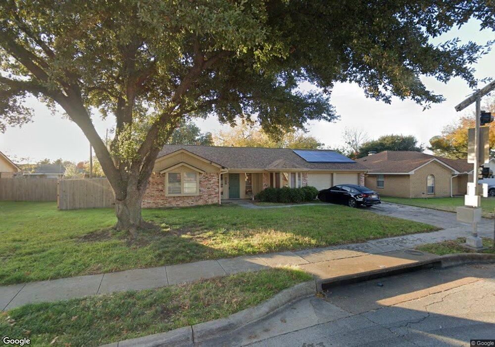
This home is located at 729 Springhill Dr, Hurst, TX 76054 and is currently estimated at $361,609, approximately $202 per square foot. 729 Springhill Dr is a home located in Tarrant County with nearby schools including W.A. Porter Elementary School, Smithfield Middle School, and Birdville High School.
Ownership History
Date
Name
Owned For
Owner Type
Purchase Details
Closed on
Sep 24, 2001
Sold by
Roussey Timothy John and Roussey Sharon Elizabeth
Bought by
Worrell Ii Robert and Worrell Joanne M
Current Estimated Value
Home Financials for this Owner
Home Financials are based on the most recent Mortgage that was taken out on this home.
Original Mortgage
$99,900
Outstanding Balance
$38,643
Interest Rate
6.88%
Estimated Equity
$322,966
Create a Home Valuation Report for This Property
The Home Valuation Report is an in-depth analysis detailing your home's value as well as a comparison with similar homes in the area
Home Values in the Area
Average Home Value in this Area
Purchase History
| Date | Buyer | Sale Price | Title Company |
|---|---|---|---|
| Worrell Ii Robert | -- | Allegiance Title Company |
Source: Public Records
Mortgage History
| Date | Status | Borrower | Loan Amount |
|---|---|---|---|
| Open | Worrell Ii Robert | $99,900 |
Source: Public Records
Tax History Compared to Growth
Tax History
| Year | Tax Paid | Tax Assessment Tax Assessment Total Assessment is a certain percentage of the fair market value that is determined by local assessors to be the total taxable value of land and additions on the property. | Land | Improvement |
|---|---|---|---|---|
| 2025 | $5,066 | $295,000 | $60,000 | $235,000 |
| 2024 | $5,066 | $313,567 | $60,000 | $253,567 |
| 2023 | $6,264 | $340,072 | $60,000 | $280,072 |
| 2022 | $6,160 | $292,542 | $40,000 | $252,542 |
| 2021 | $5,876 | $226,510 | $40,000 | $186,510 |
| 2020 | $5,821 | $226,510 | $40,000 | $186,510 |
| 2019 | $5,642 | $229,868 | $40,000 | $189,868 |
| 2018 | $4,539 | $195,125 | $40,000 | $155,125 |
| 2017 | $4,733 | $208,874 | $40,000 | $168,874 |
| 2016 | $4,303 | $182,190 | $35,000 | $147,190 |
| 2015 | $3,539 | $146,600 | $20,000 | $126,600 |
| 2014 | $3,539 | $146,600 | $20,000 | $126,600 |
Source: Public Records
Map
Nearby Homes
- 736 Springhill Dr
- 712 Springhill Dr
- 2804 Ridgewood Dr
- 712 Springwood Dr
- 2908 Steve Dr
- 6521 Rock Springs Dr
- 6801 Woodland Hills Dr
- 6704 Nob Hill Ct
- 6708 Nob Hill Ct
- 2809 Sandstone Dr
- 2668 Bent Tree Dr
- 2829 Sandstone Dr
- 2844 Hurstview Dr
- 6505 Parkway Ave
- 6625 Crane Rd
- 8920 Martin Dr
- 2732 Woodbridge Dr
- 2620 Brookridge Dr
- 6509 Paula Ct
- 713 Paul Dr
- 733 Springhill Dr
- 725 Springhill Dr
- 728 Spring Valley Dr
- 724 Spring Valley Dr
- 732 Spring Valley Dr
- 737 Springhill Dr
- 732 Springhill Dr
- 736 Spring Valley Dr
- 728 Springhill Dr
- 724 Springhill Dr
- 740 Springhill Dr
- 740 Spring Valley Dr
- 741 Springhill Dr
- 2733 Prestondale Dr
- 729 Spring Valley Dr
- 720 Springhill Dr
- 744 Springhill Dr
- 733 Spring Valley Dr
- 744 Spring Valley Dr
- 737 Glenhaven Dr