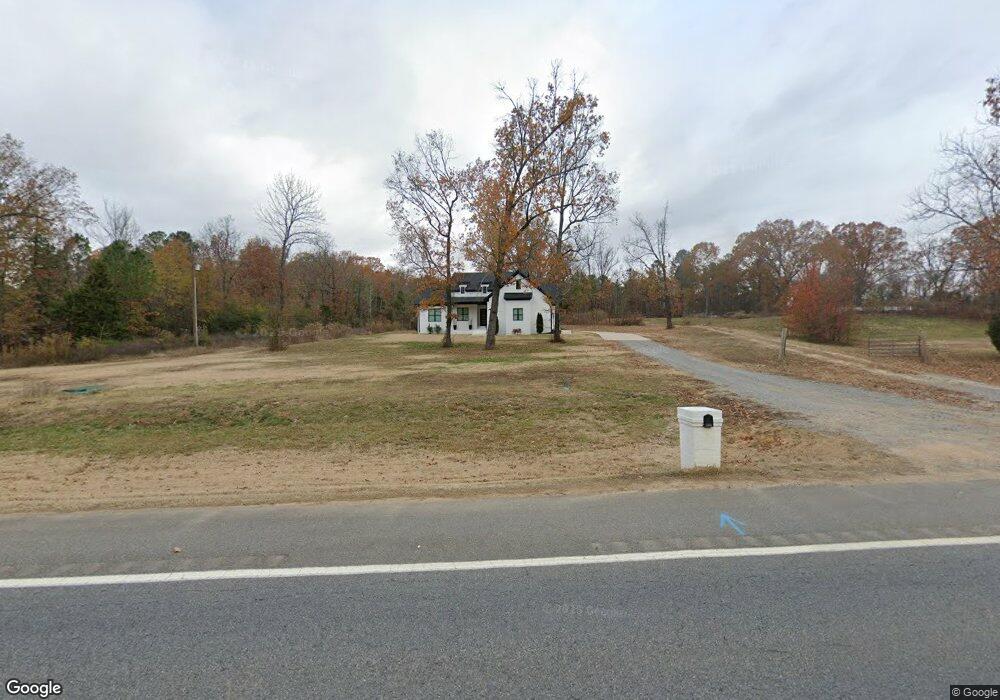
7294 Highway 67 Haskell, AR 72015
Estimated Value: $316,000 - $357,000
--
Bed
--
Bath
2,170
Sq Ft
$158/Sq Ft
Est. Value
About This Home
This home is located at 7294 Highway 67, Haskell, AR 72015 and is currently estimated at $342,333, approximately $157 per square foot. 7294 Highway 67 is a home located in Saline County with nearby schools including Westbrook Elementary School, Harmony Grove Middle School, and Harmony Grove High School.
Ownership History
Date
Name
Owned For
Owner Type
Purchase Details
Closed on
Mar 1, 2021
Sold by
Cole James W and Cole Karen L
Bought by
M & J Property Holdings Llc
Current Estimated Value
Home Financials for this Owner
Home Financials are based on the most recent Mortgage that was taken out on this home.
Original Mortgage
$195,531
Interest Rate
2.7%
Mortgage Type
Construction
Purchase Details
Closed on
Feb 24, 2021
Sold by
Cole James W and Cole Karen L
Bought by
Mj Property Holdings Llc
Home Financials for this Owner
Home Financials are based on the most recent Mortgage that was taken out on this home.
Original Mortgage
$195,531
Interest Rate
2.7%
Mortgage Type
Construction
Purchase Details
Closed on
Oct 2, 2020
Sold by
Fb Acquisition Property Xxi Llc
Bought by
Cole James
Purchase Details
Closed on
Mar 15, 2012
Bought by
Loftin
Create a Home Valuation Report for This Property
The Home Valuation Report is an in-depth analysis detailing your home's value as well as a comparison with similar homes in the area
Home Values in the Area
Average Home Value in this Area
Purchase History
| Date | Buyer | Sale Price | Title Company |
|---|---|---|---|
| M & J Property Holdings Llc | $32,400 | Commerce Title | |
| Mj Property Holdings Llc | $32,400 | Commerce Ttl & Closing Svcs | |
| Cole James | $15,000 | First National Title Company | |
| Loftin | $10,000 | -- |
Source: Public Records
Mortgage History
| Date | Status | Borrower | Loan Amount |
|---|---|---|---|
| Closed | M & J Property Holdings Llc | $195,531 | |
| Closed | Mj Property Holdings Llc | $195,531 |
Source: Public Records
Tax History Compared to Growth
Tax History
| Year | Tax Paid | Tax Assessment Tax Assessment Total Assessment is a certain percentage of the fair market value that is determined by local assessors to be the total taxable value of land and additions on the property. | Land | Improvement |
|---|---|---|---|---|
| 2025 | $3,181 | $58,682 | $3,000 | $55,682 |
| 2024 | $3,022 | $58,682 | $3,000 | $55,682 |
| 2023 | $2,851 | $58,682 | $3,000 | $55,682 |
| 2022 | $2,901 | $58,682 | $3,000 | $55,682 |
| 2021 | $149 | $1,000 | $1,000 | $0 |
| 2020 | $54 | $1,000 | $1,000 | $0 |
| 2019 | $52 | $1,000 | $1,000 | $0 |
| 2018 | $52 | $1,000 | $1,000 | $0 |
| 2017 | $52 | $1,000 | $1,000 | $0 |
| 2016 | $52 | $1,000 | $1,000 | $0 |
| 2015 | $52 | $1,000 | $1,000 | $0 |
| 2014 | $52 | $1,000 | $1,000 | $0 |
Source: Public Records
Map
Nearby Homes
- 109 Riveria Cove
- 143 Silver Springs Dr
- 105 Valderrama Dr
- 129 Silver Springs Dr
- 128 Silver Springs Dr
- 115 Harmony Hills Dr
- 117 Harmony Hills Dr
- 123 Harmony Village Dr
- 121 Harmony Hills
- 122 Harmony Village Dr
- 119 Harmony Village Dr
- Lot 87 Harmony Village
- 105 Dylan
- 103 Dylan
- 114 Harmony Village Dr
- Lot 52 Harmony Village
- Lot 51 Harmony Village
- Lot 50 Harmony Village
- 113 Harmony Village Dr
- 111 Harmony Village Dr
- 7294 Hwy 67
- 7268 Highway 67
- 7354 Highway 67
- 7221 Highway 67
- 7200 Highway 67
- 7351 Highway 67
- 7181 Highway 67
- 7370 Highway 67
- 7133 Highway 67
- 101 Riveria Cove
- 103 Riveria Cove
- 105 Riveria Cove
- 0 Riveria Cove Unit 15027890
- 0 Riveria Cove Unit 16018267
- 0 Riveria Cove Unit 17024187
- 107 Riveria Cove
- 7507 Highway 67
- 111 Riveria Cove
- 113 Riveria Cove
- 121 Glenn Abbey Dr