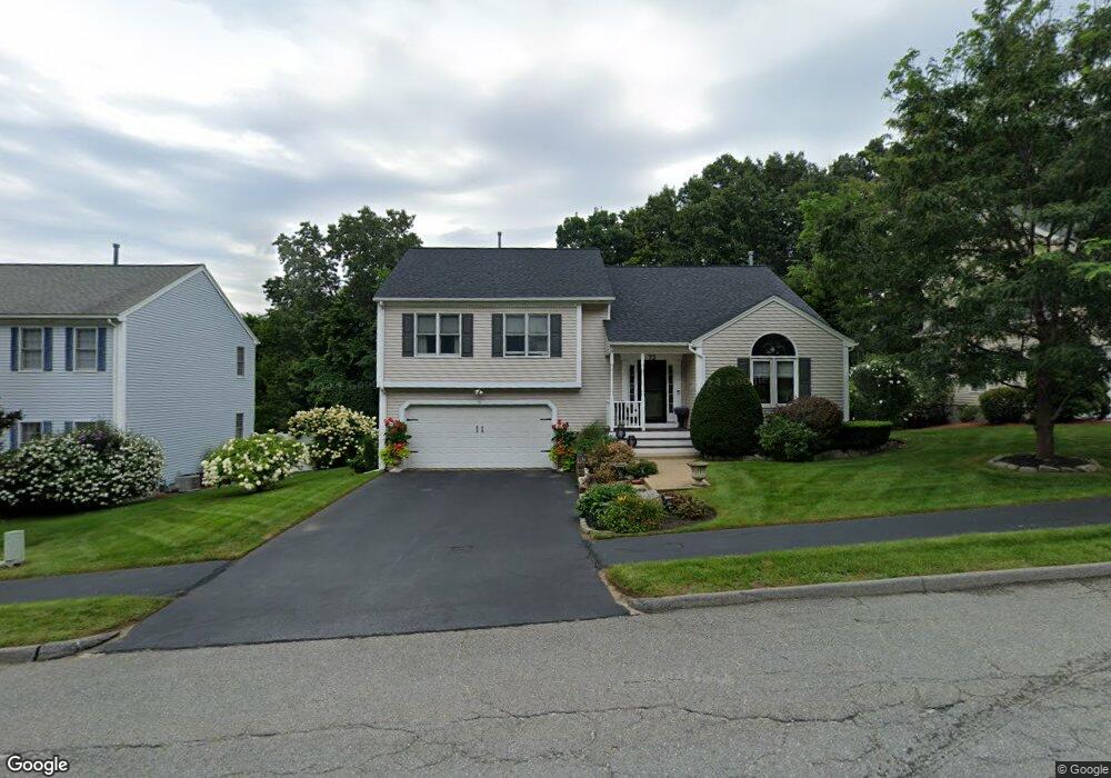
73 Bjorklund Ave Worcester, MA 01605
Forest Grove NeighborhoodEstimated Value: $524,000 - $550,000
2
Beds
3
Baths
1,467
Sq Ft
$363/Sq Ft
Est. Value
About This Home
This home is located at 73 Bjorklund Ave, Worcester, MA 01605 and is currently estimated at $532,117, approximately $362 per square foot. 73 Bjorklund Ave is a home located in Worcester County with nearby schools including Nelson Place Elementary School, Jacob Hiatt Magnet School, and Chandler Magnet.
Ownership History
Date
Name
Owned For
Owner Type
Purchase Details
Closed on
Mar 10, 2025
Sold by
Mercure Cheryl E
Bought by
Esper Rt and Esper
Current Estimated Value
Purchase Details
Closed on
Mar 30, 1998
Sold by
Lodge Corp
Bought by
Mercure Cheryl Esper
Create a Home Valuation Report for This Property
The Home Valuation Report is an in-depth analysis detailing your home's value as well as a comparison with similar homes in the area
Home Values in the Area
Average Home Value in this Area
Purchase History
| Date | Buyer | Sale Price | Title Company |
|---|---|---|---|
| Esper Rt | -- | None Available | |
| Mercure Cheryl Esper | $187,878 | -- |
Source: Public Records
Mortgage History
| Date | Status | Borrower | Loan Amount |
|---|---|---|---|
| Previous Owner | Mercure Cheryl Esper | $45,000 | |
| Previous Owner | Mercure Cheryl Esper | $20,000 |
Source: Public Records
Tax History
| Year | Tax Paid | Tax Assessment Tax Assessment Total Assessment is a certain percentage of the fair market value that is determined by local assessors to be the total taxable value of land and additions on the property. | Land | Improvement |
|---|---|---|---|---|
| 2025 | $6,304 | $477,900 | $118,200 | $359,700 |
| 2024 | $6,122 | $445,200 | $118,200 | $327,000 |
| 2023 | $5,914 | $412,400 | $102,700 | $309,700 |
| 2022 | $5,514 | $362,500 | $82,200 | $280,300 |
| 2021 | $5,740 | $352,600 | $65,800 | $286,800 |
| 2020 | $5,313 | $312,500 | $65,800 | $246,700 |
| 2019 | $5,393 | $299,600 | $59,200 | $240,400 |
| 2018 | $5,304 | $280,500 | $59,200 | $221,300 |
| 2017 | $5,222 | $271,700 | $59,200 | $212,500 |
| 2016 | $5,107 | $247,800 | $43,200 | $204,600 |
| 2015 | $4,973 | $247,800 | $43,200 | $204,600 |
| 2014 | $4,842 | $247,800 | $43,200 | $204,600 |
Source: Public Records
Map
Nearby Homes
- 71 Bjorklund Ave
- 75 Bjorklund Ave
- 17 Eleanor Dr
- 15 Eleanor Dr
- 77 Bjorklund Ave
- 67 Bjorklund Ave
- 74 Bjorklund Ave
- 76 Bjorklund Ave
- 72 Bjorklund Ave
- 63 Bjorklund Ave
- 11 Eleanor Dr
- 61 Bjorklund Ave
- 78 Bjorklund Ave
- 79 Bjorklund Ave
- 70 Bjorklund Ave
- 9 Eleanor Dr
- 80 1/2 Bjorklund Ave
- 71 Venus Dr
- 80 Bjorklund Ave
- 69 Venus Dr
Your Personal Tour Guide
Ask me questions while you tour the home.