
Seller's Agent in 2025
Amanda Kundel
Kinlin Grover Compass
(508) 362-2120
11 in this area
135 Total Sales
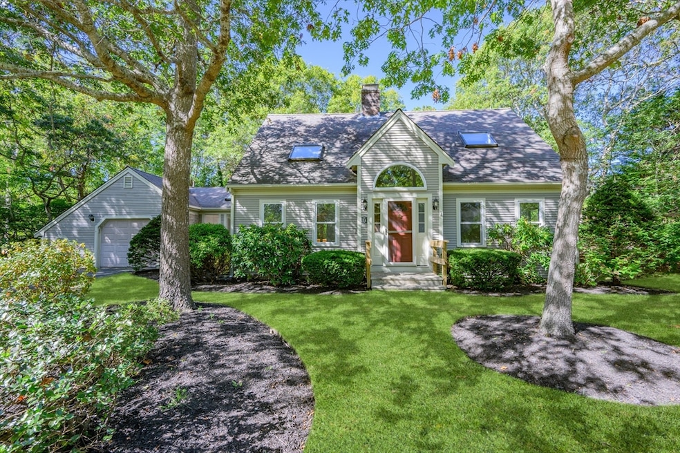
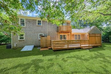
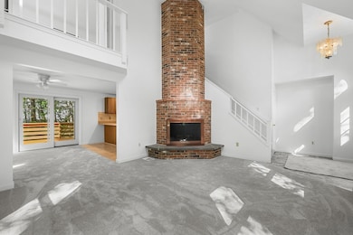
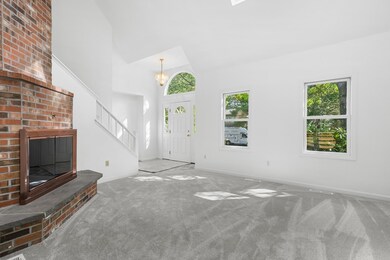
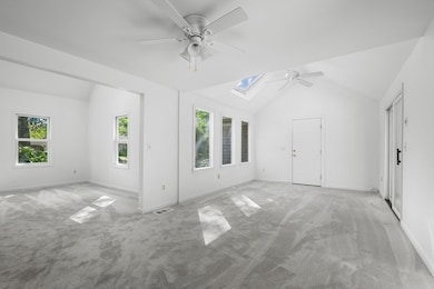
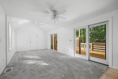
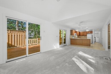
This spacious contemporary cape is sure to impress. Nestled in a neighborhood setting, just minutes to dining, shopping, and the Cape's best beaches is where you will find this beautiful property. Inside, this home features three bedrooms, including a first-floor bedroom with an adjacent bathroom and laundry for added convenience. The main living area boasts soaring ceilings and a gorgeous fireplace, creating a bright and inviting space that seamlessly connects the living room, dining area, and kitchen. This setup is perfect for both everyday living and entertaining guests. Additional features include an attached garage, central air conditioning, Town Water and Town Sewer. The property is freshly painted throughout with new carpet, creating a fresh and welcoming ambiance. Step outside to find a large deck overlooking a level yard, providing the perfect spot for outdoor relaxation and gatherings. A great year-round residence or a vacation home.
| Date | Type | Sale Price | Title Company |
|---|---|---|---|
| Deed | $338,500 | -- | |
| Deed | $136,000 | -- |
| Date | Status | Loan Amount | Loan Type |
|---|---|---|---|
| Previous Owner | $160,000 | No Value Available | |
| Previous Owner | $100,000 | No Value Available | |
| Previous Owner | $95,000 | Purchase Money Mortgage |
| Date | Event | Price | List to Sale | Price per Sq Ft |
|---|---|---|---|---|
| 11/25/2025 11/25/25 | Sold | $649,000 | 0.0% | $381 / Sq Ft |
| 10/13/2025 10/13/25 | Pending | -- | -- | -- |
| 10/10/2025 10/10/25 | For Sale | $649,000 | -- | $381 / Sq Ft |
| Year | Tax Paid | Tax Assessment Tax Assessment Total Assessment is a certain percentage of the fair market value that is determined by local assessors to be the total taxable value of land and additions on the property. | Land | Improvement |
|---|---|---|---|---|
| 2025 | $5,909 | $637,400 | $151,900 | $485,500 |
| 2024 | $5,482 | $605,700 | $151,900 | $453,800 |
| 2023 | $5,216 | $545,000 | $138,100 | $406,900 |
| 2022 | $5,129 | $443,300 | $102,300 | $341,000 |
| 2021 | $4,715 | $395,900 | $102,300 | $293,600 |
| 2020 | $4,796 | $389,000 | $102,300 | $286,700 |
| 2019 | $4,524 | $359,600 | $102,300 | $257,300 |
| 2018 | $3,920 | $318,700 | $107,700 | $211,000 |
| 2017 | $3,701 | $308,700 | $107,700 | $201,000 |
| 2016 | $3,630 | $309,500 | $108,500 | $201,000 |
| 2015 | $3,486 | $301,300 | $105,100 | $196,200 |
Seller's Agent in 2025
Amanda Kundel
Kinlin Grover Compass
(508) 362-2120
11 in this area
135 Total Sales
E
Buyer's Agent in 2025
Elaine Roy
Today Real Estate, Inc.
(508) 901-1478
14 in this area
80 Total Sales
Source: MLS Property Information Network (MLS PIN)
MLS Number: 73442392
APN: HYAN-000251-000000-000246
Disclaimer: Certain information contained herein is derived from information provided by parties other than Homes.com. All information provided is deemed reliable, but is not guaranteed to be accurate and should be independently verified.
![]() The property listing data and information, or the Images, set forth herein were provided to MLS Property Information Network, Inc. from third party sources, including sellers, lessors and public records, and were compiled by MLS Property Information Network, Inc. The property listing data and information, and the Images, are for the personal, non-commercial use of consumers having a good faith interest in purchasing or leasing listed properties of the type displayed to them and may not be used for any purpose other than to identify prospective properties which such consumers may have a good faith interest in purchasing or leasing. MLS Property Information Network, Inc. and its subscribers disclaim any and all representations and warranties as to the accuracy of the property listing data and information, or as to the accuracy of any of the Images, set forth herein.
The property listing data and information, or the Images, set forth herein were provided to MLS Property Information Network, Inc. from third party sources, including sellers, lessors and public records, and were compiled by MLS Property Information Network, Inc. The property listing data and information, and the Images, are for the personal, non-commercial use of consumers having a good faith interest in purchasing or leasing listed properties of the type displayed to them and may not be used for any purpose other than to identify prospective properties which such consumers may have a good faith interest in purchasing or leasing. MLS Property Information Network, Inc. and its subscribers disclaim any and all representations and warranties as to the accuracy of the property listing data and information, or as to the accuracy of any of the Images, set forth herein.