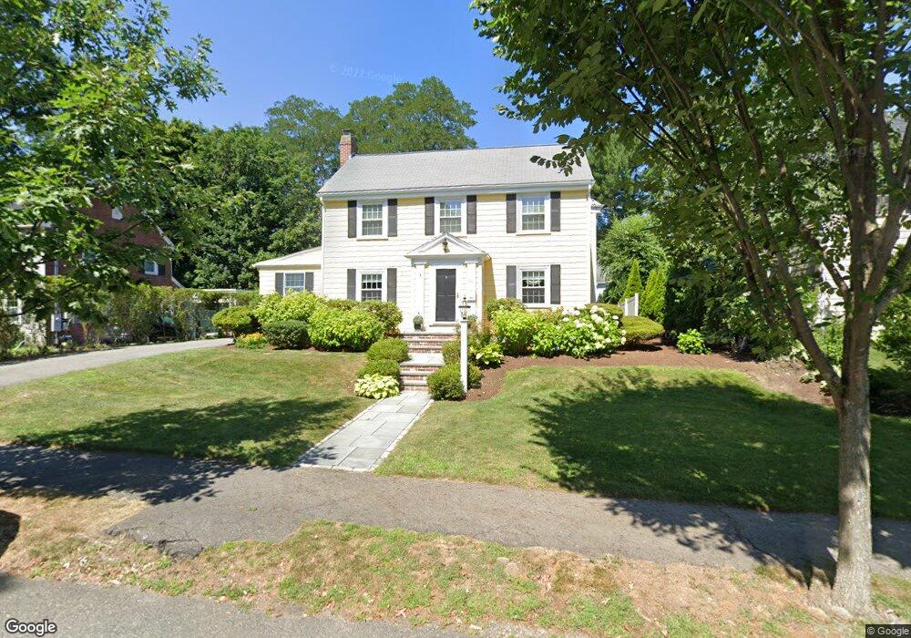
73 Day St Auburndale, MA 02466
Auburndale NeighborhoodEstimated Value: $1,264,000 - $1,959,000
4
Beds
2
Baths
2,541
Sq Ft
$659/Sq Ft
Est. Value
About This Home
This home is located at 73 Day St, Auburndale, MA 02466 and is currently estimated at $1,675,239, approximately $659 per square foot. 73 Day St is a home located in Middlesex County with nearby schools including Peirce Elementary School, Williams Elementary School, and F.A. Day Middle School.
Ownership History
Date
Name
Owned For
Owner Type
Purchase Details
Closed on
Jul 23, 1998
Sold by
Koed Louise H
Bought by
Mcauliffe Paul and Mcauliffe Mary F
Current Estimated Value
Create a Home Valuation Report for This Property
The Home Valuation Report is an in-depth analysis detailing your home's value as well as a comparison with similar homes in the area
Home Values in the Area
Average Home Value in this Area
Purchase History
| Date | Buyer | Sale Price | Title Company |
|---|---|---|---|
| Mcauliffe Paul | $300,000 | -- |
Source: Public Records
Mortgage History
| Date | Status | Borrower | Loan Amount |
|---|---|---|---|
| Open | Mcauliffe Paul | $415,000 | |
| Closed | Mcauliffe Paul | $417,000 | |
| Closed | Mcauliffe Paul | $425,000 |
Source: Public Records
Tax History Compared to Growth
Tax History
| Year | Tax Paid | Tax Assessment Tax Assessment Total Assessment is a certain percentage of the fair market value that is determined by local assessors to be the total taxable value of land and additions on the property. | Land | Improvement |
|---|---|---|---|---|
| 2025 | $14,234 | $1,452,400 | $899,600 | $552,800 |
| 2024 | $13,763 | $1,410,100 | $873,400 | $536,700 |
| 2023 | $13,113 | $1,288,100 | $663,900 | $624,200 |
| 2022 | $12,547 | $1,192,700 | $614,700 | $578,000 |
| 2021 | $12,107 | $1,125,200 | $579,900 | $545,300 |
| 2020 | $11,747 | $1,125,200 | $579,900 | $545,300 |
| 2019 | $11,416 | $1,092,400 | $563,000 | $529,400 |
| 2018 | $10,881 | $1,005,600 | $511,000 | $494,600 |
| 2017 | $10,550 | $948,700 | $482,100 | $466,600 |
| 2016 | $10,090 | $886,600 | $450,600 | $436,000 |
| 2015 | $9,620 | $828,600 | $421,100 | $407,500 |
Source: Public Records
Map
Nearby Homes
- 1754 Washington St
- 163 Day St
- 283 Woodland Rd
- 1639 Washington St
- 68 Mignon Rd
- 157 Stanton Ave
- 39 Hawthorne Ave
- 17 Gilbert St
- 10 Ruane Rd
- 51 Bourne St
- 194 Auburn St
- 179 Auburn St
- 13 Weir St
- 0 Duncan Rd Unit 72925240
- 121 Dorset Rd
- 224 Auburn St Unit 224
- 226 Auburn St Unit 226
- 10 Lorraine Cir
- 1488 Washington St Unit 1488
- 17 Lasell St