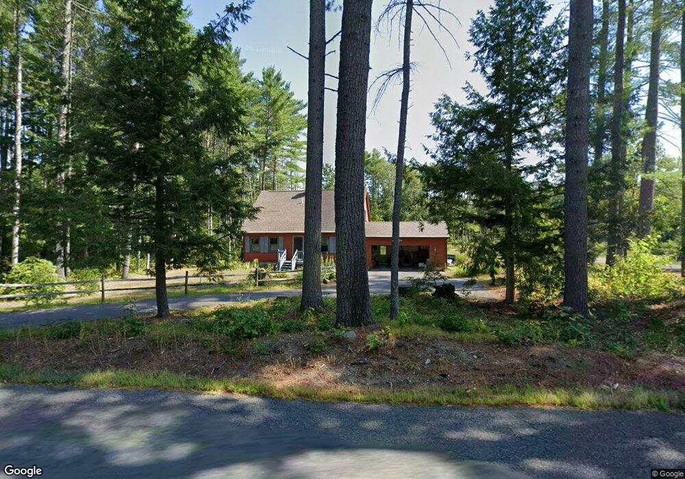
73 Fryeville Rd Orange, MA 01364
Estimated Value: $340,000 - $441,243
3
Beds
2
Baths
1,428
Sq Ft
$275/Sq Ft
Est. Value
About This Home
This home is located at 73 Fryeville Rd, Orange, MA 01364 and is currently estimated at $393,311, approximately $275 per square foot. 73 Fryeville Rd is a home located in Franklin County with nearby schools including Fisher Hill and Ralph C Mahar Regional School.
Ownership History
Date
Name
Owned For
Owner Type
Purchase Details
Closed on
Mar 13, 2025
Sold by
Sironaitis Anthony J and Sironaitis Candice A
Bought by
Sironaitis Shawn M and Sironaitis Anthony J
Current Estimated Value
Purchase Details
Closed on
Jul 12, 1989
Sold by
Ests Rolling Hills
Bought by
Sironaitis Anthony J
Home Financials for this Owner
Home Financials are based on the most recent Mortgage that was taken out on this home.
Original Mortgage
$50,000
Interest Rate
10.39%
Mortgage Type
Purchase Money Mortgage
Create a Home Valuation Report for This Property
The Home Valuation Report is an in-depth analysis detailing your home's value as well as a comparison with similar homes in the area
Home Values in the Area
Average Home Value in this Area
Purchase History
| Date | Buyer | Sale Price | Title Company |
|---|---|---|---|
| Sironaitis Shawn M | -- | None Available | |
| Sironaitis Shawn M | -- | None Available | |
| Sironaitis Anthony J | $119,438 | -- | |
| Sironaitis Anthony J | $119,438 | -- |
Source: Public Records
Mortgage History
| Date | Status | Borrower | Loan Amount |
|---|---|---|---|
| Previous Owner | Sironaitis Anthony J | $57,000 | |
| Previous Owner | Sironaitis Anthony J | $50,000 |
Source: Public Records
Tax History
| Year | Tax Paid | Tax Assessment Tax Assessment Total Assessment is a certain percentage of the fair market value that is determined by local assessors to be the total taxable value of land and additions on the property. | Land | Improvement |
|---|---|---|---|---|
| 2025 | $6,912 | $420,200 | $77,000 | $343,200 |
| 2024 | $5,658 | $324,400 | $72,100 | $252,300 |
| 2023 | $4,653 | $259,100 | $61,300 | $197,800 |
| 2022 | $4,375 | $228,800 | $38,600 | $190,200 |
| 2021 | $4,074 | $203,200 | $56,900 | $146,300 |
| 2020 | $4,023 | $197,900 | $53,000 | $144,900 |
| 2019 | $3,957 | $175,700 | $47,300 | $128,400 |
| 2018 | $3,796 | $173,000 | $46,000 | $127,000 |
| 2017 | $3,673 | $173,000 | $46,000 | $127,000 |
| 2016 | $3,604 | $166,100 | $48,200 | $117,900 |
| 2015 | $3,381 | $162,800 | $43,900 | $118,900 |
| 2014 | $3,222 | $163,200 | $41,700 | $121,500 |
Source: Public Records
Map
Nearby Homes
- 1495 W Royalston Rd
- 2791 Old Keene Rd
- 15 Tully Rd
- 15 A-B Tully Rd
- 0 Adams Dr
- 660 Pinedale Ave
- 0 W Royalston Rd
- 87 Bellevue Dr E
- 65 Lakeview Ave
- 3327 Chestnut Hill Ave
- 31 Locke Ave
- 38 Twichell St
- 78 Athol Richmond Rd
- 260 East Rd
- 77 Old Keene Rd
- 15 Wilson Ave
- 900 N Main St
- 330 N Orange Rd
- 225 Wallingford Ave
- 4 Elm Ave