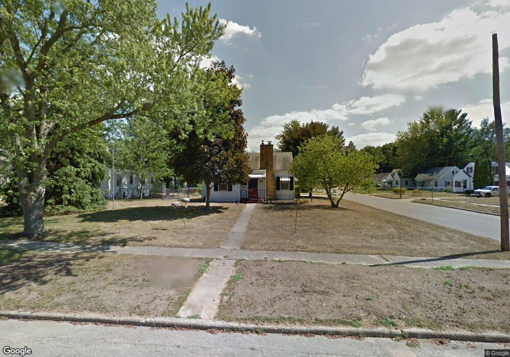
73 Gordon Blvd Battle Creek, MI 49037
North Central NeighborhoodEstimated Value: $140,000 - $161,000
2
Beds
2
Baths
869
Sq Ft
$175/Sq Ft
Est. Value
About This Home
This home is located at 73 Gordon Blvd, Battle Creek, MI 49037 and is currently estimated at $151,649, approximately $174 per square foot. 73 Gordon Blvd is a home located in Calhoun County with nearby schools including Dudley School, Northwestern Middle School, and Battle Creek Central High School.
Ownership History
Date
Name
Owned For
Owner Type
Purchase Details
Closed on
Dec 21, 2022
Sold by
Montgomery Shawn
Bought by
Reed Alicia M and Reed Timothy P
Current Estimated Value
Purchase Details
Closed on
Aug 10, 2020
Sold by
Mitcheli Joyce A
Bought by
Mitchecli Joyce A and Montogmery Shawn
Purchase Details
Closed on
Aug 3, 2020
Sold by
Kindred Margo and Montgomery Shawn
Bought by
Mitchell Joyce A
Purchase Details
Closed on
Sep 7, 1999
Sold by
Mitchell J A
Bought by
Mitchell Mitchell J and Mitchell Kindred
Create a Home Valuation Report for This Property
The Home Valuation Report is an in-depth analysis detailing your home's value as well as a comparison with similar homes in the area
Home Values in the Area
Average Home Value in this Area
Purchase History
| Date | Buyer | Sale Price | Title Company |
|---|---|---|---|
| Reed Alicia M | -- | Land Title | |
| Montgomery Shawn | -- | Land Title | |
| Mitchecli Joyce A | -- | None Available | |
| Mitchell Joyce A | -- | None Available | |
| Mitchell Mitchell J | -- | -- |
Source: Public Records
Tax History Compared to Growth
Tax History
| Year | Tax Paid | Tax Assessment Tax Assessment Total Assessment is a certain percentage of the fair market value that is determined by local assessors to be the total taxable value of land and additions on the property. | Land | Improvement |
|---|---|---|---|---|
| 2025 | -- | $65,300 | $0 | $0 |
| 2024 | $1,327 | $61,070 | $0 | $0 |
| 2023 | $1,224 | $50,037 | $0 | $0 |
| 2022 | $967 | $44,623 | $0 | $0 |
| 2021 | $1,155 | $42,559 | $0 | $0 |
| 2020 | $1,087 | $39,547 | $0 | $0 |
| 2019 | $1,082 | $33,244 | $0 | $0 |
| 2018 | $1,082 | $34,196 | $1,054 | $33,142 |
| 2017 | $1,049 | $31,880 | $0 | $0 |
| 2016 | $1,047 | $26,473 | $0 | $0 |
| 2015 | $1,110 | $22,618 | $2,948 | $19,670 |
| 2014 | $1,110 | $24,092 | $2,948 | $21,144 |
Source: Public Records
Map
Nearby Homes
- 161 Wilds Ave
- 69 Coolidge Ave W
- 62 Coolidge Ave W
- 11 Coolidge Ave W
- 706 Washington Ave N
- 341 Algonquin St
- V/L Parkview Ave
- 5 Beglin Ct
- 435 Kendall St N
- 904 Washington Ave N
- 104 Calico Ln
- 52 Roseneath Ave
- 225 Eastwood Dr
- 6329 Purdy Dr
- 561 Garrison Rd
- 000 5 Mile Rd
- 188 Roseneath Ave
- 46 Walter Ave
- 216 Kendall St N
- 224 Hubbard St
- 69 Gordon Blvd
- 121 Redner Ave
- 65 Gordon Blvd
- 117 Redner Ave
- 125 Redner Ave
- 84 W Meadowlawn Ave
- 80 W Meadowlawn Ave
- 113 Redner Ave
- 61 Gordon Blvd
- 76 W Meadowlawn Ave
- 109 Redner Ave
- 129 Redner Ave
- 72 Gordon Blvd
- 68 Gordon Blvd
- 72 W Meadowlawn Ave
- 133 Redner Ave
- 57 Gordon Blvd
- 64 Gordon Blvd
- 68 W Meadowlawn Ave
- 60 Gordon Blvd