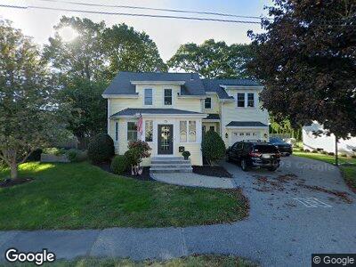
73 Greenwood Ave Needham, MA 02492
Estimated Value: $1,333,000 - $1,606,341
4
Beds
4
Baths
1,211
Sq Ft
$1,226/Sq Ft
Est. Value
About This Home
This home is located at 73 Greenwood Ave, Needham, MA 02492 and is currently estimated at $1,484,335, approximately $1,225 per square foot. 73 Greenwood Ave is a home located in Norfolk County with nearby schools including Mitchell Elementary School, High Rock Middle School, and Pollard Middle School.
Ownership History
Date
Name
Owned For
Owner Type
Purchase Details
Closed on
Dec 9, 2002
Sold by
Mccallum Edward L and Mccallum Monica J
Bought by
Sherman Eileen S
Current Estimated Value
Create a Home Valuation Report for This Property
The Home Valuation Report is an in-depth analysis detailing your home's value as well as a comparison with similar homes in the area
Home Values in the Area
Average Home Value in this Area
Purchase History
| Date | Buyer | Sale Price | Title Company |
|---|---|---|---|
| Sherman Eileen S | $444,000 | -- |
Source: Public Records
Mortgage History
| Date | Status | Borrower | Loan Amount |
|---|---|---|---|
| Open | Rolfes Marc E | $660,000 | |
| Closed | Sherman Eileen S | $100,000 | |
| Closed | Rolfes Marc E | $650,000 | |
| Closed | Rolfes Marc E | $382,000 | |
| Closed | Finn Robin A | $397,700 | |
| Closed | Finn Robin A | $407,000 | |
| Closed | Sherman Eileen | $45,000 | |
| Closed | Sherman Eileen S | $35,000 | |
| Closed | Finn Robin A | $359,700 | |
| Previous Owner | Finn Robin A | $73,000 |
Source: Public Records
Tax History Compared to Growth
Tax History
| Year | Tax Paid | Tax Assessment Tax Assessment Total Assessment is a certain percentage of the fair market value that is determined by local assessors to be the total taxable value of land and additions on the property. | Land | Improvement |
|---|---|---|---|---|
| 2025 | $11,611 | $1,095,400 | $787,200 | $308,200 |
| 2024 | $12,928 | $1,032,600 | $571,800 | $460,800 |
| 2023 | $12,960 | $993,900 | $571,800 | $422,100 |
| 2022 | $12,493 | $934,400 | $529,400 | $405,000 |
| 2021 | $12,175 | $934,400 | $529,400 | $405,000 |
| 2020 | $11,938 | $955,800 | $529,500 | $426,300 |
| 2019 | $11,119 | $897,400 | $481,300 | $416,100 |
| 2018 | $10,661 | $897,400 | $481,300 | $416,100 |
| 2017 | $10,150 | $853,700 | $481,300 | $372,400 |
| 2016 | $9,852 | $853,700 | $481,300 | $372,400 |
| 2015 | $9,638 | $853,700 | $481,300 | $372,400 |
| 2014 | $6,332 | $544,000 | $418,500 | $125,500 |
Source: Public Records
Map
Nearby Homes
- 179 Melrose Ave
- 22 Eaton Rd
- 25 Bradford St
- 62 Washington Ave
- 81 Prince St
- 150 Fair Oaks Park
- 63 Hawthorn Ave
- 54 Hawthorn Ave
- 74 Page Rd
- 17 Melrose Ave
- 181 Dedham Ave
- 32 Lincoln St Unit 34
- 77 Hillcrest Rd
- 176 Highgate St
- 62 Grant St
- 23 Fairfax Rd
- 14 Shady Ln
- 19 Oakland Ave Unit 19
- 43 Highland Ct Unit 43
- 18 Ina Rd
- 73 Greenwood Ave
- 67 Greenwood Ave
- 683 Great Plain Ave
- 679 Great Plain Ave
- 72 Woodlawn Ave
- 689 Great Plain Ave
- 66 Woodlawn Ave
- 74 Greenwood Ave
- 59 Greenwood Ave
- 66 Greenwood Ave
- 671 Great Plain Ave
- 62 Greenwood Ave
- 60 Woodlawn Ave
- 80 Woodlawn Ave
- 55 Greenwood Ave
- 665 Great Plain Ave
- 58 Greenwood Ave
- 54 Woodlawn Ave
- 187 Melrose Ave
- 49 Greenwood Ave