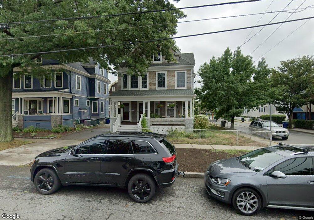
73 Highland Rd Unit 1 Somerville, MA 02144
Ball Square NeighborhoodEstimated Value: $1,393,000 - $1,631,735
1
Bed
1
Bath
850
Sq Ft
$1,758/Sq Ft
Est. Value
About This Home
This home is located at 73 Highland Rd Unit 1, Somerville, MA 02144 and is currently estimated at $1,494,434, approximately $1,758 per square foot. 73 Highland Rd Unit 1 is a home located in Middlesex County with nearby schools including Somerville High School and St. Clement Elementary School.
Ownership History
Date
Name
Owned For
Owner Type
Purchase Details
Closed on
Jul 8, 2009
Sold by
Harris-Watsky Gail and Halligan Maureen
Bought by
Macdonald Dimana P and Macdonald Christain
Current Estimated Value
Home Financials for this Owner
Home Financials are based on the most recent Mortgage that was taken out on this home.
Original Mortgage
$480,000
Outstanding Balance
$307,173
Interest Rate
4.93%
Mortgage Type
Purchase Money Mortgage
Estimated Equity
$1,187,261
Create a Home Valuation Report for This Property
The Home Valuation Report is an in-depth analysis detailing your home's value as well as a comparison with similar homes in the area
Home Values in the Area
Average Home Value in this Area
Purchase History
| Date | Buyer | Sale Price | Title Company |
|---|---|---|---|
| Macdonald Dimana P | $600,000 | -- |
Source: Public Records
Mortgage History
| Date | Status | Borrower | Loan Amount |
|---|---|---|---|
| Open | Macdonald Dimana P | $480,000 |
Source: Public Records
Tax History
| Year | Tax Paid | Tax Assessment Tax Assessment Total Assessment is a certain percentage of the fair market value that is determined by local assessors to be the total taxable value of land and additions on the property. | Land | Improvement |
|---|---|---|---|---|
| 2025 | $14,699 | $1,347,300 | $699,900 | $647,400 |
| 2024 | $14,055 | $1,336,000 | $699,900 | $636,100 |
| 2023 | $13,374 | $1,293,400 | $699,900 | $593,500 |
| 2022 | $12,597 | $1,237,400 | $666,500 | $570,900 |
| 2021 | $12,242 | $1,201,400 | $661,700 | $539,700 |
| 2020 | $11,811 | $1,170,600 | $662,100 | $508,500 |
| 2019 | $11,196 | $1,040,500 | $602,800 | $437,700 |
| 2018 | $10,351 | $915,200 | $548,000 | $367,200 |
| 2017 | $10,155 | $870,200 | $516,900 | $353,300 |
| 2016 | $9,825 | $784,100 | $461,700 | $322,400 |
| 2015 | $9,408 | $746,100 | $426,400 | $319,700 |
Source: Public Records
Map
Nearby Homes
- 74 Pearson Ave
- 29 Prichard Ave Unit 2
- 29 Prichard Ave Unit 1
- 227 Cedar St Unit 5
- 16 Rogers Ave
- 288 Cedar St
- 13 Warwick St
- 595 Broadway Unit 302
- 595 Broadway Unit 102
- 595 Broadway Unit 202
- 595 Broadway Unit 101
- 595 Broadway Unit 301
- 13 Alpine St Unit 202
- 167 Albion St
- 315 Highland Ave Unit 101
- 156 Albion St Unit 1
- 44 Henderson St Unit 44
- 32 Richardson St
- 355 Highland Ave Unit 1
- 79 Willow Ave
- 73 Highland Rd
- 77 Highland Rd
- 69 Highland Rd
- 66 Pearson Ave Unit 2
- 66 Pearson Ave
- 66 Pearson Ave Unit 1
- 83 Highland Rd
- 68 Pearson Ave
- 68 Pearson Ave Unit 1
- 68 Pearson Ave Unit 2
- 68 Pearson Ave Unit 3
- 60 Pearson Ave
- 58 Pearson Ave
- 58 Pearson Ave Unit 58
- 60 Pearson Ave Unit 1
- 58 Pearson Ave Unit 2
- 65 Highland Rd
- 74 Pearson Ave Unit 1
- 74 Pearson Ave Unit 2
- 87 Highland Rd
Your Personal Tour Guide
Ask me questions while you tour the home.