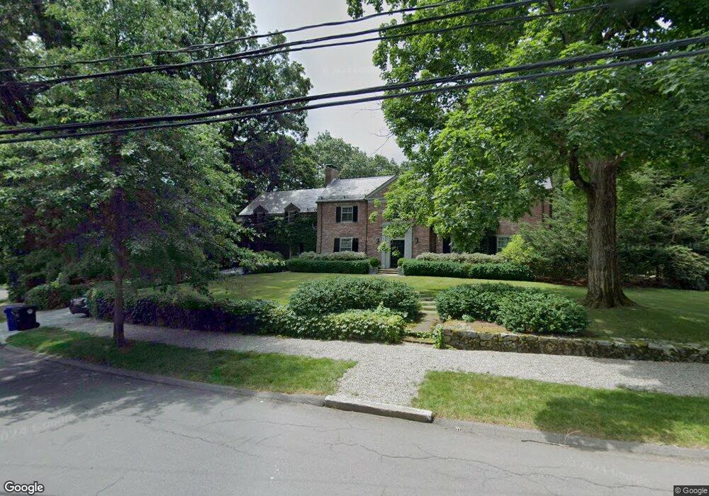
73 Laurel Rd Chestnut Hill, MA 02467
South Brookline NeighborhoodEstimated Value: $3,039,000 - $6,124,000
5
Beds
4
Baths
3,783
Sq Ft
$1,205/Sq Ft
Est. Value
About This Home
This home is located at 73 Laurel Rd, Chestnut Hill, MA 02467 and is currently estimated at $4,560,096, approximately $1,205 per square foot. 73 Laurel Rd is a home located in Norfolk County with nearby schools including Baker School, Brookline High School, and Mount Alvernia Academy.
Ownership History
Date
Name
Owned For
Owner Type
Purchase Details
Closed on
Feb 2, 1988
Sold by
Extr Nicholas Grace
Bought by
Brewster David C
Current Estimated Value
Home Financials for this Owner
Home Financials are based on the most recent Mortgage that was taken out on this home.
Original Mortgage
$788,000
Interest Rate
10.65%
Mortgage Type
Purchase Money Mortgage
Create a Home Valuation Report for This Property
The Home Valuation Report is an in-depth analysis detailing your home's value as well as a comparison with similar homes in the area
Home Values in the Area
Average Home Value in this Area
Purchase History
| Date | Buyer | Sale Price | Title Company |
|---|---|---|---|
| Brewster David C | $1,125,000 | -- |
Source: Public Records
Mortgage History
| Date | Status | Borrower | Loan Amount |
|---|---|---|---|
| Open | Brewster David C | $650,000 | |
| Closed | Brewster David C | $788,000 |
Source: Public Records
Tax History
| Year | Tax Paid | Tax Assessment Tax Assessment Total Assessment is a certain percentage of the fair market value that is determined by local assessors to be the total taxable value of land and additions on the property. | Land | Improvement |
|---|---|---|---|---|
| 2025 | $51,907 | $5,259,100 | $3,371,100 | $1,888,000 |
| 2024 | $49,506 | $5,067,100 | $3,241,400 | $1,825,700 |
| 2023 | $45,226 | $4,536,200 | $2,783,900 | $1,752,300 |
| 2022 | $44,023 | $4,320,200 | $2,651,300 | $1,668,900 |
| 2021 | $40,709 | $4,154,000 | $2,549,300 | $1,604,700 |
| 2020 | $36,873 | $3,901,900 | $2,317,600 | $1,584,300 |
| 2019 | $34,820 | $3,716,100 | $2,207,200 | $1,508,900 |
| 2018 | $35,924 | $3,797,500 | $2,334,300 | $1,463,200 |
| 2017 | $35,394 | $3,582,400 | $2,202,100 | $1,380,300 |
| 2016 | $34,886 | $3,348,000 | $2,058,000 | $1,290,000 |
| 2015 | $33,418 | $3,129,000 | $1,923,400 | $1,205,600 |
| 2014 | $33,725 | $2,960,900 | $1,743,900 | $1,217,000 |
Source: Public Records
Map
Nearby Homes
- 764 Hammond St
- 3 Glenoe Rd
- 771 Heath St Unit A
- 321 Hammond Pond Pkwy Unit 103
- 321 Hammond Pond Pkwy Unit 105
- 0 Glenoe Rd
- 15 Glenland Rd
- 811 Heath St
- 811 Heath St Unit 811
- 76 Boylston St Unit 4
- 20 Hammond Pond Pkwy Unit 602
- 20 Hammond Pond Pkwy Unit 606
- 10 Hammond Pond Pkwy Unit 606
- 70 Craftsland Rd
- 476 Heath St
- 280 Boylston St Unit 203
- 280 Boylston St Unit 713
- 280 Boylston St Unit 710
- 280 Boylston St Unit 503
- 280 Boylston St Unit 804
Your Personal Tour Guide
Ask me questions while you tour the home.