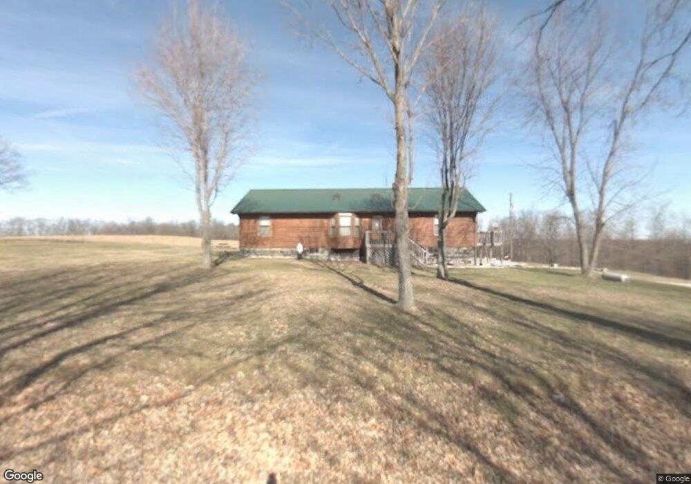
73 Martin Burgess Rd Crossville, TN 38572
Estimated Value: $273,000 - $422,000
--
Bed
2
Baths
1,568
Sq Ft
$218/Sq Ft
Est. Value
About This Home
This home is located at 73 Martin Burgess Rd, Crossville, TN 38572 and is currently estimated at $342,220, approximately $218 per square foot. 73 Martin Burgess Rd is a home located in Cumberland County with nearby schools including Frank P. Brown Elementary School and Cumberland County High School.
Ownership History
Date
Name
Owned For
Owner Type
Purchase Details
Closed on
Mar 13, 2025
Sold by
Campbell Erica Brook and Crawford Erika Brooke
Bought by
Crawford Jerry Lynn
Current Estimated Value
Purchase Details
Closed on
Sep 8, 2010
Sold by
Campbell Ronald E
Bought by
Campbell Erica Brook
Purchase Details
Closed on
Jan 20, 1989
Bought by
Campbell Ronald E
Purchase Details
Closed on
Jul 20, 1987
Bought by
Wyatt Gregory
Create a Home Valuation Report for This Property
The Home Valuation Report is an in-depth analysis detailing your home's value as well as a comparison with similar homes in the area
Home Values in the Area
Average Home Value in this Area
Purchase History
| Date | Buyer | Sale Price | Title Company |
|---|---|---|---|
| Crawford Jerry Lynn | -- | None Listed On Document | |
| Crawford Jerry Lynn | -- | None Listed On Document | |
| Campbell Erica Brook | -- | -- | |
| Campbell Ronald E | $17,000 | -- | |
| Wyatt Gregory | $16,000 | -- |
Source: Public Records
Tax History Compared to Growth
Tax History
| Year | Tax Paid | Tax Assessment Tax Assessment Total Assessment is a certain percentage of the fair market value that is determined by local assessors to be the total taxable value of land and additions on the property. | Land | Improvement |
|---|---|---|---|---|
| 2024 | $678 | $59,700 | $3,525 | $56,175 |
| 2023 | $678 | $59,700 | $0 | $0 |
| 2022 | $678 | $59,700 | $3,525 | $56,175 |
| 2021 | $600 | $38,325 | $3,300 | $35,025 |
| 2020 | $600 | $38,325 | $3,300 | $35,025 |
| 2019 | $600 | $38,325 | $3,300 | $35,025 |
| 2018 | $600 | $38,325 | $3,300 | $35,025 |
| 2017 | $432 | $27,625 | $3,300 | $24,325 |
| 2016 | $415 | $27,175 | $3,300 | $23,875 |
| 2015 | $407 | $27,175 | $3,300 | $23,875 |
| 2014 | $407 | $27,181 | $0 | $0 |
Source: Public Records
Map
Nearby Homes
- 4907 Newton Rd
- 23 Diane Cir
- 22 Diane Cir
- 1 Diane Cir
- 19 Burchette Dr
- 19 Burchett Dr
- 20A Burchett Dr
- 59 Morgan Cir
- lot # 49 Morgan Cir
- 0 Morgan Cir Unit 51/52 1293211
- 0 Morgan Cir Unit RTC2803660
- Lot 51 52 Morgan Cir
- 2, 3, 4, 5 Tresa St
- 2345 Tresa St
- 9 Tresa St
- 8 Tresa St
- 6 Tresa St
- 11 Tresa St
- 7 Tresa St
- 10 Tresa St
- 156 Martin Burgess Rd
- 249 Martin Burgess Rd
- 4407 Flynns Cove Rd
- 295 Martin Burgess Rd
- 224 Martin Burgess Rd
- 224 Martin Burgess Rd
- 4515 Flynns Cove Rd
- 344 Martin Burgess Rd
- 297 Martin Burgess Rd
- 297 Martin Burgess Rd
- 220 Thomas Springs Rd
- 4614 Newton Rd
- 2680 Midway Rd
- 6 Ac Thomas Springs Rd
- 88 Thomas Springs Rd
- 4667 Newton Rd
- 470 Martin Burgess Rd
- 7.12 Ac Thomas Springs Rd
- 103 Thomas Springs Rd
- 130 Thomas Springs Rd