Estimated Value: $597,245 - $656,000
4
Beds
5
Baths
1,675
Sq Ft
$375/Sq Ft
Est. Value
About This Home
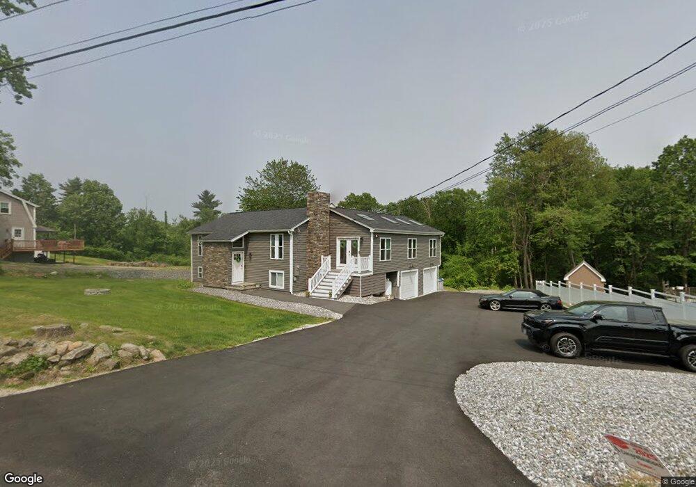
This home is located at 73 Stark Rd, Derry, NH 03038 and is currently estimated at $628,061, approximately $374 per square foot. 73 Stark Rd is a home located in Rockingham County with nearby schools including Derry Village School, West Running Brook Middle School, and Pinkerton Academy.
Ownership History
Date
Name
Owned For
Owner Type
Purchase Details
Closed on
Nov 21, 2025
Sold by
Pocock Kelly D and Jett John T
Bought by
Jett John T and Jett Jennifer M
Current Estimated Value
Purchase Details
Closed on
Apr 4, 2022
Sold by
Pocock Kelly D and Jett Jennifer M
Bought by
Pocock Kelly D and Jett Jennifer M
Purchase Details
Closed on
Mar 11, 2022
Sold by
Marks Brandon R
Bought by
Pocock Kelly D and Jett Jennifer M
Purchase Details
Closed on
Sep 5, 2003
Sold by
Hunzelman Albert C and Hunzelman Cynthia M
Bought by
Pocock Kelly D
Home Financials for this Owner
Home Financials are based on the most recent Mortgage that was taken out on this home.
Original Mortgage
$275,400
Interest Rate
6.02%
Mortgage Type
Purchase Money Mortgage
Create a Home Valuation Report for This Property
The Home Valuation Report is an in-depth analysis detailing your home's value as well as a comparison with similar homes in the area
Home Values in the Area
Average Home Value in this Area
Purchase History
| Date | Buyer | Sale Price | Title Company |
|---|---|---|---|
| Jett John T | -- | -- | |
| Jett John T | -- | -- | |
| Pocock Kelly D | -- | None Available | |
| Pocock Kelly D | -- | None Available | |
| Pocock Kelly D | -- | None Available | |
| Pocock Kelly D | -- | None Available | |
| Pocock Kelly D | -- | None Available | |
| Pocock Kelly D | -- | None Available | |
| Pocock Kelly D | $289,900 | -- |
Source: Public Records
Mortgage History
| Date | Status | Borrower | Loan Amount |
|---|---|---|---|
| Previous Owner | Pocock Kelly D | $12,000 | |
| Previous Owner | Pocock Kelly D | $275,400 |
Source: Public Records
Tax History
| Year | Tax Paid | Tax Assessment Tax Assessment Total Assessment is a certain percentage of the fair market value that is determined by local assessors to be the total taxable value of land and additions on the property. | Land | Improvement |
|---|---|---|---|---|
| 2025 | $8,726 | $459,500 | $225,100 | $234,400 |
| 2024 | $8,588 | $459,500 | $225,100 | $234,400 |
| 2023 | $7,693 | $372,000 | $191,300 | $180,700 |
| 2022 | $6,910 | $362,900 | $191,300 | $171,600 |
| 2021 | $7,376 | $297,900 | $151,200 | $146,700 |
| 2020 | $7,251 | $297,900 | $151,200 | $146,700 |
| 2019 | $6,977 | $267,100 | $121,600 | $145,500 |
| 2018 | $6,953 | $267,100 | $121,600 | $145,500 |
| 2017 | $7,264 | $251,700 | $116,600 | $135,100 |
| 2016 | $6,843 | $252,900 | $116,600 | $136,300 |
| 2015 | $7,088 | $242,500 | $116,600 | $125,900 |
| 2014 | $7,134 | $242,500 | $116,600 | $125,900 |
| 2013 | $7,155 | $227,200 | $108,600 | $118,600 |
Source: Public Records
Map
Nearby Homes
- 5 Stone Fence Dr
- 5 Craven Terrace
- 21 Berry Rd
- 139 Rockingham Rd Unit 21
- 6 Homestead Dr
- 51 Bedard Ave
- 13 Kilrea Rd Unit L
- 144 Rockingham Rd
- 89 Lane Rd
- 4 Westview Dr
- 17 Tyler Rd
- 242 Rockingham Rd
- 52 Windham Depot Rd
- 13 Sunnyside Ln Unit L
- 8 Blueberry Rd Unit U: R
- 16 Towne Dr
- 12R Brian Ave Unit R
- 4 Norman Dr Unit L
- 2 Brown Rd
- 15 Bonnie Ln Unit R
Your Personal Tour Guide
Ask me questions while you tour the home.