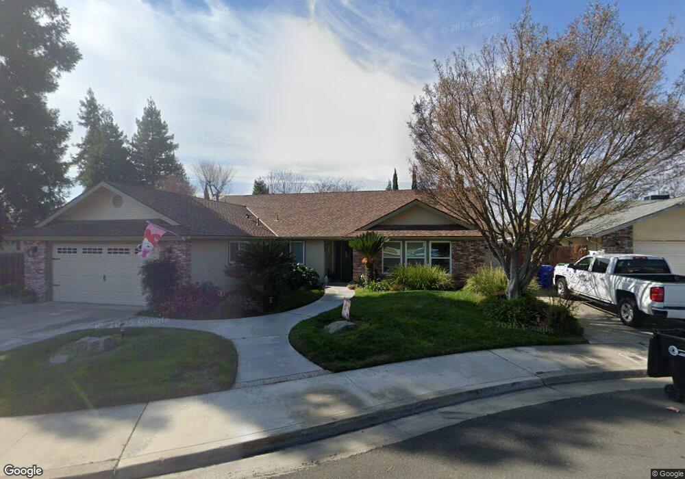
73 Taylor Way Porterville, CA 93257
Porterville Northwest NeighborhoodEstimated Value: $348,923 - $416,000
3
Beds
2
Baths
1,720
Sq Ft
$220/Sq Ft
Est. Value
About This Home
This home is located at 73 Taylor Way, Porterville, CA 93257 and is currently estimated at $378,231, approximately $219 per square foot. 73 Taylor Way is a home located in Tulare County with nearby schools including Burton Elementary School, Burton Middle School, and Porterville High School.
Ownership History
Date
Name
Owned For
Owner Type
Purchase Details
Closed on
Apr 8, 1999
Sold by
Perez Robert Michael
Bought by
Perez Pamela E
Current Estimated Value
Home Financials for this Owner
Home Financials are based on the most recent Mortgage that was taken out on this home.
Original Mortgage
$92,000
Interest Rate
6.94%
Mortgage Type
Purchase Money Mortgage
Purchase Details
Closed on
Mar 19, 1999
Sold by
Perez Robert Michael
Bought by
Resendez Brenda C
Home Financials for this Owner
Home Financials are based on the most recent Mortgage that was taken out on this home.
Original Mortgage
$92,000
Interest Rate
6.94%
Mortgage Type
Purchase Money Mortgage
Create a Home Valuation Report for This Property
The Home Valuation Report is an in-depth analysis detailing your home's value as well as a comparison with similar homes in the area
Home Values in the Area
Average Home Value in this Area
Purchase History
| Date | Buyer | Sale Price | Title Company |
|---|---|---|---|
| Perez Pamela E | -- | Cuesta Title Company | |
| Resendez Brenda C | $115,000 | Chicago Title Co |
Source: Public Records
Mortgage History
| Date | Status | Borrower | Loan Amount |
|---|---|---|---|
| Previous Owner | Resendez Brenda C | $92,000 |
Source: Public Records
Tax History Compared to Growth
Tax History
| Year | Tax Paid | Tax Assessment Tax Assessment Total Assessment is a certain percentage of the fair market value that is determined by local assessors to be the total taxable value of land and additions on the property. | Land | Improvement |
|---|---|---|---|---|
| 2025 | $1,894 | $180,293 | $39,193 | $141,100 |
| 2024 | $1,894 | $176,759 | $38,425 | $138,334 |
| 2023 | $1,899 | $173,294 | $37,672 | $135,622 |
| 2022 | $1,826 | $169,897 | $36,934 | $132,963 |
| 2021 | $1,798 | $166,566 | $36,210 | $130,356 |
| 2020 | $1,765 | $164,858 | $35,839 | $129,019 |
| 2019 | $1,764 | $161,625 | $35,136 | $126,489 |
| 2018 | $1,686 | $158,456 | $34,447 | $124,009 |
| 2017 | $1,659 | $155,349 | $33,772 | $121,577 |
| 2016 | $1,581 | $152,303 | $33,110 | $119,193 |
| 2015 | $1,525 | $150,016 | $32,613 | $117,403 |
| 2014 | $1,525 | $147,077 | $31,974 | $115,103 |
Source: Public Records
Map
Nearby Homes
- 2179 W Della Ave
- 100 S Westwood St Unit 52
- 100 S Westwood St Unit 1
- 100 S Westwood St Unit 17
- 100 S Westwood St Unit 97
- 100 S Westwood St
- 100 S Westwood St Unit Lot 105
- 100 S Westwood St Unit 110
- 100 S Westwood St Unit Lot 71
- 100 S Westwood St Unit 128
- 100 S Westwood St Unit 92
- 100 S Westwood St Unit 20
- 226 S Argyle Place
- 313 Balmoral Dr
- 15247 Road 223
- 2070 W Harrison Ave
- 22346 W Thurman Ave
- 1922 W River Ave
- 249 S Westwood St
- 2300 W Morton Ave Unit 163
- 63 Taylor Way
- 83 Taylor Way
- 2205 W Garden Ct
- 53 Taylor Way
- 2202 W Garden Ct
- 2215 W Garden Ct
- 93 Taylor Way
- 2215 W Garden Ct
- 84 Taylor Way
- 74 Taylor Way
- 43 Taylor Way
- 94 Taylor Way
- 64 Taylor Way
- 98 Taylor Way
- 2212 W Garden Ct
- 2201 Tomah Ave
- 2204 W Della Ave
- 72 Silver Maple Way
- 2191 Tomah Ave
- 2214 W Della Ave