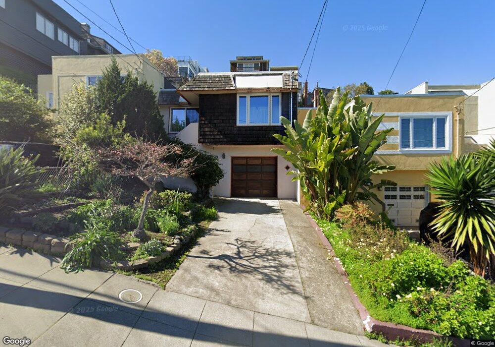
730 De Haro St San Francisco, CA 94107
Potrero NeighborhoodEstimated Value: $1,035,654 - $1,864,000
--
Bed
1
Bath
1,015
Sq Ft
$1,535/Sq Ft
Est. Value
About This Home
This home is located at 730 De Haro St, San Francisco, CA 94107 and is currently estimated at $1,558,164, approximately $1,535 per square foot. 730 De Haro St is a home located in San Francisco County with nearby schools including Daniel Webster Elementary School, James Lick Middle School, and The New School of San Francisco.
Ownership History
Date
Name
Owned For
Owner Type
Purchase Details
Closed on
Feb 1, 2021
Sold by
Ward William Thomas
Bought by
Ward Vera Jean
Current Estimated Value
Purchase Details
Closed on
Jan 29, 2021
Sold by
Ward Vera Jean and The William T Ward And Vera J
Bought by
Lopez Kerry Jen
Purchase Details
Closed on
Apr 20, 2009
Sold by
Ward Vera Fouke and Fouke Vera
Bought by
Ward William T and Ward Vera J
Purchase Details
Closed on
Feb 8, 1994
Sold by
Fouke George R
Bought by
Ward Vera Fouke and Fouke Vera
Create a Home Valuation Report for This Property
The Home Valuation Report is an in-depth analysis detailing your home's value as well as a comparison with similar homes in the area
Home Values in the Area
Average Home Value in this Area
Purchase History
| Date | Buyer | Sale Price | Title Company |
|---|---|---|---|
| Ward Vera Jean | -- | -- | |
| Lopez Kerry Jen | -- | None Available | |
| Ward William T | -- | None Available | |
| Ward Vera Fouke | -- | -- |
Source: Public Records
Tax History Compared to Growth
Tax History
| Year | Tax Paid | Tax Assessment Tax Assessment Total Assessment is a certain percentage of the fair market value that is determined by local assessors to be the total taxable value of land and additions on the property. | Land | Improvement |
|---|---|---|---|---|
| 2025 | $1,367 | $50,298 | $23,761 | $26,537 |
| 2024 | $1,367 | $49,313 | $23,296 | $26,017 |
| 2023 | $1,335 | $48,347 | $22,840 | $25,507 |
| 2022 | $1,292 | $47,400 | $22,393 | $25,007 |
| 2021 | $1,180 | $46,471 | $21,954 | $24,517 |
| 2020 | $1,207 | $45,995 | $21,729 | $24,266 |
| 2019 | $1,170 | $45,094 | $21,303 | $23,791 |
| 2018 | $1,131 | $44,211 | $20,886 | $23,325 |
| 2017 | $818 | $43,345 | $20,477 | $22,868 |
| 2016 | $771 | $42,496 | $20,076 | $22,420 |
| 2015 | $758 | $41,859 | $19,775 | $22,084 |
| 2014 | $738 | $41,040 | $19,388 | $21,652 |
Source: Public Records
Map
Nearby Homes
- 700 De Haro St
- 631 Carolina St
- 666 Carolina St Unit 666
- 542 Kansas St
- 1812 20th St
- 352 Arkansas St
- 451 Kansas St Unit 410
- 2225 Mariposa St
- 1002 Rhode Island St Unit 1
- 507 Potrero Ave
- 264 Missouri St
- 2119 22nd St
- 2023 22nd St
- 561 Connecticut St
- 573 Connecticut St
- 701 Hampshire St Unit 5
- 2625 19th St
- 312 Utah St
- 333-335 Potrero Ave
- 338 Potrero Ave Unit 206
- 736 De Haro St
- 724 De Haro St
- 718 De Haro St
- 760 De Haro St
- 712 De Haro St
- 1400 De Haro St
- 762 De Haro St
- 731 Rhode Island St
- 706 De Haro St
- 719 Rhode Island St
- 743 Rhode Island St
- 741 Rhode Island St
- 747 Rhode Island St
- 764 De Haro St
- 713 Rhode Island St
- 755 Rhode Island St
- 737 Rhode Island St
- 701 Rhode Island St
- 1919 19th St
- 725 Rhode Island St Unit 727