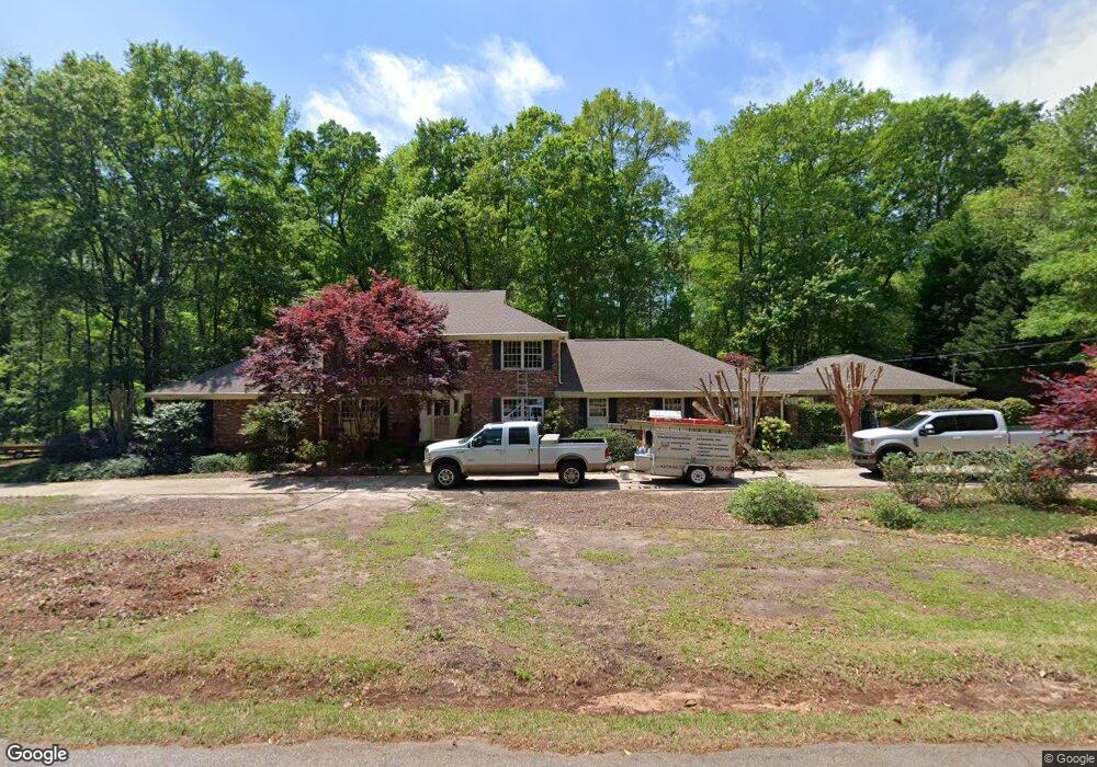
730 Mason Dr Covington, GA 30014
Estimated Value: $443,438 - $507,000
Studio
5
Baths
4,278
Sq Ft
$109/Sq Ft
Est. Value
About This Home
This home is located at 730 Mason Dr, Covington, GA 30014 and is currently estimated at $468,360, approximately $109 per square foot. 730 Mason Dr is a home located in Newton County with nearby schools including Flint Hill Elementary School, Cousins Middle School, and Eastside High School.
Ownership History
Date
Name
Owned For
Owner Type
Purchase Details
Closed on
Sep 29, 2021
Sold by
Whatley Richard S
Bought by
Laster Anne and Laster Monty
Current Estimated Value
Purchase Details
Closed on
Dec 5, 2009
Sold by
Whatley Richard S
Bought by
Whatley Marilyn W
Home Financials for this Owner
Home Financials are based on the most recent Mortgage that was taken out on this home.
Original Mortgage
$45,000
Interest Rate
5.01%
Mortgage Type
New Conventional
Create a Home Valuation Report for This Property
The Home Valuation Report is an in-depth analysis detailing your home's value as well as a comparison with similar homes in the area
Home Values in the Area
Average Home Value in this Area
Purchase History
| Date | Buyer | Sale Price | Title Company |
|---|---|---|---|
| Laster Anne | $345,000 | -- | |
| Whatley Richard S | -- | -- | |
| Whatley Marilyn W | -- | -- | |
| Whatley Richard S | -- | -- |
Source: Public Records
Mortgage History
| Date | Status | Borrower | Loan Amount |
|---|---|---|---|
| Previous Owner | Whatley Richard S | $45,000 |
Source: Public Records
Tax History
| Year | Tax Paid | Tax Assessment Tax Assessment Total Assessment is a certain percentage of the fair market value that is determined by local assessors to be the total taxable value of land and additions on the property. | Land | Improvement |
|---|---|---|---|---|
| 2025 | $4,264 | $171,360 | $16,800 | $154,560 |
| 2024 | $4,224 | $166,760 | $16,800 | $149,960 |
| 2023 | $4,103 | $151,200 | $12,600 | $138,600 |
| 2022 | $3,551 | $130,880 | $12,600 | $118,280 |
| 2021 | $3,507 | $115,640 | $12,600 | $103,040 |
| 2020 | $3,688 | $113,680 | $15,000 | $98,680 |
| 2019 | $3,820 | $115,880 | $15,000 | $100,880 |
| 2018 | $1,693 | $102,520 | $15,000 | $87,520 |
| 2017 | $3,419 | $103,480 | $15,000 | $88,480 |
| 2016 | $2,867 | $87,400 | $15,000 | $72,400 |
| 2015 | $2,988 | $90,920 | $15,000 | $75,920 |
| 2014 | $2,979 | $90,920 | $0 | $0 |
Source: Public Records
Map
Nearby Homes
- 13158 Greywolf Ln
- 13466 Whitman Ln SE
- 13280 Tolstoy Dr SE
- 13622 Whitman Ln SE
- 13268 Tolstoy Dr SE
- 13628 Whitman Ln SE
- 13611 Whitman Ln SE
- 13274 Tolstoy Dr SE
- 13478 Whitman Ln SE
- 13304 Tolstoy Dr SE
- 13605 Whitman Ln SE
- 12258 Vista Dr
- 11884 Rizvan Place
- 11864 Rizvan Place
- 11872 Rizvan Place
- 11878 Rizvan Place
- 11817 Rizvan Place
- 11828 Neely Ln
- 13292 E Tolstoy Dr SE
- 13286 Tolstoy Dr
Your Personal Tour Guide
Ask me questions while you tour the home.