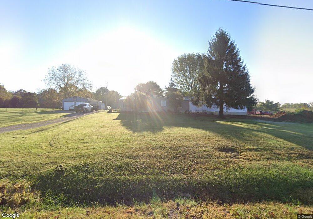
730 Poplar Ridge Rd West Union, OH 45693
Estimated Value: $204,000 - $297,000
3
Beds
2
Baths
1,424
Sq Ft
$170/Sq Ft
Est. Value
About This Home
This home is located at 730 Poplar Ridge Rd, West Union, OH 45693 and is currently estimated at $242,727, approximately $170 per square foot. 730 Poplar Ridge Rd is a home located in Adams County with nearby schools including West Union Elementary School and West Union High School.
Ownership History
Date
Name
Owned For
Owner Type
Purchase Details
Closed on
May 8, 2015
Sold by
Kitchen Brian and Kitchen Bridgett
Bought by
Wickerham Mark D and Wickerham Dara J
Current Estimated Value
Home Financials for this Owner
Home Financials are based on the most recent Mortgage that was taken out on this home.
Original Mortgage
$106,000
Interest Rate
3.68%
Mortgage Type
New Conventional
Purchase Details
Closed on
Dec 29, 2004
Sold by
Neu Roger W
Bought by
Wickerham Mark D
Purchase Details
Closed on
Dec 20, 1991
Bought by
Neu Roger W
Create a Home Valuation Report for This Property
The Home Valuation Report is an in-depth analysis detailing your home's value as well as a comparison with similar homes in the area
Home Values in the Area
Average Home Value in this Area
Purchase History
| Date | Buyer | Sale Price | Title Company |
|---|---|---|---|
| Wickerham Mark D | $30,000 | None Available | |
| Wickerham Mark D | $10,000 | -- | |
| Neu Roger W | $45,700 | -- |
Source: Public Records
Mortgage History
| Date | Status | Borrower | Loan Amount |
|---|---|---|---|
| Closed | Wickerham Mark D | $106,000 |
Source: Public Records
Tax History Compared to Growth
Tax History
| Year | Tax Paid | Tax Assessment Tax Assessment Total Assessment is a certain percentage of the fair market value that is determined by local assessors to be the total taxable value of land and additions on the property. | Land | Improvement |
|---|---|---|---|---|
| 2024 | $1,311 | $47,780 | $14,670 | $33,110 |
| 2023 | $1,320 | $47,780 | $14,670 | $33,110 |
| 2022 | $1,310 | $38,750 | $11,730 | $27,020 |
| 2021 | $1,172 | $38,750 | $11,730 | $27,020 |
| 2020 | $1,199 | $38,750 | $11,730 | $27,020 |
| 2019 | $1,199 | $38,750 | $11,730 | $27,020 |
| 2018 | $1,072 | $33,680 | $10,190 | $23,490 |
| 2017 | $1,055 | $33,680 | $10,190 | $23,490 |
| 2016 | $1,053 | $33,680 | $10,190 | $23,490 |
| 2015 | $1,072 | $34,370 | $9,030 | $25,340 |
| 2014 | -- | $34,370 | $9,030 | $25,340 |
Source: Public Records
Map
Nearby Homes
- 4702 Brush Creek Rd
- 4702 Ohio Brush Creek Rd
- 1805 Waggoner Riffle Rd
- 467 Waggoner Riffle Rd
- 2060 Moores Run Rd
- 405 Lookout View
- 410 Owens Rd
- 175 Hidden Acres Dr
- 1082 E Walnut St
- 333 Crawford Rd
- 271 Crawford Rd
- 4423 Pumpkin Ridge Rd
- 144 ac Pumpkin Ridge Rd
- 585 High St
- 4700 Ohio 247
- 269 Paulette Ln
- 537 1st St
- 725 E Walnut St
- 1478 Robinson Hollow Rd
- 526 E Walnut St
- 820 Poplar Ridge Rd
- 20 Mccarty Rd
- 854 Poplar Ridge Rd
- 150 Mccarty Rd
- 987 Poplar Ridge Rd
- 266 Edith Osman Rd
- 986 Poplar Ridge Rd
- 240 Mccarty Rd
- 1017 Poplar Ridge Rd
- 983 Poplar Ridge Rd
- 58.7ac Mccarty Rd
- 58.7 Acre Mccarty Rd
- 500 Edith Osman Rd
- 520 Mccarty Rd
- 1129 Poplar Ridge Rd
- 407 Edith Osman Rd
- 56.58ac Beasley Fork Rd
- 600 Mccarty Rd
- 220 Trent Rd
- 1630 Poplar Ridge Rd