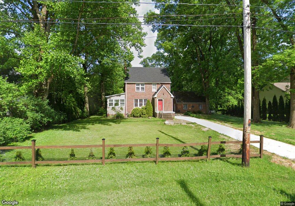
731 Brunsdorph Rd Fairlawn, OH 44333
Estimated Value: $247,659 - $310,000
3
Beds
1
Bath
1,512
Sq Ft
$184/Sq Ft
Est. Value
About This Home
This home is located at 731 Brunsdorph Rd, Fairlawn, OH 44333 and is currently estimated at $278,165, approximately $183 per square foot. 731 Brunsdorph Rd is a home located in Summit County with nearby schools including Copley-Fairlawn Middle School, Copley High School, and Fairlawn Lutheran School.
Ownership History
Date
Name
Owned For
Owner Type
Purchase Details
Closed on
Nov 17, 1999
Sold by
The Smith Land Co
Bought by
Ricker Clay W and Ricker Isabel A
Current Estimated Value
Home Financials for this Owner
Home Financials are based on the most recent Mortgage that was taken out on this home.
Original Mortgage
$109,800
Outstanding Balance
$34,085
Interest Rate
7.97%
Estimated Equity
$244,080
Purchase Details
Closed on
Aug 24, 1999
Sold by
Armstrong Arthur R
Bought by
Smith Land Company Inc
Home Financials for this Owner
Home Financials are based on the most recent Mortgage that was taken out on this home.
Original Mortgage
$249,500
Interest Rate
7.59%
Create a Home Valuation Report for This Property
The Home Valuation Report is an in-depth analysis detailing your home's value as well as a comparison with similar homes in the area
Home Values in the Area
Average Home Value in this Area
Purchase History
| Date | Buyer | Sale Price | Title Company |
|---|---|---|---|
| Ricker Clay W | $122,000 | Exchange Place Title Agency | |
| Smith Land Company Inc | $350,000 | Exchange Place Title Agency |
Source: Public Records
Mortgage History
| Date | Status | Borrower | Loan Amount |
|---|---|---|---|
| Open | Ricker Clay W | $109,800 | |
| Previous Owner | Smith Land Company Inc | $249,500 |
Source: Public Records
Tax History Compared to Growth
Tax History
| Year | Tax Paid | Tax Assessment Tax Assessment Total Assessment is a certain percentage of the fair market value that is determined by local assessors to be the total taxable value of land and additions on the property. | Land | Improvement |
|---|---|---|---|---|
| 2025 | $2,799 | $70,301 | $14,280 | $56,021 |
| 2024 | $2,799 | $70,301 | $14,280 | $56,021 |
| 2023 | $2,799 | $70,301 | $14,280 | $56,021 |
| 2022 | $2,255 | $46,691 | $9,846 | $36,845 |
| 2021 | $2,119 | $46,691 | $9,846 | $36,845 |
| 2020 | $2,541 | $57,500 | $15,150 | $42,350 |
| 2019 | $2,075 | $41,860 | $17,880 | $23,980 |
| 2018 | $2,033 | $41,860 | $17,880 | $23,980 |
| 2017 | $2,120 | $41,860 | $17,880 | $23,980 |
| 2016 | $2,119 | $40,940 | $17,880 | $23,060 |
| 2015 | $2,120 | $40,940 | $17,880 | $23,060 |
| 2014 | $2,112 | $40,940 | $17,880 | $23,060 |
| 2013 | $2,196 | $42,710 | $17,880 | $24,830 |
Source: Public Records
Map
Nearby Homes
- 0 Brunsdorph Rd
- 786 Brunsdorph Rd
- 2957 Greenspire Ln
- 600 White Tail Ridge Dr
- 3201 Ridgewood Rd
- 3241 Ridgewood Rd
- 897 Bellaire Dr
- V/L White Tail Ridge Dr
- 2845 Orchard Grove Ct
- 482 Gresham Dr
- 462 Gresham Dr
- 804 Miramar Ln
- 848 Jacoby Rd
- 0 Kumho Dr
- 721 S Cleveland Massillon Rd
- 360 Marviel Dr
- 3340 Willow Ln
- 342 S Miller Rd
- 3584 Bay Hill Dr
- 3143 Morewood Rd
- 721 Brunsdorph Rd
- V/L A Brunsdorph Rd
- V/L Brunsdorph Rd
- V/LA Brunsdorph Rd
- 689 Brunsdorph Rd
- 688 Brunsdorph Rd
- 743 Brunsdorph Rd
- 0 V L Brunsdorph Dr
- 711 Brunsdorph Rd
- V/L 1 Brunsdorph Dr
- V/L Brunsdorph Dr
- 726 White Tail Ridge Dr
- 761 Brunsdorph Rd
- 0 V L 3 Brunsdorph Dr Unit 4410410
- 0 V L 2 Brunsdorph Dr Unit 4410306
- 734 White Tail Ridge Dr
- 718 White Tail Ridge Dr
- 0 V L 4 Brunsdorph Dr Unit 4410323
- 3070 Forest Ridge Ct
- 3060 Forest Ridge Ct