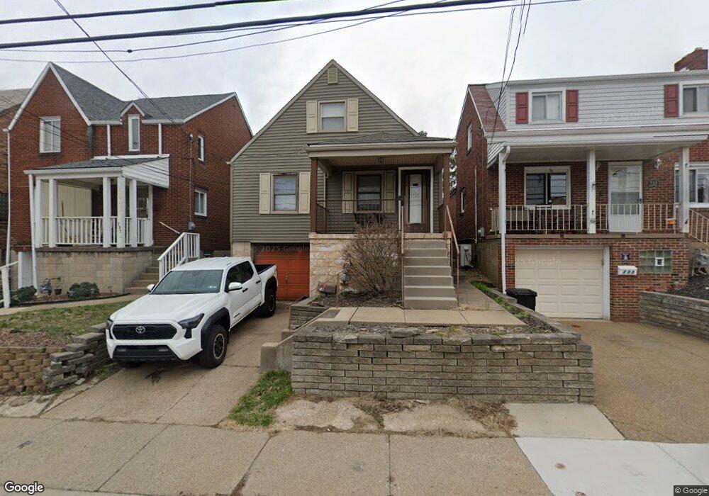
731 Dunster St Pittsburgh, PA 15226
Brookline NeighborhoodEstimated Value: $130,000 - $194,000
3
Beds
2
Baths
1,474
Sq Ft
$111/Sq Ft
Est. Value
About This Home
This home is located at 731 Dunster St, Pittsburgh, PA 15226 and is currently estimated at $163,961, approximately $111 per square foot. 731 Dunster St is a home located in Allegheny County with nearby schools including Pittsburgh West Liberty K-5, Pittsburgh South Brook, and Pittsburgh Carrick High School.
Ownership History
Date
Name
Owned For
Owner Type
Purchase Details
Closed on
Nov 17, 2021
Sold by
Brooks Allen T Est and Brooks Patricia Est
Bought by
Cofini Zachary T
Current Estimated Value
Home Financials for this Owner
Home Financials are based on the most recent Mortgage that was taken out on this home.
Original Mortgage
$123,975
Outstanding Balance
$113,759
Interest Rate
3.09%
Mortgage Type
New Conventional
Estimated Equity
$50,202
Purchase Details
Closed on
Nov 12, 2021
Sold by
Brooks Allen T and Brooks Patricia
Bought by
Cofini Zachary T
Home Financials for this Owner
Home Financials are based on the most recent Mortgage that was taken out on this home.
Original Mortgage
$123,975
Outstanding Balance
$113,759
Interest Rate
3.09%
Mortgage Type
New Conventional
Estimated Equity
$50,202
Purchase Details
Closed on
Sep 23, 1975
Bought by
Brooks Allen T and Brooks Patricia
Create a Home Valuation Report for This Property
The Home Valuation Report is an in-depth analysis detailing your home's value as well as a comparison with similar homes in the area
Home Values in the Area
Average Home Value in this Area
Purchase History
| Date | Buyer | Sale Price | Title Company |
|---|---|---|---|
| Cofini Zachary T | $105,000 | -- | |
| Cofini Zachary T | $105,000 | -- | |
| Cofini Zachary T | $105,000 | -- | |
| Brooks Allen T | $25,000 | -- |
Source: Public Records
Mortgage History
| Date | Status | Borrower | Loan Amount |
|---|---|---|---|
| Open | Cofini Zachary T | $123,975 | |
| Closed | Cofini Zachary T | $123,975 |
Source: Public Records
Tax History Compared to Growth
Tax History
| Year | Tax Paid | Tax Assessment Tax Assessment Total Assessment is a certain percentage of the fair market value that is determined by local assessors to be the total taxable value of land and additions on the property. | Land | Improvement |
|---|---|---|---|---|
| 2025 | $1,067 | $46,300 | $20,800 | $25,500 |
| 2024 | $1,067 | $46,300 | $20,800 | $25,500 |
| 2023 | $1,067 | $46,300 | $20,800 | $25,500 |
| 2022 | $1,462 | $46,300 | $20,800 | $25,500 |
| 2021 | $967 | $46,300 | $20,800 | $25,500 |
| 2020 | $1,048 | $46,300 | $20,800 | $25,500 |
| 2019 | $1,048 | $46,300 | $20,800 | $25,500 |
| 2018 | $748 | $46,300 | $20,800 | $25,500 |
| 2017 | $1,048 | $46,300 | $20,800 | $25,500 |
| 2016 | $219 | $46,300 | $20,800 | $25,500 |
| 2015 | $219 | $46,300 | $20,800 | $25,500 |
| 2014 | $1,025 | $46,300 | $20,800 | $25,500 |
Source: Public Records
Map
Nearby Homes
- 711 Mayville Ave
- 661 Dunster St
- 863 Dunster St
- 728 Mayville Ave
- 603 Crysler St
- 405 Fernhill Ave
- 1669 Edgebrook Ave
- 1937 Plainview Ave
- 2007 Plainview Ave
- 339 Fernhill Ave
- 320 Fernhill Ave
- 608 Elmbank St
- 1831 Woodward Ave
- 2054 Woodward Ave
- 2201 Whited St
- 1848 Ringwalt St
- 2143 Plainview Ave
- 2403 Lynnbrook Ave
- 2400 Pioneer Ave
- 0 Ballinger St Unit 1705904