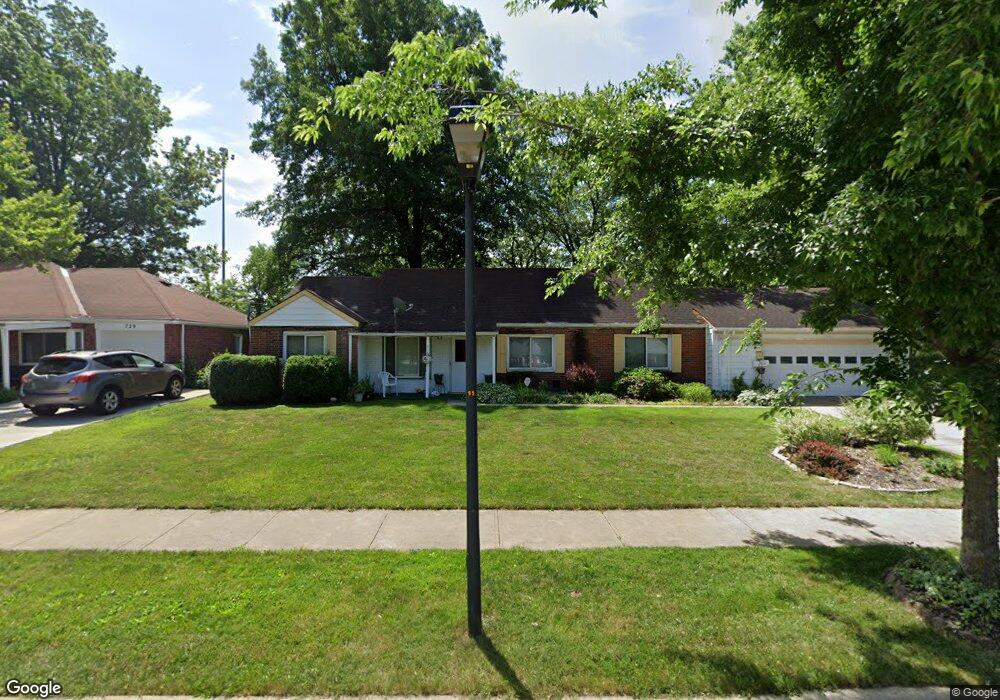
731 Walnut Dr Euclid, OH 44132
Estimated Value: $197,600 - $226,000
3
Beds
2
Baths
1,828
Sq Ft
$112/Sq Ft
Est. Value
About This Home
This home is located at 731 Walnut Dr, Euclid, OH 44132 and is currently estimated at $205,150, approximately $112 per square foot. 731 Walnut Dr is a home located in Cuyahoga County with nearby schools including Shoreview Elementary School, Euclid High School, and Mater Dei Academy.
Ownership History
Date
Name
Owned For
Owner Type
Purchase Details
Closed on
Jun 4, 2018
Sold by
Seay Shirley and Seay Robert
Bought by
Thompson Frank
Current Estimated Value
Purchase Details
Closed on
Aug 26, 2008
Sold by
Homesales Inc
Bought by
Seay Robert P
Purchase Details
Closed on
Apr 14, 2008
Sold by
Evans Henry C and Evans Theresa G
Bought by
Homesales Inc and Homesales Inc Of Delaware
Purchase Details
Closed on
Sep 27, 1988
Sold by
Evans Henry C and Evans Theresa G
Bought by
Evans Henry C
Purchase Details
Closed on
Jan 1, 1975
Bought by
Seiler Alan C and Seiler Eliz J
Create a Home Valuation Report for This Property
The Home Valuation Report is an in-depth analysis detailing your home's value as well as a comparison with similar homes in the area
Home Values in the Area
Average Home Value in this Area
Purchase History
| Date | Buyer | Sale Price | Title Company |
|---|---|---|---|
| Thompson Frank | -- | None Available | |
| Seay Robert P | $52,500 | Accutitle Agency Inc | |
| Homesales Inc | $53,334 | Attorney | |
| Evans Henry C | -- | -- | |
| Evans Henry C | $68,000 | -- | |
| Seiler Alan C | -- | -- |
Source: Public Records
Tax History
| Year | Tax Paid | Tax Assessment Tax Assessment Total Assessment is a certain percentage of the fair market value that is determined by local assessors to be the total taxable value of land and additions on the property. | Land | Improvement |
|---|---|---|---|---|
| 2024 | $2,806 | $59,745 | $11,725 | $48,020 |
| 2023 | $2,310 | $44,350 | $10,290 | $34,060 |
| 2022 | $2,323 | $44,350 | $10,290 | $34,060 |
| 2021 | $2,571 | $44,350 | $10,290 | $34,060 |
| 2020 | $1,754 | $33,600 | $7,810 | $25,800 |
| 2019 | $3,182 | $96,000 | $22,300 | $73,700 |
| 2018 | $3,213 | $33,600 | $7,810 | $25,800 |
| 2017 | $3,321 | $28,980 | $6,230 | $22,750 |
| 2016 | $3,329 | $28,980 | $6,230 | $22,750 |
| 2015 | $3,034 | $28,980 | $6,230 | $22,750 |
| 2014 | $3,034 | $28,980 | $6,230 | $22,750 |
Source: Public Records
Map
Nearby Homes
- 730 Hemlock Dr
- 670 Hemlock Dr
- 815 E 272nd St
- 597 Hemlock Dr
- 27190 Zeman Ave
- 591 Hemlock Dr
- 26931 Shoreview Ave
- 27125 Mallard Ave
- 26831 Shoreview Ave
- 26430 Drakefield Ave
- 610 E 266th St
- 1354 Craneing Rd
- 26351 Farringdon Ave
- 27430 Forestview Ave
- 643 E 261st St
- 440 E 271st St
- 579 E 260th St
- 571 E 260th St
- 29310 Grand Blvd
- 625 Lloyd Rd
Your Personal Tour Guide
Ask me questions while you tour the home.