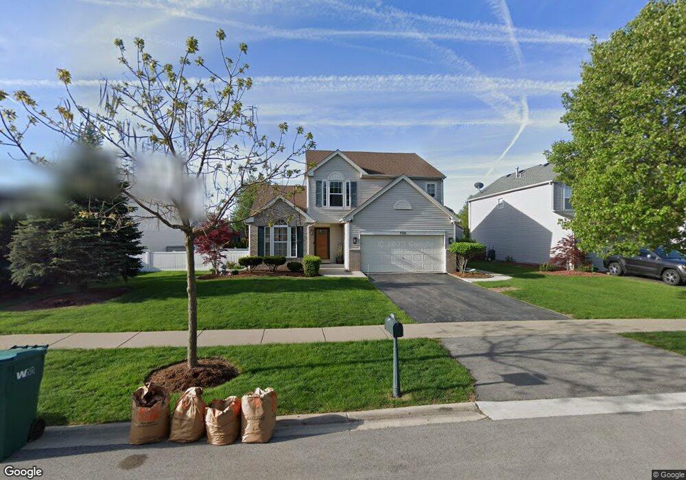
7310 Ashbrook Ln Unit 1 Plainfield, IL 60586
North Minooka NeighborhoodEstimated Value: $365,986 - $382,000
Studio
1
Bath
1,764
Sq Ft
$213/Sq Ft
Est. Value
About This Home
This home is located at 7310 Ashbrook Ln Unit 1, Plainfield, IL 60586 and is currently estimated at $375,662, approximately $212 per square foot. 7310 Ashbrook Ln Unit 1 is a home located in Kendall County with nearby schools including Charles Reed Elementary School, Aux Sable Middle School, and Plainfield South High School.
Ownership History
Date
Name
Owned For
Owner Type
Purchase Details
Closed on
Nov 4, 2002
Sold by
Neumann Homes Inc
Bought by
Porsovigan Gilbert F and Porsovigan Joselyn C
Current Estimated Value
Home Financials for this Owner
Home Financials are based on the most recent Mortgage that was taken out on this home.
Original Mortgage
$183,607
Interest Rate
6%
Mortgage Type
Purchase Money Mortgage
Create a Home Valuation Report for This Property
The Home Valuation Report is an in-depth analysis detailing your home's value as well as a comparison with similar homes in the area
Home Values in the Area
Average Home Value in this Area
Purchase History
| Date | Buyer | Sale Price | Title Company |
|---|---|---|---|
| Porsovigan Gilbert F | $193,500 | Chicago Title Insurance Co |
Source: Public Records
Mortgage History
| Date | Status | Borrower | Loan Amount |
|---|---|---|---|
| Previous Owner | Porsovigan Gilbert F | $183,607 |
Source: Public Records
Tax History
| Year | Tax Paid | Tax Assessment Tax Assessment Total Assessment is a certain percentage of the fair market value that is determined by local assessors to be the total taxable value of land and additions on the property. | Land | Improvement |
|---|---|---|---|---|
| 2024 | $7,654 | $111,849 | $15,449 | $96,400 |
| 2023 | $6,670 | $98,396 | $13,434 | $84,962 |
| 2022 | $6,670 | $89,756 | $13,133 | $76,623 |
| 2021 | $6,297 | $83,366 | $13,111 | $70,255 |
| 2020 | $6,060 | $79,066 | $13,027 | $66,039 |
| 2019 | $5,843 | $75,263 | $13,027 | $62,236 |
| 2018 | $5,550 | $70,124 | $13,027 | $57,097 |
| 2017 | $5,539 | $67,461 | $13,027 | $54,434 |
| 2016 | $5,287 | $63,257 | $12,866 | $50,391 |
| 2015 | $4,897 | $56,425 | $12,210 | $44,215 |
| 2014 | -- | $54,635 | $12,210 | $42,425 |
| 2013 | -- | $54,635 | $12,210 | $42,425 |
Source: Public Records
Map
Nearby Homes
- 2302 Covington Ct
- 2224 Ashby Ln
- 2031 Havenhill Dr
- 2126 Ingersoll Ct
- 2009 Ashbrook Ct Unit 3
- 7514 Rosewind Dr Unit 2
- 7013 Manchester Dr
- 2404 White Ash Ct
- 2017 Lilyana Ln
- 7202 Faxton Ln
- 2401 Red Oak Ct
- 7311 Fordham Ln
- 1910 Crestview Dr Unit 2
- 1702 Waterman Dr
- 7804 Briarcliff Dr
- 1811 Cumberland Dr
- 2508 Falls Ct
- 6709 Buchanan Cir
- 6710 Buchanan Cir
- 6707 Buchanan Cir
- 7312 Ashbrook Ln
- 7308 Ashbrook Ln
- 2222 Covington Ln Unit 2
- 2217 Ashbrook Ln
- 2220 Covington Ln
- 7309 Ashbrook Ln
- 2215 Ashbrook Ln Unit 2
- 2218 Covington Ln Unit 2
- 7307 Ashbrook Ln
- 2213 Ashbrook Ln
- 2225 Covington Ln Unit 1
- 2222 Ashbrook Ln Unit 2
- 2221 Covington Ln Unit 2
- 2223 Covington Ln
- 2304 Covington Ct
- 2220 Ashbrook Ln
- 2216 Covington Ln Unit 2
- 2301 Covington Ct
- 2224 Ashbrook Ln Unit 2
- 2218 Ashbrook Ln Unit 2
Your Personal Tour Guide
Ask me questions while you tour the home.