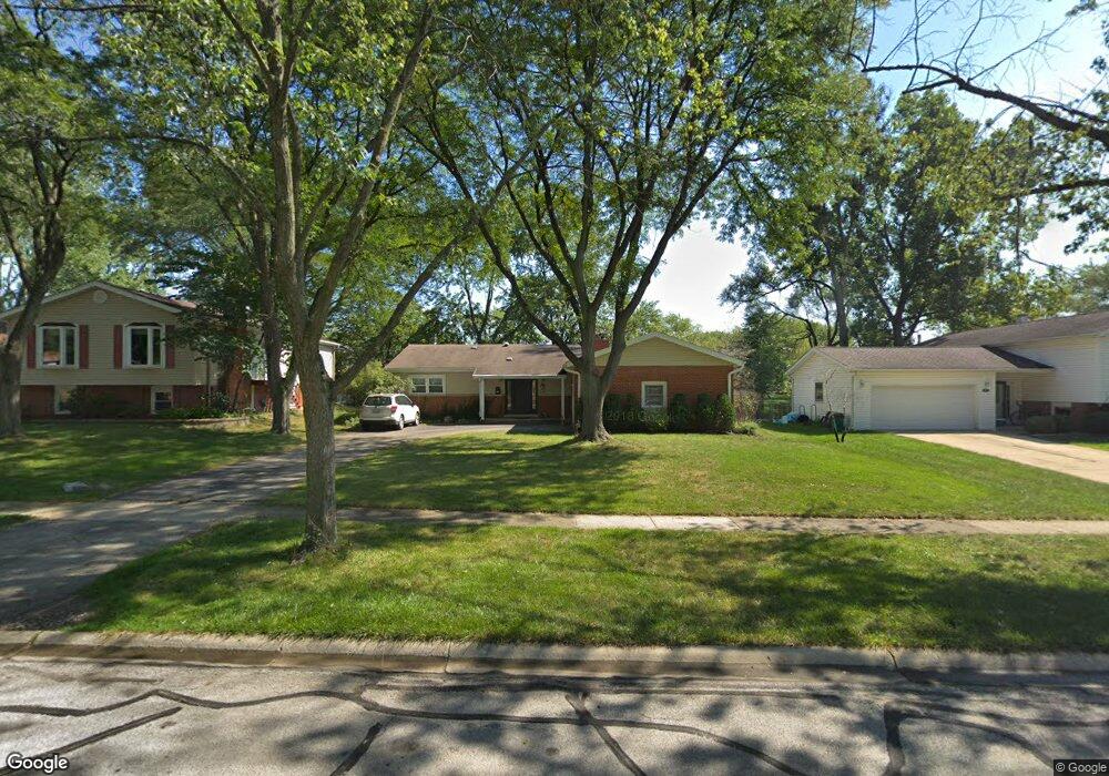
7313 Bunker Rd Darien, IL 60561
Estimated Value: $403,367 - $489,000
--
Bed
--
Bath
1,426
Sq Ft
$315/Sq Ft
Est. Value
About This Home
This home is located at 7313 Bunker Rd, Darien, IL 60561 and is currently estimated at $448,592, approximately $314 per square foot. 7313 Bunker Rd is a home located in DuPage County with nearby schools including Mark Delay School, Lace Elementary School, and Eisenhower Jr High School.
Ownership History
Date
Name
Owned For
Owner Type
Purchase Details
Closed on
Sep 9, 2002
Sold by
Whiteside Geraldine C and Geraldine C Whiteside Trust
Bought by
Gasaway Bruce and Stubbs Gasaway Jennifer
Current Estimated Value
Home Financials for this Owner
Home Financials are based on the most recent Mortgage that was taken out on this home.
Original Mortgage
$164,000
Outstanding Balance
$69,308
Interest Rate
6.4%
Estimated Equity
$379,284
Purchase Details
Closed on
Oct 14, 1996
Sold by
Whiteside Geraldine C
Bought by
Whiteside Geraldine C and The Geraldine C Whiteside Trus
Purchase Details
Closed on
Dec 30, 1993
Sold by
Bell Sharon L
Bought by
Whiteside Geraldine C
Purchase Details
Closed on
Dec 8, 1993
Sold by
Carbone Rocco
Bought by
Bell Sharon
Create a Home Valuation Report for This Property
The Home Valuation Report is an in-depth analysis detailing your home's value as well as a comparison with similar homes in the area
Home Values in the Area
Average Home Value in this Area
Purchase History
| Date | Buyer | Sale Price | Title Company |
|---|---|---|---|
| Gasaway Bruce | $205,000 | First American Title | |
| Whiteside Geraldine C | -- | -- | |
| Whiteside Geraldine C | $154,000 | Intercounty Title Company | |
| Bell Sharon | -- | -- |
Source: Public Records
Mortgage History
| Date | Status | Borrower | Loan Amount |
|---|---|---|---|
| Open | Gasaway Bruce | $164,000 | |
| Closed | Gasaway Bruce | $30,750 |
Source: Public Records
Tax History Compared to Growth
Tax History
| Year | Tax Paid | Tax Assessment Tax Assessment Total Assessment is a certain percentage of the fair market value that is determined by local assessors to be the total taxable value of land and additions on the property. | Land | Improvement |
|---|---|---|---|---|
| 2024 | $6,916 | $123,346 | $44,959 | $78,387 |
| 2023 | $6,610 | $113,390 | $41,330 | $72,060 |
| 2022 | $6,698 | $111,050 | $40,480 | $70,570 |
| 2021 | $6,765 | $109,790 | $40,020 | $69,770 |
| 2020 | $6,674 | $107,620 | $39,230 | $68,390 |
| 2019 | $6,450 | $103,260 | $37,640 | $65,620 |
| 2018 | $6,003 | $97,250 | $37,370 | $59,880 |
| 2017 | $5,867 | $93,580 | $35,960 | $57,620 |
| 2016 | $5,712 | $89,310 | $34,320 | $54,990 |
| 2015 | $5,628 | $84,030 | $32,290 | $51,740 |
| 2014 | $5,331 | $78,850 | $31,390 | $47,460 |
| 2013 | $5,200 | $78,220 | $31,240 | $46,980 |
Source: Public Records
Map
Nearby Homes
- 7216 Leonard Dr
- 7510 Farmingdale Dr Unit 208
- 7525 Nantucket Dr Unit 210
- 7515 Nantucket Dr Unit 404
- 7715 Sussex Creek Dr Unit 1D
- 7713 Brookhaven Ave
- 716 Somerset Ln
- 320 Sheridan Dr Unit 2C
- 7817 Mayfair Ln
- 1145 Lacebark Ct
- 1121 Lodgepole Ct
- 709 79th St Unit 103
- 709 79th St Unit 307
- 709 79th St Unit 403
- 801 79th St Unit 105
- 1116 Bristlecone Ct
- Lot 1, 2, 3, 4 & 5 Nantucket Dr
- 824 High Ridge Ct
- 9S080 Stratford Place
- 6655 S Cass Ave Unit 5D
- 7317 Bunker Rd
- 7309 Bunker Rd
- 7314 Richmond Ave
- 7321 Bunker Rd
- 7318 Richmond Ave
- 7310 Richmond Ave
- 7305 Bunker Rd
- 7322 Richmond Ave
- 7310 Bunker Rd
- 7314 Bunker Rd
- 7306 Richmond Ave
- 7318 Bunker Rd
- 7325 Bunker Rd
- 7306 Bunker Rd
- 7301 Bunker Rd
- 7322 Bunker Rd
- 7326 Richmond Ave
- 7302 Richmond Ave
- 7329 Bunker Rd
- 7302 Bunker Rd Unit 1