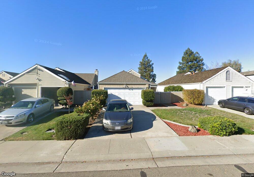
7319 Lighthouse Dr Stockton, CA 95219
Estimated Value: $331,212 - $382,000
2
Beds
2
Baths
959
Sq Ft
$378/Sq Ft
Est. Value
About This Home
This home is located at 7319 Lighthouse Dr, Stockton, CA 95219 and is currently estimated at $362,553, approximately $378 per square foot. 7319 Lighthouse Dr is a home located in San Joaquin County with nearby schools including John R. Williams School, Sierra Middle School, and Lincoln High School.
Ownership History
Date
Name
Owned For
Owner Type
Purchase Details
Closed on
Oct 1, 2003
Sold by
Hutz Theodore B and Hutz Mary R
Bought by
Hutz Theodore K and Hutz Theodore B
Current Estimated Value
Home Financials for this Owner
Home Financials are based on the most recent Mortgage that was taken out on this home.
Original Mortgage
$140,000
Outstanding Balance
$65,377
Interest Rate
6.22%
Mortgage Type
Purchase Money Mortgage
Estimated Equity
$297,176
Purchase Details
Closed on
Dec 31, 2002
Sold by
Hutz Theodore B and Hutz Mary R
Bought by
Hutz Theodore K and Hutz Theodore B
Purchase Details
Closed on
Dec 14, 2000
Sold by
Hutz Theodore K and Hutz Maureen B
Bought by
Hutz Theodore B and Hutz Mary R
Home Financials for this Owner
Home Financials are based on the most recent Mortgage that was taken out on this home.
Original Mortgage
$53,418
Interest Rate
6.91%
Mortgage Type
Seller Take Back
Purchase Details
Closed on
Dec 13, 2000
Sold by
Bond Philip J
Bought by
Hutz Theodore K and Hutz Maureen B
Home Financials for this Owner
Home Financials are based on the most recent Mortgage that was taken out on this home.
Original Mortgage
$53,418
Interest Rate
6.91%
Mortgage Type
Seller Take Back
Purchase Details
Closed on
Feb 3, 1998
Sold by
Winkler Josef A and Winkler Lisa A
Bought by
Bond Philip J
Home Financials for this Owner
Home Financials are based on the most recent Mortgage that was taken out on this home.
Original Mortgage
$99,910
Interest Rate
7.17%
Mortgage Type
VA
Purchase Details
Closed on
Apr 13, 1994
Sold by
Snelling Mark
Bought by
Winkler Josef A
Home Financials for this Owner
Home Financials are based on the most recent Mortgage that was taken out on this home.
Original Mortgage
$86,940
Interest Rate
7.59%
Purchase Details
Closed on
Feb 17, 1994
Sold by
Snelling Milton and Snelling Marilyn
Bought by
Snelling Mark
Home Financials for this Owner
Home Financials are based on the most recent Mortgage that was taken out on this home.
Original Mortgage
$86,940
Interest Rate
7.59%
Create a Home Valuation Report for This Property
The Home Valuation Report is an in-depth analysis detailing your home's value as well as a comparison with similar homes in the area
Purchase History
| Date | Buyer | Sale Price | Title Company |
|---|---|---|---|
| Hutz Theodore K | -- | Alliance Title Co | |
| Hutz Theodore B | -- | Alliance Title Co | |
| Hutz Theodore K | -- | -- | |
| Hutz Theodore B | $53,500 | -- | |
| Hutz Theodore K | $93,418 | -- | |
| Bond Philip J | $97,000 | Old Republic Title Company | |
| Winkler Josef A | $108,500 | Commonwealth Land Title Ins | |
| Snelling Mark | -- | Commonwealth Land Title Ins |
Source: Public Records
Mortgage History
| Date | Status | Borrower | Loan Amount |
|---|---|---|---|
| Open | Hutz Theodore B | $140,000 | |
| Closed | Hutz Theodore B | $53,418 | |
| Previous Owner | Bond Philip J | $99,910 | |
| Previous Owner | Winkler Josef A | $86,940 |
Source: Public Records
Tax History
| Year | Tax Paid | Tax Assessment Tax Assessment Total Assessment is a certain percentage of the fair market value that is determined by local assessors to be the total taxable value of land and additions on the property. | Land | Improvement |
|---|---|---|---|---|
| 2025 | $2,386 | $188,336 | $45,198 | $143,138 |
| 2024 | $2,339 | $184,644 | $44,312 | $140,332 |
| 2023 | $2,322 | $181,025 | $43,444 | $137,581 |
| 2022 | $2,222 | $177,477 | $42,593 | $134,884 |
| 2021 | $2,194 | $173,998 | $41,758 | $132,240 |
| 2020 | $2,194 | $172,215 | $41,330 | $130,885 |
| 2019 | $2,162 | $168,839 | $40,520 | $128,319 |
| 2018 | $2,121 | $165,529 | $39,726 | $125,803 |
| 2017 | $2,081 | $162,285 | $38,948 | $123,337 |
| 2016 | $2,061 | $159,104 | $38,185 | $120,919 |
| 2014 | $2,017 | $153,646 | $36,875 | $116,771 |
Source: Public Records
Map
Nearby Homes
- 7348 Lighthouse Dr
- 7308 Lighthouse Dr
- 7157 Lighthouse Dr
- 3511 Schooner Dr
- 3790 Hatchers Cir
- 7412 Southfield Way
- 6869 Sumter Quay Cir
- 6836 Cumberland Place
- 7124 Kelley Dr
- 7506 Richland Way
- 7011 Shoreham Place
- 8120 Independence Ave
- 6829 Gordon Ct
- 6816 Cumberland Place
- 2926 Garrison Ct
- 7039 Bridgeport Cir
- 0 Fort Donelson Dr Unit ML82024976
- 4044 Fort Donelson Dr
- 9051 Kelley Dr
- 8710 Kelley Dr
- 7325 Lighthouse Dr
- 7313 Lighthouse Dr
- 7331 Lighthouse Dr
- 7307 Lighthouse Dr
- 7337 Lighthouse Dr
- 7235 Lighthouse Dr
- 7343 Lighthouse Dr
- 7229 Lighthouse Dr
- 7320 Lighthouse Dr
- 7314 Lighthouse Dr
- 7326 Lighthouse Dr
- 7349 Lighthouse Dr
- 7223 Lighthouse Dr
- 7234 Lighthouse Dr
- 7338 Lighthouse Dr
- 7355 Lighthouse Dr
- 7228 Lighthouse Dr
- 7217 Lighthouse Dr
- 7340 Lighthouse Dr
- 7342 Lighthouse Dr
Your Personal Tour Guide
Ask me questions while you tour the home.