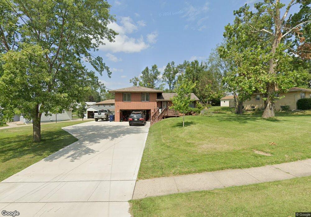
7319 Maple Dr Urbandale, IA 50322
Estimated Value: $266,000 - $284,000
3
Beds
2
Baths
1,205
Sq Ft
$228/Sq Ft
Est. Value
About This Home
This home is located at 7319 Maple Dr, Urbandale, IA 50322 and is currently estimated at $274,868, approximately $228 per square foot. 7319 Maple Dr is a home located in Polk County with nearby schools including Karen Acres Elementary School, Valerius Elementary School, and Urbandale Middle School.
Ownership History
Date
Name
Owned For
Owner Type
Purchase Details
Closed on
May 18, 2005
Sold by
Federal National Mortgage Association
Bought by
Dumpor Bernard and Dumpor Bernadis
Current Estimated Value
Home Financials for this Owner
Home Financials are based on the most recent Mortgage that was taken out on this home.
Original Mortgage
$150,000
Outstanding Balance
$78,562
Interest Rate
5.91%
Mortgage Type
Fannie Mae Freddie Mac
Estimated Equity
$196,306
Purchase Details
Closed on
Oct 7, 2004
Sold by
Mortgage Electronic Registration Systems
Bought by
Federal National Mortgage Association
Purchase Details
Closed on
Mar 10, 2000
Sold by
Balsan Lois W and Anne Goscinski D
Bought by
Clark Michael and Clark Michelle
Home Financials for this Owner
Home Financials are based on the most recent Mortgage that was taken out on this home.
Original Mortgage
$97,750
Interest Rate
10.7%
Create a Home Valuation Report for This Property
The Home Valuation Report is an in-depth analysis detailing your home's value as well as a comparison with similar homes in the area
Home Values in the Area
Average Home Value in this Area
Purchase History
| Date | Buyer | Sale Price | Title Company |
|---|---|---|---|
| Dumpor Bernard | -- | -- | |
| Federal National Mortgage Association | $151,000 | -- | |
| Clark Michael | $114,500 | -- |
Source: Public Records
Mortgage History
| Date | Status | Borrower | Loan Amount |
|---|---|---|---|
| Open | Dumpor Bernard | $150,000 | |
| Previous Owner | Clark Michael | $97,750 |
Source: Public Records
Tax History Compared to Growth
Tax History
| Year | Tax Paid | Tax Assessment Tax Assessment Total Assessment is a certain percentage of the fair market value that is determined by local assessors to be the total taxable value of land and additions on the property. | Land | Improvement |
|---|---|---|---|---|
| 2025 | $4,684 | $284,700 | $82,400 | $202,300 |
| 2024 | $4,684 | $258,600 | $73,700 | $184,900 |
| 2023 | $4,672 | $258,600 | $73,700 | $184,900 |
| 2022 | $4,618 | $217,700 | $63,600 | $154,100 |
| 2021 | $4,618 | $217,700 | $63,600 | $154,100 |
| 2020 | $4,438 | $202,000 | $59,000 | $143,000 |
| 2019 | $4,196 | $202,000 | $59,000 | $143,000 |
| 2018 | $4,044 | $182,500 | $52,100 | $130,400 |
| 2017 | $3,726 | $182,500 | $52,100 | $130,400 |
| 2016 | $3,636 | $165,300 | $46,700 | $118,600 |
| 2015 | $3,636 | $165,300 | $46,700 | $118,600 |
| 2014 | $3,560 | $160,400 | $44,500 | $115,900 |
Source: Public Records
Map
Nearby Homes
- 7201 Maple Dr
- 7051 Oak Brook Dr
- 7204 Douglas Ave
- 3808 72nd St
- 3206 68th St
- 7100 Holcomb Ave
- 3907 73rd St
- 3233 68th St
- 2708 68th St
- 8073 Cobblestone Rd
- 8037 Cobblestone Ct
- 6717 Roseland Dr
- 2548 Pine Cir
- 6620 Boston Ave
- 3611 68th St
- 8024 Cobblestone Rd
- 8008 Cobblestone Rd
- 2405 81st Cir
- 2250 70th St
- 6700 Sheridan Ave
- 7313 Maple Dr
- 7323 Maple Dr
- 7318 Beechwood Dr
- 7314 Beechwood Dr
- 7309 Maple Dr
- 7310 Beechwood Dr
- 7318 Maple Dr
- 7320 Maple Dr
- 7322 Maple Dr
- 7310 Maple Dr
- 7301 Maple Dr
- 7306 Beechwood Dr
- 3201 74th St
- 7306 Maple Dr
- 7302 Beechwood Dr
- 7406 Beechwood Dr
- 7401 Beechwood Dr
- 7315 Beechwood Dr
- 7217 Maple Dr
- 7302 Maple Dr