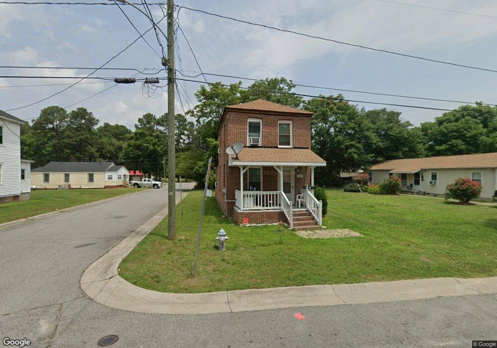
732 Battery Ave Suffolk, VA 23434
Holy Neck NeighborhoodEstimated Value: $138,489 - $194,000
3
Beds
1
Bath
1,260
Sq Ft
$130/Sq Ft
Est. Value
About This Home
This home is located at 732 Battery Ave, Suffolk, VA 23434 and is currently estimated at $164,122, approximately $130 per square foot. 732 Battery Ave is a home located in Suffolk City with nearby schools including Hillpoint Elementary School, Forest Glen Middle School, and Lakeland High School.
Ownership History
Date
Name
Owned For
Owner Type
Purchase Details
Closed on
Feb 1, 2021
Sold by
H & H Properties Llc 570
Bought by
Huffman Nathaniel J
Current Estimated Value
Home Financials for this Owner
Home Financials are based on the most recent Mortgage that was taken out on this home.
Original Mortgage
$97,500
Outstanding Balance
$88,539
Interest Rate
3.63%
Mortgage Type
Stand Alone Refi Refinance Of Original Loan
Estimated Equity
$75,583
Purchase Details
Closed on
Aug 14, 2018
Sold by
Woodley Clara B
Bought by
H & H Properties Llc
Create a Home Valuation Report for This Property
The Home Valuation Report is an in-depth analysis detailing your home's value as well as a comparison with similar homes in the area
Home Values in the Area
Average Home Value in this Area
Purchase History
| Date | Buyer | Sale Price | Title Company |
|---|---|---|---|
| Huffman Nathaniel J | -- | None Available | |
| H & H Properties Llc | $23,000 | Attorney |
Source: Public Records
Mortgage History
| Date | Status | Borrower | Loan Amount |
|---|---|---|---|
| Open | Huffman Nathaniel J | $97,500 |
Source: Public Records
Tax History Compared to Growth
Tax History
| Year | Tax Paid | Tax Assessment Tax Assessment Total Assessment is a certain percentage of the fair market value that is determined by local assessors to be the total taxable value of land and additions on the property. | Land | Improvement |
|---|---|---|---|---|
| 2024 | $1,233 | $71,900 | $45,300 | $26,600 |
| 2023 | $1,162 | $68,400 | $43,100 | $25,300 |
| 2022 | $567 | $52,000 | $30,800 | $21,200 |
| 2021 | $508 | $45,800 | $24,600 | $21,200 |
| 2020 | $464 | $41,800 | $22,400 | $19,400 |
| 2019 | $464 | $41,800 | $22,400 | $19,400 |
| 2018 | $594 | $41,800 | $22,400 | $19,400 |
| 2017 | $447 | $41,800 | $22,400 | $19,400 |
| 2016 | $447 | $41,800 | $22,400 | $19,400 |
| 2015 | $351 | $42,500 | $22,400 | $20,100 |
| 2014 | $351 | $42,500 | $22,400 | $20,100 |
Source: Public Records
Map
Nearby Homes
- 814 Battery Ave
- 812 Battery Ave
- 717 Ashley Ave
- 707 Ashley Ave
- 632 Brook Ave
- 815 Kilby Ave
- 515 Battery Ave
- 916 Delaware Ave
- 523 Mason Ave
- 461 Wellons St
- 435 Wellons St
- 433 Wellons St
- 418 Kilby Ave
- 314 Linden Ave
- 309 Linden Ave
- 406 Saint James Ave
- 419 Wellons St
- 411 Nevada St
- 308 Linden Ave
- 708 Maryland Ave
- 800 Battery Ave
- 728 Battery Ave
- 731 Ashley Ave
- 729 Ashley Ave
- 727 Ashley Ave
- 600 Cannon St
- 505 Cannon St
- 801 Battery Ave
- 720 Battery Ave
- 723 Ashley Ave
- 803 Battery Ave
- 806 Battery Ave
- 718 Battery Ave
- 805 Battery Ave
- 805 Ashley Ave
- 716 Battery Ave
- 728 Ashley Ave
- 730 Brook Ave
- 811 Battery Ave
- 715 Battery Ave