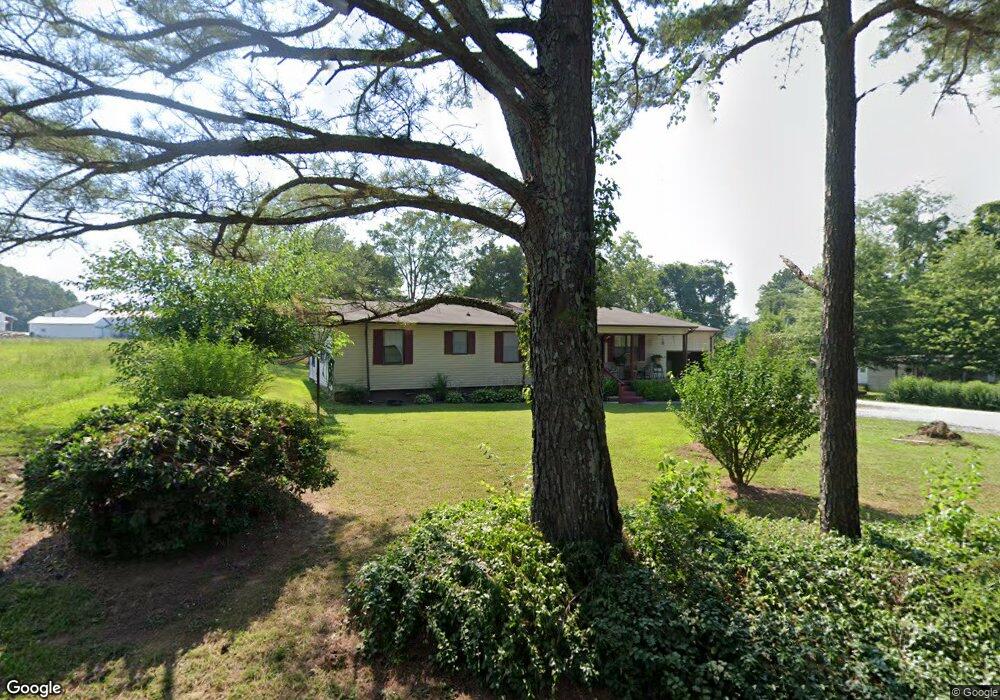
732 Byrd Rd Humboldt, TN 38343
Estimated Value: $107,690 - $249,000
--
Bed
1
Bath
1,767
Sq Ft
$105/Sq Ft
Est. Value
About This Home
This home is located at 732 Byrd Rd, Humboldt, TN 38343 and is currently estimated at $186,230, approximately $105 per square foot. 732 Byrd Rd is a home with nearby schools including Crockett County High School.
Ownership History
Date
Name
Owned For
Owner Type
Purchase Details
Closed on
Dec 12, 2013
Sold by
Cook Myrtle L
Bought by
Cook Timothy and Cook Linda Faye
Current Estimated Value
Purchase Details
Closed on
May 11, 1988
Bought by
Cook Leonard and Cook Myrtle L
Purchase Details
Closed on
Jan 1, 1983
Bought by
Cook Kenneth B and Cook Mary D
Purchase Details
Closed on
Sep 14, 1981
Purchase Details
Closed on
Jan 21, 1974
Purchase Details
Closed on
Jan 1, 1974
Purchase Details
Closed on
Aug 7, 1954
Create a Home Valuation Report for This Property
The Home Valuation Report is an in-depth analysis detailing your home's value as well as a comparison with similar homes in the area
Home Values in the Area
Average Home Value in this Area
Purchase History
| Date | Buyer | Sale Price | Title Company |
|---|---|---|---|
| Cook Timothy | -- | -- | |
| Cook Leonard | $7,000 | -- | |
| Cook Kenneth B | $7,000 | -- | |
| -- | -- | -- | |
| -- | -- | -- | |
| -- | $8,000 | -- | |
| -- | -- | -- |
Source: Public Records
Tax History Compared to Growth
Tax History
| Year | Tax Paid | Tax Assessment Tax Assessment Total Assessment is a certain percentage of the fair market value that is determined by local assessors to be the total taxable value of land and additions on the property. | Land | Improvement |
|---|---|---|---|---|
| 2025 | $454 | $29,750 | $0 | $0 |
| 2024 | $454 | $20,000 | $3,000 | $17,000 |
| 2023 | $445 | $20,000 | $3,000 | $17,000 |
| 2022 | $454 | $20,000 | $3,000 | $17,000 |
| 2021 | $405 | $15,350 | $1,625 | $13,725 |
| 2020 | $397 | $15,350 | $1,625 | $13,725 |
| 2019 | $405 | $15,350 | $1,625 | $13,725 |
| 2018 | $405 | $15,350 | $1,625 | $13,725 |
| 2017 | $405 | $15,350 | $1,625 | $13,725 |
| 2016 | $405 | $15,350 | $1,625 | $13,725 |
| 2015 | $413 | $15,350 | $1,625 | $13,725 |
| 2014 | $413 | $15,638 | $0 | $0 |
Source: Public Records
Map
Nearby Homes
- 21679 U S 79
- 120 Westwood Cove
- 133 Mason St
- 127 Franklin St
- 00 Lot#1 Humboldt Lake Rd
- 00 Lot#4 Humboldt Lake Rd
- 0 Clarence Norfleet Rd
- 24 Walter Helms Rd
- 00 Plomar Williams Rd
- 0 Plomar Williams Rd
- 397 Aubrey Fergerson Rd
- 1313 Old Bells Rd
- 0 Aubrey Fergerson Rd
- 00 Highway 45 W
- 0 W Main St
- 23 Forked Oak Ln
- 106 S 13th Ave
- 580 Westside Dr
- 76 Etheridge St Unit R
- 214 Vine St
- 841 Byrd Rd
- 1544 Mason Grove Rd
- 1544 Mason Grove Rd
- 1480 Mason Grove Rd
- 553 Byrd Rd
- 00 Byrd Rd
- 364 Byrd Rd
- 1511 Mason Grove Rd
- 1217 Mason Grove Rd
- 1184 Mason Grove Rd
- 132 Dade Ellington Rd
- 1114 Mason Grove Rd
- 216 Byrd Rd
- 2040 Mason Grove Rd
- 2040 Mason Grove Rd
- 198 Byrd Rd
- 2170 Mason Grove Rd
- 2209 Mason Grove Rd
- 2226 Mason Grove Rd
- 2238 Mason Grove Rd