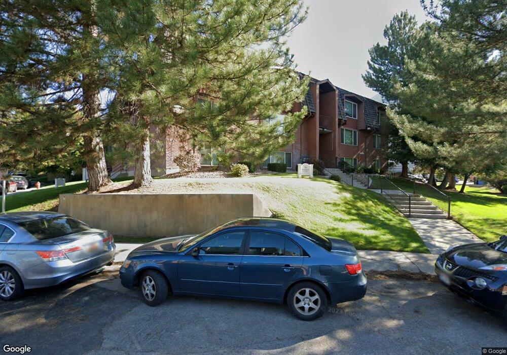
732 N 800 E Provo, UT 84606
Joaquin NeighborhoodEstimated Value: $330,000 - $404,000
2
Beds
1
Bath
932
Sq Ft
$387/Sq Ft
Est. Value
About This Home
This home is located at 732 N 800 E, Provo, UT 84606 and is currently estimated at $360,561, approximately $386 per square foot. 732 N 800 E is a home located in Utah County with nearby schools including Provo Peaks School, Centennial Middle School, and Timpview High School.
Ownership History
Date
Name
Owned For
Owner Type
Purchase Details
Closed on
Nov 16, 2021
Sold by
Dellastatious Diana L
Bought by
Diana L Dellastatious Living Trust
Current Estimated Value
Purchase Details
Closed on
Nov 18, 2015
Sold by
Dellastatious Jackson and Dellastatious Diana L
Bought by
Dellastatious Diana L
Purchase Details
Closed on
Apr 20, 2012
Sold by
Dellastatious Jackson H and Dellastatious Diana I
Bought by
Dellastatious Jackson H and Dellastatious Diana L
Purchase Details
Closed on
Apr 5, 2012
Sold by
Church Nancy and Church Jason
Bought by
Dellastatous Jackson H and Dellastatous Diana L
Purchase Details
Closed on
Jan 3, 2012
Sold by
Dellastatious Jackson H and Dellastatious Diana L
Bought by
Church Nancy and Church Jason
Purchase Details
Closed on
Oct 30, 2003
Sold by
Lauritzen Martha
Bought by
Pemberley Holdings Llc
Purchase Details
Closed on
Mar 29, 2001
Sold by
Levanger Thomas D and Levanger Jannie S
Bought by
Lauritzen David K and Lauritzen Martha
Create a Home Valuation Report for This Property
The Home Valuation Report is an in-depth analysis detailing your home's value as well as a comparison with similar homes in the area
Home Values in the Area
Average Home Value in this Area
Purchase History
| Date | Buyer | Sale Price | Title Company |
|---|---|---|---|
| Diana L Dellastatious Living Trust | -- | Fadel Law Firm | |
| Dellastatious Diana L | -- | Provo Land Title Co | |
| Dellastatious Jackson H | -- | Atlas Title Electronically | |
| Dellastatous Jackson H | -- | None Available | |
| Church Nancy | -- | Accommodation | |
| Pemberley Holdings Llc | -- | -- | |
| Lauritzen David K | -- | Old Republic Title Company |
Source: Public Records
Tax History
| Year | Tax Paid | Tax Assessment Tax Assessment Total Assessment is a certain percentage of the fair market value that is determined by local assessors to be the total taxable value of land and additions on the property. | Land | Improvement |
|---|---|---|---|---|
| 2025 | $1,782 | $178,200 | -- | -- |
| 2024 | $1,782 | $175,395 | $0 | $0 |
| 2023 | $1,693 | $164,285 | $0 | $0 |
| 2022 | $1,728 | $169,070 | $0 | $0 |
| 2021 | $1,453 | $247,900 | $29,700 | $218,200 |
| 2020 | $1,433 | $229,200 | $27,500 | $201,700 |
| 2019 | $1,207 | $200,900 | $23,000 | $177,900 |
| 2018 | $1,102 | $186,000 | $23,000 | $163,000 |
| 2017 | $1,002 | $92,895 | $0 | $0 |
| 2016 | $995 | $86,020 | $0 | $0 |
| 2015 | $856 | $74,800 | $0 | $0 |
| 2014 | $821 | $74,800 | $0 | $0 |
Source: Public Records
Map
Nearby Homes
- 737 E 750 N Unit 1
- 907 E 820 N Unit 11
- 785 E 560 N Unit 405
- 611 N 700 E Unit 5
- 655 E 600 N Unit 6
- 986 N 900 E Unit 31
- 541 E 500 N Unit 12
- 364 N 500 E
- 532 N Seven Peaks Blvd Unit 302
- 1051 E 300 N
- 487 N 400 E
- 864 E 200 N
- 240 N 500 East St
- 990 Cedar Ave
- 747 N 200 E Unit 1
- 466 N 200 E
- 635 N Ridge Dr Unit 25
- 232 E 400 N
- 380 N 200 E
- 1205 N Old Willow Ln
- 732 N 800 E Unit 33
- 732 N 800 E
- 732 N 800 E Unit 31
- 732 N 800 E
- 732 N 800 E
- 732 N 800 E
- 732 N 800 E
- 732 N 800 E
- 732 N 800 E
- 732 N 800 E
- 732 N 800 E
- 732 N 800 E Unit 36
- 732 N 800 E Unit 11
- 732 N 800 E Unit 13
- 732 N 800 E Unit 12
- 732 N 800 E Unit 34
- 732 N 800 E Unit 24
- 732 N 800 E Unit 21
- 760 N 800 E
- 760 N 800 E Unit 204
Your Personal Tour Guide
Ask me questions while you tour the home.