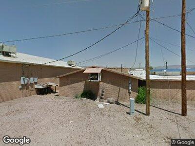
732 N Highway 77 St Mammoth, AZ 85618
--
Bed
--
Bath
3,325
Sq Ft
0.38
Acres
About This Home
This home is located at 732 N Highway 77 St, Mammoth, AZ 85618. 732 N Highway 77 St is a home located in Pinal County with nearby schools including San Manuel High School.
Ownership History
Date
Name
Owned For
Owner Type
Purchase Details
Closed on
Apr 14, 2008
Sold by
Corkers Inc
Bought by
Singh Mammoth Enterprises Llc
Home Financials for this Owner
Home Financials are based on the most recent Mortgage that was taken out on this home.
Original Mortgage
$137,500
Interest Rate
5.99%
Mortgage Type
Seller Take Back
Purchase Details
Closed on
May 16, 2001
Sold by
Ruiz Carmen
Bought by
Bellas Jeffrey James and Bellas Jennifer Anne
Home Financials for this Owner
Home Financials are based on the most recent Mortgage that was taken out on this home.
Original Mortgage
$50,000
Interest Rate
6.94%
Mortgage Type
Seller Take Back
Create a Home Valuation Report for This Property
The Home Valuation Report is an in-depth analysis detailing your home's value as well as a comparison with similar homes in the area
Home Values in the Area
Average Home Value in this Area
Purchase History
| Date | Buyer | Sale Price | Title Company |
|---|---|---|---|
| Singh Mammoth Enterprises Llc | $290,000 | Fidelity National Title | |
| Bellas Jeffrey James | $150,000 | Fidelity National Title Agen |
Source: Public Records
Mortgage History
| Date | Status | Borrower | Loan Amount |
|---|---|---|---|
| Previous Owner | Singh Mammoth Enterprises Llc | $137,500 | |
| Previous Owner | Bellas Jeffrey J | $44,000 | |
| Previous Owner | Bellas Jeffrey James | $50,000 |
Source: Public Records
Tax History Compared to Growth
Tax History
| Year | Tax Paid | Tax Assessment Tax Assessment Total Assessment is a certain percentage of the fair market value that is determined by local assessors to be the total taxable value of land and additions on the property. | Land | Improvement |
|---|---|---|---|---|
| 2025 | $3,917 | -- | -- | -- |
| 2024 | $3,801 | -- | -- | -- |
| 2023 | $3,976 | $25,557 | $2,214 | $23,343 |
| 2022 | $3,801 | $24,092 | $2,214 | $21,878 |
| 2021 | $3,896 | $24,334 | $0 | $0 |
| 2020 | $3,758 | $23,996 | $0 | $0 |
| 2019 | $3,642 | $22,779 | $0 | $0 |
| 2018 | $3,519 | $21,553 | $0 | $0 |
| 2017 | $3,442 | $21,440 | $0 | $0 |
| 2016 | $3,199 | $1,604 | $1,604 | $1,604 |
| 2014 | -- | $8,995 | $580 | $8,415 |
Source: Public Records
Map
Nearby Homes
- 104 Jones Ave Unit 36
- 712 N Dungan Dr Unit 5 & 6
- 745 N San Pedro Dr
- 0 San Pedro Dr Unit 4 6784136
- 1000 N Old Hwy 77 -- Unit 36
- 740 N Tiger Dr
- 111 W Dungan Dr
- 103 N Verdugo Place
- 201 N Catalina Ave
- 102 N Verdugo Place
- 116 E 1st St Unit 2
- 112 E 1st St
- 417 W Sunset Dr
- 0 Barrows Place Unit 22322458
- TBD Carlsbad Ave
- 19931 S Sterling Ave
- TBD S River Rd
- 3200 S Mesa Rd
- 103 S Avenue A
- TBD E Aravaipa Vistas Rd Unit 20Acres