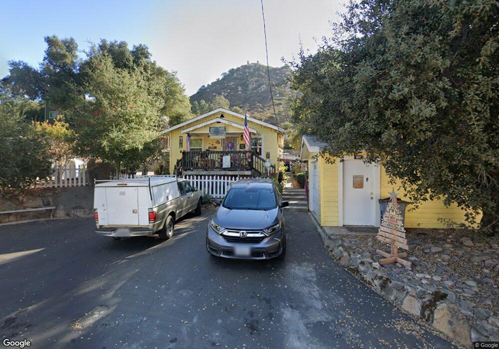
732 Silverbrook Dr El Cajon, CA 92019
Harbison Canyon NeighborhoodEstimated Value: $471,000 - $569,000
3
Beds
1
Bath
628
Sq Ft
$857/Sq Ft
Est. Value
About This Home
This home is located at 732 Silverbrook Dr, El Cajon, CA 92019 and is currently estimated at $538,421, approximately $857 per square foot. 732 Silverbrook Dr is a home located in San Diego County with nearby schools including Granite Hills High School and Cabrillo Point Academy.
Ownership History
Date
Name
Owned For
Owner Type
Purchase Details
Closed on
Oct 30, 2000
Sold by
Eckel Margaret B
Bought by
Judd David E and Judd Nikki Lee
Current Estimated Value
Home Financials for this Owner
Home Financials are based on the most recent Mortgage that was taken out on this home.
Original Mortgage
$152,000
Outstanding Balance
$56,089
Interest Rate
7.9%
Estimated Equity
$482,332
Purchase Details
Closed on
Jul 5, 1985
Create a Home Valuation Report for This Property
The Home Valuation Report is an in-depth analysis detailing your home's value as well as a comparison with similar homes in the area
Home Values in the Area
Average Home Value in this Area
Purchase History
We collect this data history from publicly available records. To have your information removed, we recommend requesting removal directly through your county’s website.
| Date | Buyer | Sale Price | Title Company |
|---|---|---|---|
| Judd David E | $160,000 | First American Title | |
| -- | $56,000 | -- |
Source: Public Records
Mortgage History
We collect this data history from publicly available records. To have your information removed, we recommend requesting removal directly through your county’s website.
| Date | Status | Borrower | Loan Amount |
|---|---|---|---|
| Open | Judd David E | $152,000 |
Source: Public Records
Tax History
| Year | Tax Paid | Tax Assessment Tax Assessment Total Assessment is a certain percentage of the fair market value that is determined by local assessors to be the total taxable value of land and additions on the property. | Land | Improvement |
|---|---|---|---|---|
| 2025 | $2,729 | $241,068 | $103,960 | $137,108 |
| 2024 | $2,729 | $236,342 | $101,922 | $134,420 |
| 2023 | $2,774 | $231,709 | $99,924 | $131,785 |
| 2022 | $2,755 | $227,166 | $97,965 | $129,201 |
| 2021 | $2,830 | $222,713 | $96,045 | $126,668 |
| 2020 | $2,698 | $220,431 | $95,061 | $125,370 |
| 2019 | $2,647 | $216,110 | $93,198 | $122,912 |
| 2018 | $2,591 | $211,873 | $91,371 | $120,502 |
| 2017 | $511 | $207,720 | $89,580 | $118,140 |
| 2016 | $2,452 | $203,648 | $87,824 | $115,824 |
| 2015 | $2,439 | $200,590 | $86,505 | $114,085 |
| 2014 | $2,382 | $196,662 | $84,811 | $111,851 |
Source: Public Records
Map
Nearby Homes
- 0 Silverbrook Dr Unit 5
- 707 Silverbrook Dr
- 833 Cochran Trail
- 760 Lingel Dr
- 0 Lingel Dr Unit 1
- 824 Ethel Trail
- 933 Silverbrook Dr
- 209 Frances Dr
- 1010 1/2 Wilson Ave
- 1186 Harbison Canyon
- 0 Harbison Canyon Rd Unit PTP2604195
- 1631 Harbison Canyon Rd Unit 22
- 1631 Harbison Canyon Rd Unit 26
- 1631 Harbison Canyon Rd Unit 12
- 1631 Harbison Canyon Rd Unit 77
- 1631 Harbison Canyon Rd Unit 24
- 1496 Montana Serena Ct
- 0 Stallion Oaks Rd Unit 1
- 5676 Dehesa Rd
- 164 Dawn View Way
- 744 Silverbrook Dr
- 716 Silverbrook Dr
- 737 Silverbrook Dr
- 717 Silverbrook Dr
- 0 Silverbrook Trail Unit PTP2202117
- 0 Silverbrook Trail Unit PTP2505357
- 0 Silverbrook Dr Unit PTP2505357
- 0 Silverbrook Dr Unit CRPTP2403333
- 0 Silverbrook Dr Unit PTP2403333
- 0 Silverbrook Dr Unit PTP2305877
- 0 Silverbrook Dr Unit 3 & 4 180012496
- 0 Silverbrook Trail Unit 3 & 4
- 0 Silverbrook Dr
- 756 Silverbrook Dr
- 488 Silverbrook Dr
- 726 Harbison Canyon Rd
- 700 Silverbrook Dr
- 769 Silverbrook Dr
- 744 Harbison Canyon Rd
- 716 Harbison Canyon Rd
Your Personal Tour Guide
Ask me questions while you tour the home.