


7320 Hampshire Dr NE Cedar Rapids, IA 52402
Estimated payment $2,669/month
Highlights
- Recreation Room
- Sun or Florida Room
- 2 Car Attached Garage
- Oak Ridge School Rated A-
- Formal Dining Room
- Eat-In Kitchen
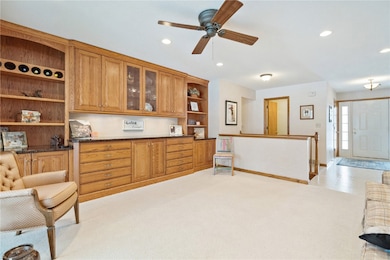
About This Home
Does everything you look at in this price range leave you feeling cramped? Then don't miss this beautifully maintained Bowman Woods ranch. With nearly 2400 sq ft on the main level, you will find incredible room sizes everywhere. The large family room will accommodate nearly any furniture you might need and the primary bedroom is generous enough for a large bedroom suite. The triple french doors off of the living room open to the 15x15 sunroom. This will likely be one of your favorite places to gather and hang out. On top of all the great main floor space, the lower level features a 4th bedroom, 1/2 bath and more storage then anyone ever needs. The roof and furnace are approximately 4-5 years old, central air is 7 years. Very flexible possession. Don't miss your opportunity to see this great home before it's too late.
Home Details
Home Type
- Single Family
Est. Annual Taxes
- $7,087
Year Built
- Built in 1991
Parking
- 2 Car Attached Garage
- Garage Door Opener
- On-Street Parking
- Off-Street Parking
Home Design
- Brick Exterior Construction
- Frame Construction
- Vinyl Siding
Interior Spaces
- 1-Story Property
- Gas Fireplace
- Family Room with Fireplace
- Living Room
- Formal Dining Room
- Recreation Room
- Sun or Florida Room
- Basement Fills Entire Space Under The House
Kitchen
- Eat-In Kitchen
- Breakfast Bar
- Range
- Microwave
- Dishwasher
- Disposal
Bedrooms and Bathrooms
- 4 Bedrooms
Laundry
- Laundry Room
- Laundry on main level
- Dryer
- Washer
Schools
- Bowman Woods Elementary School
- Oak Ridge Middle School
- Linn Mar High School
Utilities
- Forced Air Heating and Cooling System
- Heating System Uses Gas
- Gas Water Heater
Additional Features
- Patio
- Lot Dimensions are 79 x 150
Listing and Financial Details
- Assessor Parcel Number 1126382013
Map
Home Values in the Area
Average Home Value in this Area
Tax History
| Year | Tax Paid | Tax Assessment Tax Assessment Total Assessment is a certain percentage of the fair market value that is determined by local assessors to be the total taxable value of land and additions on the property. | Land | Improvement |
|---|---|---|---|---|
| 2025 | $6,752 | $357,800 | $66,500 | $291,300 |
| 2024 | $6,346 | $365,000 | $66,500 | $298,500 |
| 2023 | $6,346 | $362,100 | $66,500 | $295,600 |
| 2022 | $6,078 | $286,500 | $60,400 | $226,100 |
| 2021 | $6,074 | $283,500 | $56,400 | $227,100 |
| 2020 | $6,074 | $267,300 | $46,300 | $221,000 |
| 2019 | $5,710 | $254,300 | $46,300 | $208,000 |
| 2018 | $5,462 | $254,300 | $46,300 | $208,000 |
| 2017 | $5,478 | $247,600 | $46,300 | $201,300 |
| 2016 | $5,386 | $240,800 | $46,300 | $194,500 |
| 2015 | $5,486 | $244,982 | $28,203 | $216,779 |
| 2014 | $5,486 | $244,982 | $28,203 | $216,779 |
| 2013 | $5,304 | $244,982 | $28,203 | $216,779 |
Property History
| Date | Event | Price | List to Sale | Price per Sq Ft |
|---|---|---|---|---|
| 12/11/2025 12/11/25 | For Sale | $395,000 | -- | $123 / Sq Ft |
Purchase History
| Date | Type | Sale Price | Title Company |
|---|---|---|---|
| Warranty Deed | $235,500 | None Available | |
| Special Warranty Deed | $66,500 | Iowa Title Company |
Source: Cedar Rapids Area Association of REALTORS®
MLS Number: 2509780
APN: 11263-82013-00000
Disclaimer: Certain information contained herein is derived from information provided by parties other than Homes.com. All information provided is deemed reliable, but is not guaranteed to be accurate and should be independently verified.
![]() IDX information is provided exclusively for personal, non-commercial use, and may not be used for any purpose other than to identify prospective properties consumers may be interested in purchasing.
IDX information is provided exclusively for personal, non-commercial use, and may not be used for any purpose other than to identify prospective properties consumers may be interested in purchasing.
Information is deemed reliable but not guaranteed.
- 342 Cambridge Dr NE
- 3310 Timber Ridge Ct
- 7415 Pin Tail Dr NE
- 316 Sussex Dr NE
- 2654 Mulberry Ct
- 7502 Summerset Ave NE
- 7599 Summerset Ave NE
- 803 73rd St NE
- 6726 Bowman Ln NE
- 1000 Hampshire Cir
- 980 Hampshire Cir
- 960 Hampshire Cir
- 1151 Plumwood Ct NE
- 1150 Bedford Ct
- 948 Hampshire Cir
- 916 Hampshire Cir
- 8901 Zeppelin Ave NE
- 884 Hampshire Cir
- 222 Mccarran Ave NE
- 226 Mccarran Ave NE
- 6741 C Ave NE
- 635 Ashton Place NE
- 663 Boyson Rd NE
- 427 Ashton Place NE
- 6214 Rockwell Dr NE
- 600 Blairs Ferry Rd NE
- 975 W 9th Ave
- 6025 Ridgemont Dr NE
- 1197 Blairs Ferry Rd
- 600 Bentley Dr
- 3205 8th St Unit 1
- 3265 8th St Unit 4
- 1621 Pinehurst Dr NE
- 190-210 Ridge Dr
- 830 Blairs Ferry Rd
- 648 Marion Blvd
- 125 E Boyson Rd
- 810-830 Bridgit Ln SE
- 4580 Tama St SE
- 285 Robins Rd
