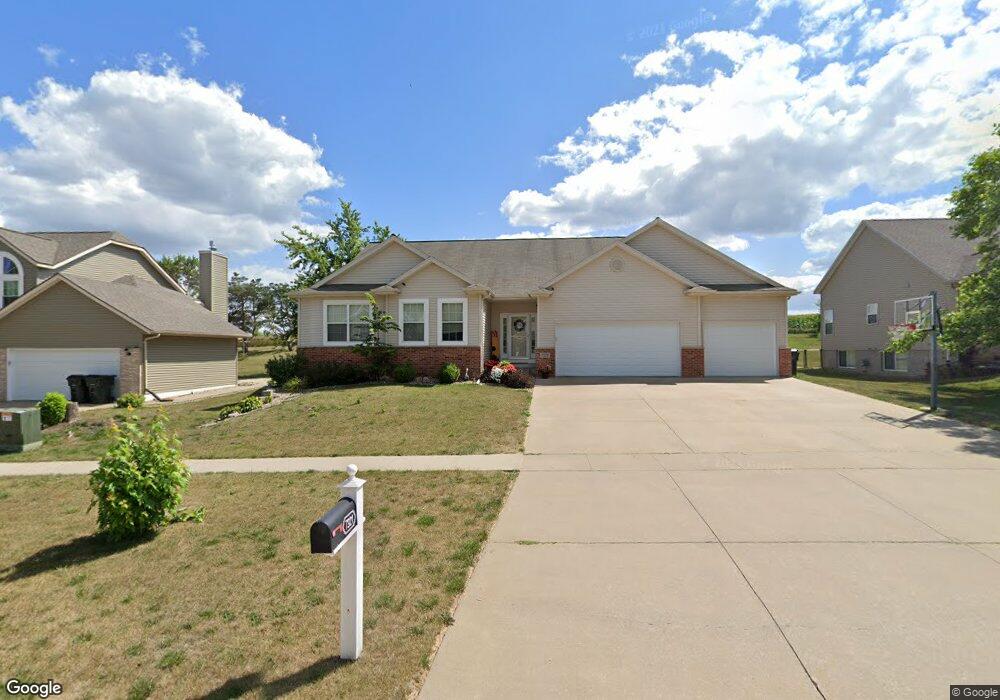
7321 1st Ave SW Cedar Rapids, IA 52405
Cherry Hill Park NeighborhoodEstimated Value: $392,098 - $427,000
4
Beds
3
Baths
3,018
Sq Ft
$136/Sq Ft
Est. Value
About This Home
This home is located at 7321 1st Ave SW, Cedar Rapids, IA 52405 and is currently estimated at $410,525, approximately $136 per square foot. 7321 1st Ave SW is a home located in Linn County with nearby schools including Junction City Elementary School, West Willow Elementary School, and Bourbon Central Elementary School.
Ownership History
Date
Name
Owned For
Owner Type
Purchase Details
Closed on
Feb 26, 2019
Sold by
Minor Nicole M
Bought by
Minor Todd L
Current Estimated Value
Home Financials for this Owner
Home Financials are based on the most recent Mortgage that was taken out on this home.
Original Mortgage
$275,996
Outstanding Balance
$242,153
Interest Rate
4.3%
Mortgage Type
VA
Estimated Equity
$168,372
Purchase Details
Closed on
Apr 30, 2014
Sold by
Bunn William C and Bunn Mindy M
Bought by
Minor Todd L and Minor Nicole M
Home Financials for this Owner
Home Financials are based on the most recent Mortgage that was taken out on this home.
Original Mortgage
$203,000
Interest Rate
4.33%
Mortgage Type
VA
Purchase Details
Closed on
Feb 27, 2007
Sold by
Midwest Development Co
Bought by
Bunn William C and Bunn Mindy M
Home Financials for this Owner
Home Financials are based on the most recent Mortgage that was taken out on this home.
Original Mortgage
$168,750
Interest Rate
6.27%
Mortgage Type
Purchase Money Mortgage
Create a Home Valuation Report for This Property
The Home Valuation Report is an in-depth analysis detailing your home's value as well as a comparison with similar homes in the area
Home Values in the Area
Average Home Value in this Area
Purchase History
| Date | Buyer | Sale Price | Title Company |
|---|---|---|---|
| Minor Todd L | -- | None Available | |
| Minor Todd L | $220,000 | None Available | |
| Bunn William C | $224,500 | None Available |
Source: Public Records
Mortgage History
| Date | Status | Borrower | Loan Amount |
|---|---|---|---|
| Open | Minor Todd L | $275,996 | |
| Previous Owner | Minor Todd L | $203,000 | |
| Previous Owner | Bunn William C | $168,750 |
Source: Public Records
Tax History Compared to Growth
Tax History
| Year | Tax Paid | Tax Assessment Tax Assessment Total Assessment is a certain percentage of the fair market value that is determined by local assessors to be the total taxable value of land and additions on the property. | Land | Improvement |
|---|---|---|---|---|
| 2025 | $5,754 | $372,100 | $77,300 | $294,800 |
| 2024 | $6,038 | $363,800 | $70,900 | $292,900 |
| 2023 | $6,038 | $344,300 | $70,900 | $273,400 |
| 2022 | $5,848 | $298,500 | $62,300 | $236,200 |
| 2021 | $5,858 | $294,700 | $55,800 | $238,900 |
| 2020 | $5,858 | $277,400 | $55,800 | $221,600 |
| 2019 | $4,882 | $238,300 | $47,200 | $191,100 |
| 2018 | $4,742 | $238,300 | $47,200 | $191,100 |
| 2017 | $4,731 | $225,892 | $42,900 | $182,992 |
| 2016 | $4,731 | $225,892 | $42,900 | $182,992 |
| 2015 | $4,735 | $225,892 | $42,941 | $182,951 |
| 2014 | $4,550 | $225,892 | $42,941 | $182,951 |
| 2013 | $4,704 | $225,892 | $42,941 | $182,951 |
Source: Public Records
Map
Nearby Homes
- 7806 Hillsboro Dr SW
- 509 Grey Slate Dr SW
- 6812 Underwood Ave SW
- 614 Grey Slate Dr SW
- 620 Grey Slate Dr SW
- 6916 Rock Wood Dr SW
- 6907 Rock Wood Dr SW
- 6608 Limestone Ct NW
- 1590 Stoney Pt Rd & 6600 16th Ave SW
- 916 Blue Stone St NW
- 6305 Greenbriar Ln SW Unit B
- 6118 Greenbriar Ln SW Unit D
- 6008 Eastview Ave SW
- 5918 Sharon Ln NW
- 200 Cherry Park Dr NW
- 164 Cherry Hill Rd NW
- 323 Norwick Rd SW
- 00
- 0 Iowa 100
- 150 Meadowlark Ln NW
- 7315 1st Ave SW
- 7405 1st Ave SW
- 7309 1st Ave SW
- 7411 1st Ave SW
- 7318 1st Ave NW
- 7303 1st Ave SW
- 7312 1st Ave NW
- 7402 1st Ave NW
- 7417 1st Ave SW
- 7306 1st Ave NW
- 7408 1st Ave NW
- 7225 1st Ave SW
- 7300 1st Ave NW
- 7423 1st Ave SW
- 7414 1st Ave NW
- 7219 1st Ave SW
- 7319 Sandhurst Dr NW
- 7401 Sandhurst Dr NW
- 7232 1st Ave NW
- 7315 Sandhurst Dr NW