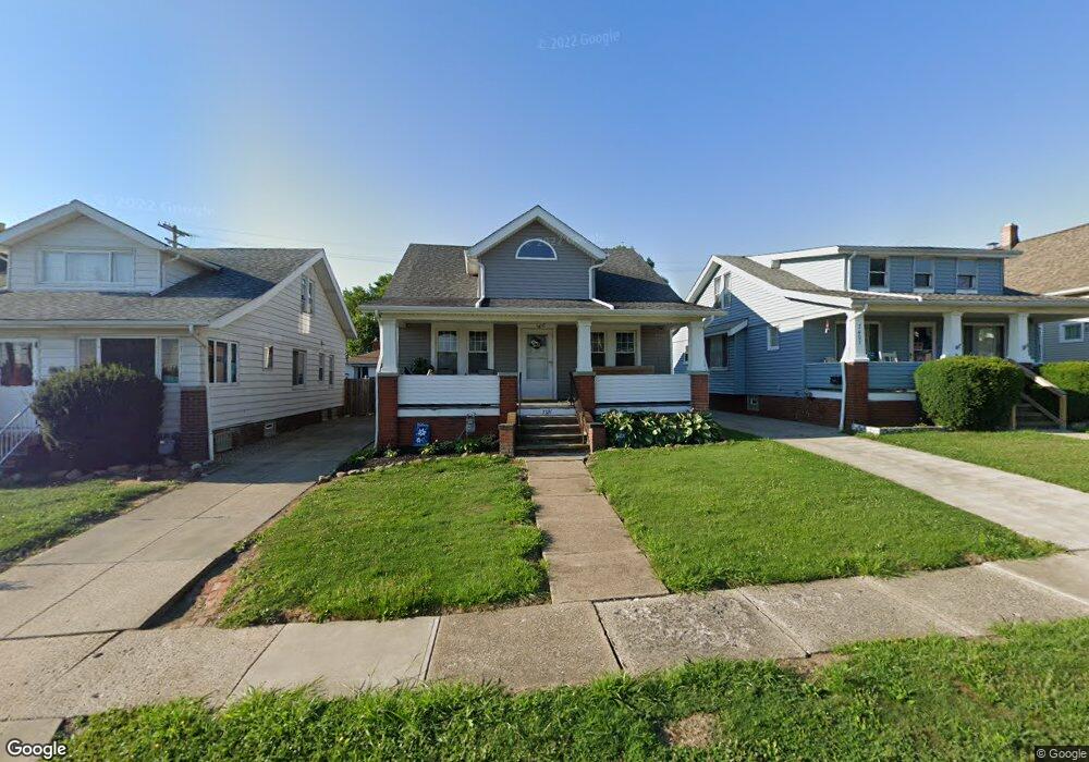
7321 Newport Ave Cleveland, OH 44129
Estimated Value: $196,000 - $207,000
3
Beds
2
Baths
1,538
Sq Ft
$130/Sq Ft
Est. Value
About This Home
This home is located at 7321 Newport Ave, Cleveland, OH 44129 and is currently estimated at $200,617, approximately $130 per square foot. 7321 Newport Ave is a home located in Cuyahoga County with nearby schools including Ridge-Brook Elementary School, Greenbriar Middle School, and Parma High School.
Ownership History
Date
Name
Owned For
Owner Type
Purchase Details
Closed on
Jun 9, 2011
Sold by
Rinaldi Anita L and Mendicino Elizabeth
Bought by
Ziemnik Kristin J
Current Estimated Value
Home Financials for this Owner
Home Financials are based on the most recent Mortgage that was taken out on this home.
Original Mortgage
$65,788
Outstanding Balance
$47,159
Interest Rate
5.5%
Mortgage Type
FHA
Estimated Equity
$153,458
Purchase Details
Closed on
Dec 1, 1975
Sold by
Rinaldi Anthony and Rinaldi Antonette
Bought by
Rinaldi Antonette
Purchase Details
Closed on
Jan 1, 1975
Bought by
Rinaldi Anthony and Rinaldi Antonette
Create a Home Valuation Report for This Property
The Home Valuation Report is an in-depth analysis detailing your home's value as well as a comparison with similar homes in the area
Home Values in the Area
Average Home Value in this Area
Purchase History
| Date | Buyer | Sale Price | Title Company |
|---|---|---|---|
| Ziemnik Kristin J | $67,500 | Chicago Title Insurance Co | |
| Rinaldi Antonette | -- | -- | |
| Rinaldi Anthony | -- | -- |
Source: Public Records
Mortgage History
| Date | Status | Borrower | Loan Amount |
|---|---|---|---|
| Open | Ziemnik Kristin J | $65,788 |
Source: Public Records
Tax History Compared to Growth
Tax History
| Year | Tax Paid | Tax Assessment Tax Assessment Total Assessment is a certain percentage of the fair market value that is determined by local assessors to be the total taxable value of land and additions on the property. | Land | Improvement |
|---|---|---|---|---|
| 2024 | $3,379 | $55,335 | $9,940 | $45,395 |
| 2023 | $2,825 | $39,410 | $8,190 | $31,220 |
| 2022 | $2,798 | $39,410 | $8,190 | $31,220 |
| 2021 | $2,877 | $39,410 | $8,190 | $31,220 |
| 2020 | $2,521 | $30,310 | $6,300 | $24,010 |
| 2019 | $2,411 | $86,600 | $18,000 | $68,600 |
| 2018 | $2,227 | $30,310 | $6,300 | $24,010 |
| 2017 | $2,191 | $25,340 | $4,410 | $20,930 |
| 2016 | $2,178 | $25,340 | $4,410 | $20,930 |
| 2015 | $2,146 | $25,340 | $4,410 | $20,930 |
| 2014 | $2,146 | $26,950 | $4,690 | $22,260 |
Source: Public Records
Map
Nearby Homes
- 7707 Liberty Ave
- 8206 Newport Ave
- 6606 Theota Ave
- 6211 Luelda Ave
- 6014 Laverne Ave
- 5906 Velma Ave
- 8018 Pinegrove Ave
- 5810 Laverne Ave
- 6011 Theota Ave
- 8119 Pinegrove Ave
- 6306 Flowerdale Ave
- 6508 Delora Ave
- 5618 Bradley Ave
- 5511 Velma Ave
- 7609 Wooster Pkwy
- 5406 Merkle Ave
- 6903 Forest Ave
- 6025 Northcliff Ave
- 5901 Delora Ave
- 6209 Archmere Ave
- 7319 Newport Ave
- 7407 Newport Ave
- 7411 Newport Ave
- 7402 Manhattan Ave
- 7415 Newport Ave
- 7406 Manhattan Ave
- 7318 Manhattan Ave
- 7410 Manhattan Ave
- 7419 Newport Ave
- 7414 Manhattan Ave
- 7402 Newport Ave
- 7318 Newport Ave
- 7406 Newport Ave
- 7410 Newport Ave
- 7414 Newport Ave
- 7416 Manhattan Ave
- 7503 Newport Ave
- 7418 Manhattan Ave
- 7418 Newport Ave
- SL 72 Manhattan Ave